ENGLISH

11卷/2期

11卷/2期

華藝線上圖書館

Pages:

111-126

論文名稱

產生正射影像區塊作為新拍航空影像控制用之可行性探討

Title

Feasibility Study on Generation of Aerial Orthoimage Patches as Controls for New Aerial Images

作者

邱式鴻

Author

Shih-Hong Chio

中文摘要

去除航空影像上的像點高差和像片傾斜移位的真正射影像,可提供正確的幾何和輻射資訊作為新拍影像的控制之用。然而去除像點高差移位時,通常必須費時費力地獲取地形地物的精確高程。因此本文提出在未知精確高程資訊下由兩張以上已知方位的航空影像產生真正射影像區塊的方法,試驗中採用"浮測面"的概念產生某一高程範圍內對應某一平面地形的數組候選正射影像區塊。每一組候選正射影像區塊對應一特定高程,接著發展演算法決定一組最佳正射影像區塊,最後將這組正射影像區塊融合成一真正射影像區塊。由初步試驗成果證實所提方法的可行性。

Abstract

Orthoimages can be used as control information to determine the exterior orientation of new aerial images. For that purpose, the image displacements on aerial images due to photographic tilt and topographic relief (including the height of topographic objects) should be exactly removed to generate "true" orthoimages. Thus the correct geometrical and radiometric information can be provided from them for control information. However it is always time-consuming and labour-intensive to capture the accurate heights of terrain area for removing the image displacements from topographic relief. Therefore, this paper will propose a methodology to generate the orthoimage patches from multiple aerial images without capturing accurate terrain heights. In the proposed method, a concept of floating plane, similar to the concept of floating mark, will be presented to produce several orthoimage candidate sets for a terrain area at some height range from multiple aerial images. Each orthoimage candidate set consists of several related orthoimage patches for a terrain area at some specific height. Subsequently, a procedure will be developed to decide an optimal orthoimage set for this terrain area among those orthoimage candidate sets. While the optimal orthoimage set is decided, the height information is also determined. After that, a unique orthoimage patch for this terrain area will be fused from this optimal ortlloimage set. The relevant assessment of accuracy is also discussed and conducted in this paper. The preliminary experiments prove the feasibility of the proposed method.

關鍵字

航空像片、資料融合、外方位、正射糾正、正射影像

Keywords

Aerial images, Data Fusion, Exterior Orientation, Orthorectification, Orthoimage

附件檔名

華芸線上圖書館

N / A

備註說明

200606-11-2-111-126

Pages:

127-141

論文名稱

利用卡曼濾波器技術由多時序雷達量測來估計與預測土壤溼度

Title

Estimation and Prediction of Soil Moisture from Multi-temporal Radar Measurements Based on the Kalman Filter Technique

作者

會裕強,朱得銘

Author

Y. C. Tzeng,D. M. Chu

中文摘要

監測土壤溼度的變化,對許多應用而言是非常重要的。研究結果顯示,以雷達量測來對映土壤表面溼度具有極大的潛力。利用溼度變化在時間上的相關性,吾人可預期土壤溼度的估計與預測是可以達到一相當的準確度。此一時間上的相關性經過適當的模式化後,可藉由卡曼濾波器的理論將其納入。同時運用卡曼濾波器的兩個方程式,亦即處理方程式與量測方程式,可以由雷達量測來估計土壤溼度及預測土壤溼度在時間上的變化。土壤溼度與雷達散射係數間的對映關係是以量測方程式來表示,而土壤溼度在時序上漸乾或漸濕的狀態變化則以處理方程式來表示。本研究以裸露土之土壤溼度及其雷達散射係數的數值模擬來驗證此一方法之有效性。模擬結果顯示若土壤漸乾或漸濕的變化可更準確地模式化,應可改善多時序土壤溼度預測的準確度。

Abstract

Monitoring soil moisture changes is of importance in many applications. Studies show that radar has great potential to provide useful near surface moisture mapping. By making use of the temporal correlation of the moisture changes, estimation and prediction might be achieved with satisfying accuracy. The temporal effects, when appropriately modeled, can be taken into account by means of the Kalman filter theory. The two equations in the Kalman filter, namely, process equation and measurement equation, are used simultaneously to estimate moisture content from radar measurements and to predict the moisture changes over time. The relationship of the moisture content and radar scattering coefficient is built into the measurement equation, while the dry-up (or wet-down) of soil moisture in multi-temporal states was modeled into the process equation. Validation of the presented approach is verified through numerical simulations of radar measurements over the bare soil surfaces. Simulation results indicate that the estimation and prediction of the multi-temporal moisture content can be improved when the dry-up or wet-down process is properly modeled.

關鍵字

土壤溼度,卡曼濾波器,雷達散射係數

Keywords

soil moisture, Kalman filter, radar scattering coefficient

附件檔名

華芸線上圖書館

N / A

備註說明

200606-11-2-127-141

Pages:

143-159

論文名稱

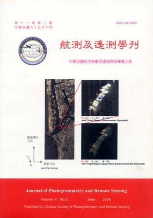
應用共軛梯度演算法在條帶式合成孔徑雷達目標物特徵增強處理

Title

Stripmap Mode SAR Target Feature Enhanced Using Modified CG Method

作者

蔣政諺,陳錕山,吳宗達

Author

Cheng-Yen Chiang,Kun-Shan Chen,Tzong-Dar Wu

中文摘要

目標物點狀散射點特徵在合成孔徑雷達目標物影像辨識上非常重要,因此找尋合適的萃取方法就十分關鍵,目標物點狀特徵的萃取原則在於維持主波瓣的強度,並降低旁波瓣的影響,並且能有效反應真實目標物散射點位置。本研究以增顯目標物點狀散射點為主要目標。合成孔徑雷達影像依取像方式可分成兩類,焦點式和掃描式。本研究主要是由M.Cetin所提出針對焦點式合成孔徑雷達增顯地表反射係數的演算邏輯為基礎,其設計理念是以回波訊號方程式為基礎,建構成為演算法之轉換核心矩陣,再針對這個模型作最佳化的運算。本研究將上述方法擴張到掃描式合成孔徑雷達的資料上,並且由訊號接收數學式重新建構出一個新的演算法核心矩陣,方便未來研究上的應用。本研究運用調控演算法(Regularization Algorithm) 增顯散射點特徵,由於合成孔徑雷達的資料為複數資料,求解過程以複數共輒梯度為主要概念並配合準牛頓演算法(Quasi-Newton iteration)和柯列斯基分解(Cholesky decomposition)處理最佳化的問題配合影像切割的方式來完成。本研究使用RADARSAT 高解析度 掃描式合成孔徑雷達影像為測試資料,並配合地真調查的結果來佐證,除次之外也使用NASA/JPL AIRSAR全偏極資料為第二組例子。研究中將此方法與傳統方法MV(Minimum variance) 和MUSIC (Multiple Signal Classification) 的效能作比較,展示散射點增強的結果並使用評鑑指標如目標物對背景雜訊比、主波瓣3dB寬和實際運算時間。結果顯示在經過規則化適當調整演算法參數之後,無論是在評鑑指標或是在統計機率密度分佈圖上,目標點旁波瓣的抑制和目標物與背景分離上皆有明顯的效果。

Abstract

Target identification and recognition of SAR images require good feature selection and enhancement. Due to the coherent process, it is difficult to discriminate the SAR target feature properties simply using the shape, shadow, tone, color and texture, to name a few. The scattering center is one of the important properties for extracting the SAR feature. In this paper, we modified an algorithm based a conjugate gradient (CG) optimum method originally proposed for spotlight mode SAR images, in order to enhance the Stripmap mode SAR targets. First, we introduced to the background of scatter center enhanced for Spotlight mode from early papers. Second, we presented the SAR received signal model as the basic of CG method. Following, most importance is to introduce how to construct a kernel of CG method. To validate the effectiveness and efficiency of the modified method, a series of RADARSAT SAR images at fine mode were tested with ground truth available overpass the image acquisition. In addition to, we import the fully polarization SAR data from NASNJPL AIRSAR acquired from south Taiwan when Sep. 27, 2000. We also compared the performance with MV (Minimum Variance) and MUSIC (Multiple Signal Classification) methods. Performance indices include target to clutter ratio, 3dB main lobe width and CPU time. From the logarithmic probability density distribution and column ordering plot of enhanced image and original image, it was demonstrated that modified method provides the best performance among the three methods besides CPU time.

關鍵字

合成孔徑雷達、掃描式、焦點式、特做萃取、目標物增強

Keywords

SAR, Stripmap mode, Spotlight mode, feature extraction, target enhancement

附件檔名

華芸線上圖書館

N / A

備註說明

200606-11-2-143-159

Pages:

161-174

論文名稱

利用類神經網路方法於高解析衛星影像及地形資料之崩塌地辨識_以九份二山為例

Title

Landslide Features Interpreted by Neural Network Method Using a High-Resolution Satellite Image and Terrain Data - A Joer-Fen-Ell Mountain Case

作者

張崑宗,劉進金

Author

K. T. Chang , J. K. Liu

中文摘要

崩塌地是地球表面為求得動態平衡所引發的自然現象。台灣多颱風及地震,基於永續經營目的,台灣水庫管理單位每五到十年就對集水區範圍內崩塌地做一全面調查。自七零年代起,航照人工判釋技術被認為是崩塌地調查上最可靠的方法。本文中,將人工判釋之經驗法則加以量化,結合高解析衛星影像、光達所獲得DEM資料、以及道路及河流等向量資料,求取辨識特徵,以統計因子分析方法了解各特徵間關聯性。接著,利用多層次認知類神經網路進行崩塌地辨識訓練與測試。最後將所得結果與人工判讀結果比較與評估。結果顯示代表裸露地表之色調因子於崩塌地辨識上為一種顯著特徵。崩塌地與非崩塌地辨識精度最高分別可達98%與88%,可知本文所提出方法可有效輔助崩塌地調查。

Abstract

Landslides are natural phenomena for the dynamic balance of earth surface. Due to the frequent occurrences of Typhoons and earthquake activities in Taiwan, mass movements are common threatens to our lives. Moreover, it is a common practice for the agencies of water reservoirs in Taiwan to make a reconnaissance of the landslides of the watershed every 5 to 10 years for the purpose of conservation. It is found that the application of aerial photo-interpretation technique for this purpose has been recognized as an effective approach since 1970s. However, an efficient and automatic interpretation scheme has never been established. Therefore, two issues are to be resolved for creating a useful and timely landslide database, i.e. the consistency of the sub-datasets and the completeness of the coverage. As the manual interpretation and automatic recognition are compared, the former is a practical and operational method, but the result it derived is largely dependent on the professional background of interpretation operator. In this paper, the interpretation knowledge is quantified into recognition criteria. Multi-source data, e.g. a Quickbird satellite image, DTM reduced from a LIDAR data, road and river vector data, are fused to construct the feature space for landslides analysis. Then, those features are used to recognize landslides by a multilayer perceptron (MLP) Neural Network Method. The extraction result is evaluated in comparison with the manual-interpretation result. The experiments indicate that the bare surface (color tone factor) is a significant interpretation key for landslides recognition. In this case study, the highest recognition accuracy for landslides and non-landslides are 98% and 88%, respectively. Therefore, the conducted method can assist landslides investigation efficiently and automatically.
關鍵字

類神經網路、高解析力、衛星影像、空載光達、崩塌地

Keywords

Artificial Neural Networks, high-resolution, satellite image, airborne LIDAR, Landslides

附件檔名

華芸線上圖書館

N / A

備註說明

200606-11-2-161-174

Pages:

175-189

論文名稱

利用光達資料模塑建物之研究

Title

Building Shaping from LIDAR Data

作者

張智安, 陳良健

Author

Tee-Ann Teo,Liang-Chien Chen

中文摘要

建物模型為數碼城市中重要的空間資料。本研究之目的為使用光達進行建物模塑,主要工作包含建物偵測、建物輪廓線重建及建物屋頂面重建。首先分析光達資料偵測建物區域,接著使用建物等高線產生正規化輪廓線,並以輪廓線內部的光達點雲模塑建物屋頂面。在建物輪廓線重建中,研究中使用光達資料於不同高度之建築物等值線,利用這些等值線產生建物邊界線,研究中假設建築物輪廓線由直線構成且具有正交性,經由正交及共線兩個正規化處理後,可產生規則的輪廓線。在建物屋頂面重建中,使用建物輪廓線內部的光達點雲進行屋頂面之共面分析,研究中使用三角網區域成長法偵測共平面之屋頂面,以相鄰三角網法向量夾角做為共平面門檻,並以最小二乘法回歸出屋頂面之平面,產生房屋模型。研究中使用新竹科學園區之光達資料進行測試,並以1/1000地形圖進行平面評估。因資料特性之差異,本文除了使用屋角點坐標進行平面評估外,並使用建物疊合面積誤差做為評估。本研究以建物模塑為研究重點,研究中針對偵測成功之建物進行模塑,所產生的房屋模型平面優於面積之6%,高程模塑誤差約0.08公尺。

Abstract

Building model is one of the important spatial information of cyber city. The objective of this investigation is the shaping of the building models from LIDAR data. The major work includes building detection, boundary determination and roof reconstruction. First, we analyze the LIDAR data to detect the building regions. Then, the regular building boundaries are obtained by LIDAR contours. Finally, the roofs of the building are shaped from LIDAR point clouds. In the boundary determination, we use the contours to determine the building boundaries. It is assumed that building boundaries are orthogonal. The orthogonal and collinear constraints are applied in building boundary determination. In the roof reconstruction, a TIN-based region growing is applied to extract the roof planes. The coplanarity and adjacency between triangles are considered for TIN-based region growing. Then, a least squares regression is selected to determine the coplanarity function of planar segment. The proposed method has been tested with LIDAR data of Hsin-Chu Science-based Industrial Park with 1/1000 topomap in evaluation. Due to the data characteristic, we use comer-based and area-based accuracy assessment in the validation. Experimental results indicate that the horizontal error is better than 6% in terms of area, and the shaping error of the reconstructed models is better than 0.08 meter.

關鍵字

光達、等高線、房屋、重建

Keywords

LIDAR, Contour, Building, Reconstruction

附件檔名

華芸線上圖書館

N / A

備註說明

200606-11-2-175-189

Pages:

191-200

論文名稱

季節性對流層變化影響GPS 衛星定位精度之研究

Title

A Study on the Relationship Between Seasonal Tropospheric Variation and Positioning Accuracy by GPS

作者

王傳盛,劉說安

Author

Chuan-Sheng Wang, Yuei-An Liou

中文摘要

GPS在大地網型測量的定位精度,在近二十年來已被改進相當的多,主要的誤差或錯誤來源,像是電離層折射、軌道精度、天線相位中心模擬、環境造成的訊號多路徑效應與散射、對流層折射..等,都逐漸的被降低或消除。在大地測量最先進的GPS資料分析方法中,水平坐標的定位精度約在1-2mm左右,垂直坐標的定位精度約在5-10mm左右。垂直定位精度較差的理由有兩個。第一,因為衛星在天空中的分佈狀況有其理論上的幾何極限值,且截止仰角通常設在15度。第二,由於對流層折射的影響,特別是水氣所造成的訊號遲延。因台灣位於溫濕之亞熱帶,大氣中水氣含量高且隨著季節呈現相當大的變化;故本研究利用台灣(工業技術研究院量測技術發展中心)、關島、日本、新加坡及中國大陸(武漢)IGS固定站、內政部衛星追蹤站、氣象局GPS觀測站之GPS衛星觀測資料,並採取大氣經驗模式,配合參數估計求取對流層遲延殘差的方式,計算點位糖球高程變化與季節性氣候變化的關係。並分析Saastamoinen model與Hopfield model兩種不同大氣模式應用於GPS定位精度之比較。本研究結果顯示在2003年7月和12月份相同點位橢球高程的月平均值最大可相差20mm,每日求解成果,則可違約60mm;而Saastamoinen model與Hopfield model兩種大氣模式,對相同的資料進行計算則發現橢球高程後者會較前者多出4mm的偏差量。

Abstract

The positioning accuracy of the Global Positioning System (GPS) has been improved considerably during the past two decades. The main error sources such as ionospheric refraction, orbital accuracy, antenna phase center variation, signal multipath, and tropospheric delay have been reduced substantially, if not eliminated. In this study, seasonal effect on the GPS positioning accuracy is investigated. Taiwan is chosen for her unique geographic location and complex topography with abound water vapor in the air but spatially and seasonally dependent. The GPS data were collected from continuously operating reference stations by the Ministry of the Interior (MOl), Central Weather Bureau (CWB), and Industrial Technology Research Institute (ITRI) of Taiwan, and International GPS Service (IGS). The investigation of the relationship between variance of the vertical coordinate and change of climate is carried out by computing the GPS data collected in July and December 2003 to represent summer and winter, respectively. In addition, the comparison in results by using the Saastamoinen model and Hopfield model for correcting the influence of the atmospheric path delay is presented. It is found that the maximum difference in the monthly average ellipsoid height between the two months is about 20 mm. The corresponding daily maximum difference is 60 mm. Also, the ellipsoid height derived by using the Saastamoinen model is smaller than that by using the Hopfield mode1.

關鍵字

全球定位系統、橢球高程、對流層效應

Keywords

GPS, ellipsoid height, tropospheric effect

附件檔名

華芸線上圖書館

N / A

備註說明

200606-11-2-191-200

Pages:

201-211

論文名稱

視訊資料中目標物追蹤及定位之研究

Title

Object Tracking and Positioning On the Video Images

作者

陳敏新,陳繼藩

Author

Min-Hsin Chen,Chi-Farn Chen

中文摘要

數位攝影機由於它的普及性以及相對於一般監視器的高畫質,使得數位攝影機逐漸變成具應用性質的監測工具。本研究提出了一個利用數位攝影機進行目標物追蹤及定位的應用。研究主要的目的是在攝影機裝置於一個移動載台的情況下,能夠自動的追蹤與定位一個靜止的物體。由於攝影機的拍攝的角度與位置會隨著時間改變,因此目標物在視訊影像上的形狀與大小也會隨著改變。本研究提出了一個以形狀為基礎的追蹤方法,透過Shape Matrix Algorithm(SMA)在位移,旋轉與尺度不變的特性,來找出畫面間物件的相似程度。當每個畫面的目標物皆被追蹤之後,就可以利用共線關係與最小二乘法進行目標物地面座標的求定。

Abstract

This study presents an application of digital video camera for object tracking and positioning.The main purpose of the study is to automatically trace and position a motionless object on the video images that are recorded on a moving vehicle. Because of the change of the camera's focal length and the movement of the vehicle, by observation, the appearance of a motionless object on the video images firstly will gradually change its shape and completely lose its shape after a period of time. The variation of the shape apparently will bring about the complexity for developing the automated algorithm to trace and position the object on the video image. In this study, we develop an object-based matching technique to implement the tracking task. The technique uses shape matrix algorithm (SMA) that has scale and rotation invariant characteristics to calculate the similarity of variant shapes between adjacent images. The technique consists of three steps:(1) the segmentation step that is used to separate object and background on the video image;(2) the matching step that uses SMA to match the variant shapes between adjacent images and obtain the relative orientation parameters of the shapes; and (3) the tracking step that employs both Target Define Ground Operator (TDGO) and relative orientation parameters to trace the feature point of the object. After the object is traced in every video frame, the photogrammetric collinearity condition is used to transform the object from the image coordinates to the ground coordinates. An experiment is performed to trace a motionless ship in the open sea. The result shows that the proposed method can successfully trace and position the ship even the ship had become entirely out of shape on the video images.

關鍵字

物件追蹤、物件定位、視訊影像、形狀為主的物件匹配

Keywords

Object tracking, Positioning, Video Image, Color-based Segmentation, Shape-based Matching

附件檔名

華芸線上圖書館

N / A

備註說明

200606-11-2-201-211

Pages:

213-236

論文名稱

多航帶推掃式衛星方位平差及影像正射化

Title

Block Adjustment and Orthorectification for Multi-Orbit Satellite Images

作者

劉建良,陳良健

Author

Chien-Liang LID,Liang-Chien CHEN

中文摘要

對於大範圍土地利用監測應用,單張衛星影像可能無法涵蓋目標區域。以多軌道正射影像,經鑲嵌可得到大範圍正射影像。若不同軌道衛星影像單獨進行方位重建,可能造成相同地面點在兩張正射影像上不重合,使鑲嵌後之正射影像在接縫處有錯開的現象。欲減少此現象,在軌道幾何校正時區域平差為較佳的方式。本研究將提出一個軌道區域平差模式,其主要工作包括(1)建立載體參數修正模式、(2)計算航帶連結點修正向量、(3)以最小二乘過濾法進行衛星軌道精密修正及(4)影像正射化,最終進行正射影像鑲嵌。實驗結果顯示,加入航帶連結點進行軌道區域平差後,軌道間相對誤差小於6公尺,且減少鑲嵌影像接縫處錯開現象。

Abstract

In various applications, areas of interest sometimes cover two or more satellite images, thus mosaicking for those images becomes important. Scene-based orbit adjustment could yield geometric discrepancies that could cause image discontinuity along the seam line during mosaicking. Thus, block adjustment is preferable. The objective of this investigation is to establish a simple yet effective block adjustment procedure for multi-orbit satellite images. The major works of the proposed scheme are:(1)adjustment of satellite's orbit accurately, (2)calculation of the error vectors for each tie point using digital terrain model and ray tracing technique, (3)refining the orbit using the Least Squares Filtering technique and (4)generation of the orthophotos. Test images are from SPOT 5 satellite. Experimental results indicate that, the relative accuracy between orthoimages is about 6 meter. It is also demonstrated that the mosaicked image is better seamed when tie points are employed in the adjustment.

關鍵字

區域平差、軌道修正、最小二乘過濾模式、航帶連結點、影像正射化

Keywords

Block Adjustment, Least Squares Filtering, Tie Points, Orthoimage

附件檔名

華芸線上圖書館

N / A

備註說明

200606-11-2-213-236

更多活動學刊