ENGLISH

16卷/4期

16卷/4期

華藝線上圖書館

Pages:

229-243

論文名稱

可攜式高光譜影像儀應用於遙測空氣品質指標

Title

Developing A Portable Hyperspectral Camera To Monitor Air Quality Index

作者

施明倫, 林唐煌, 洪志豪, 蔡廣叡

Author

Min-Luen Shih, Tang-Huan Lin, Chih-Hao Hung, Guang-Ray Tsai

中文摘要

傳統臺灣各縣市周遭空氣品質監測站係依人口數比例架設,僅能固定單點採樣,儀器精密且維修亦較複雜。目前遙測技術已廣泛應用於環境污染之監測,因此本研究擬開發一套可攜式高光譜影像儀(HyCAM-I)藉以更機動性地遙測空氣污染指標(Pollutants standard index, PSI),藉由建立之空氣品質光譜估算模式,用以即時監測任一未知區域之空氣品質。 本研究建模方法採用支撐向量機迴歸(Support Vector Regression, SVR)模式與多變量線性迴歸(Multivariate Linear Regression, MLR)模式,並評估以500nm, 550nm及600nm波段反射率做為模式輸入變量以估算PSI。兩模式在驗證樣本之平均決定係數(R2)分別為0.28與0.47;平均均方根誤差(RMSE)分別為12與10;平均RMSE/觀測值標準差(StDev)分別為0.93與0.77;平均絕對百分比誤差(MAPE)分別為20%與17%。於光譜分析空氣污染指標方面,其最佳波段值約位於500nm及600nm附近。依本研究結果顯示以可攜式高光譜影像儀用於監測空氣污染指標相當具有其可行性,可機動作為未來即時監控未設測站區域空氣品質之工具。

Abstract

Ground-based air quality monitoring stations were set up traditionally in accordance with population density. It could only sample the air pollutants at selected stationery locations with high operation and maintenance cost. Nowadays, remote sensing technology has been widely applied to monitor the ambient atmospheric environment, this research is intended to develop a portable hyperspectral camera (HyCAM-I) to monitor the air Pollutant Standard Index (PSI) remotely. With the establishment of an air quality estimation model from the hyperspectral data and the sampling calculated hourly PSIhr, we can measure the air quality easier in any ungaged region by mobile HyCAM-I rather than using the traditional site-specific monitoring data. For building up the air quality index estimation model, this study adopted the supporting vector regression (SVR) model and the multivariate linear regression (MLR) model to calibrate the relationship of the measured hyperspectral data and the PSIhr index. Three bands of 500nm, 550nm and 600nm were used as the input variables to estimate the outputs of the PSIhr. Cross validation method was used to verify the model efficiency. The results showed that the estimation of the SVR model may have over learned, and caused the estimation errors of the SVR model more unstable and greater than those of the MLR model. However, the average estimation error of the MLR model is still acceptable but need to be verified by improving the device with expanding the samples in the future to enhance the reliability.

關鍵字

高光譜影像儀(HyCAM-I)、遙測(RS)、空氣污染指標(PSI)、支撐向量機迴歸(SVR)、多變量線性迴歸(MLR)

Keywords

hyperspectral camera, remote sensing, pollutants standard index, support vector machine, multivariate linear regression.

附件檔名

華芸線上圖書館

N / A

備註說明

201301-16-229-243

Pages:

245-260

論文名稱

以自率光束法提升四旋翼UAV航拍影像之空三平差精度

Title

Using Self-Calibration to Promote the Aerotriangulation Accuracy of Images Aquired from a Quadrotor UAV

作者

謝幸宜, 邱式鴻

Author

Hsing-Yi Hsieh, Shih-Hong Chio

中文摘要

整合GPS、INS的無人飛行載具UAV(Unmanned Aerial Vehicle)可安全、快速地蒐集資料。然UAV系統常搭載非量測型像機取像,以一般航測方式執行空三平差時,將使平差結果產生較大誤差。自率光束法空三平差可將影像坐標的系統誤差模式化、並加以改正,提升空三平差精度。本文中以四旋翼UAV系統搭載非量測型像機獲取影像,於空三平差作業時比較以:(1)光束法空三平差、(2)自率光束法空三平差、以及(3)預改正的自率光束法空三平差的平差結果。結果顯示:預改正的自率光束法空三平差結果最佳,以Brown(1976)附加參數模式的自率光束法空三平差精度次之,且均優於光束法空三平差精度。

Abstract

Unmanned aerial vehicles (UAVs) integrating with GPS and INS provide a safe and fast method for data acquisition. The UAVs which can implement automatic pilot promote the automation of data collection. In UAV systems, the GPS antenna and the INS system are not aligned with the perspective center, so that the GPS and INS records should be revised according to the geometry of UAV systems for exterior orientation references. And the cameras equipped with UAVs are often belonging to the non-metric camera, whose interior orientation parameters can be acquired by close-range photogrammetry softwares. However, there are several different camera models used in the softwares and the interior parameters calibrated by different softwares would not be the same, so that the interior parameters of the non-metric camera should not be regard as constant in aerotriangulation. Self-calibration can not only calibrate the camera in close-range photogrammetry but also model and compensate the departures from collinearity in aerotriangulation to promote the positioning accuracy. This study uses the images acquired from a safe UAV system, a Quadrotor UAV, and compares the results by using different aerotriangulation procedures. In this paper, the optimal accuracy can be obtained by using self-calibration in bundle adjustment with all measurements been pre-corrected for radial and decentering lens distortion. And the suboptumal accuracy can be obtained by using Brown’s (1976) added parameters in bundle adjustment, better than the results of using bundle adjustment. But using Ebner’s (1976) added parameters in bundle adjustment cannot help promoting the positioning accuracy.
關鍵字

四旋翼、無人飛行載具、非量測型像機、自率光束法

Keywords

Quadrotor, UAV, Non-metric Camera, Self-calibration

附件檔名

華芸線上圖書館

N / A

備註說明

201301-16-245-260

Pages:

261-277

論文名稱

遙測影像製作水稻坵塊主題圖資訊不確定性問題之研究-以QuickBird影像為例

Title

The Study of Uncertainty Problems of Paddy Rice Thematic Map based on QuickBird Satellite Image

作者

雷祖強, 萬絢, 周天穎, 歐陽志豪, 曾國欣

Author

Tsu-Chiang Lei, Shiuan Wan, Tine-Yin Chou, Chih-Hao Ou-Yang, Guo- Shin Tzeng

中文摘要

在台灣目前已逐漸廣泛應用高解析度影像(例如Quickbird) 來製作水稻坵塊主題圖(Paddy rice thematic map),但在應用高解析度影像上的同時會不可避免存在一定程度的不確定性,這些不確定性有:地物類別眾多容易產生分類混淆問題,影像資訊過於豐富反而不利分類等問題。因此本研究目的乃是探討利用衛星影像在進行水稻特徵抽取(Feature extraction)時與其他植生類別(草地與林地)相互混淆之影響性,也就是水稻主題圖製作時之不確定性問題。首先本研究透過紋理資訊(Texture information)增加來改進光譜特徵知識不足的問題,其後再利用模糊數學轉換各項類別的知識,再利用Apriori關連規則與Shannon熵方法來挖掘出多類別訓練樣本間之關聯知識表達,而這樣的關聯知識將有助於分離出影像中水稻與其他植生類別的混淆程度,進而獲得水稻辨識可信度之結果。研究貢獻有二點:1. 本研究之分析程序可成功的將空間特徵中資訊不確定性程度分離出來,而水稻主題圖製作時可明確定義可靠正確率;2. 提出GIS圖資更新之發展策略。

Abstract

Currently, the application on the new generation of high-resolution images (such as QuickBird image) to produce of “Paddy Rice Thematic Map” has become widely accepted. But in the application of high-resolution images, the difficulties are encountered on the confused categories and the surplus of variables. These uncertainty factors will involve poor classification outcomes. Therefore, the purpose of this study is to discuss the confused (uncertainty) influence problems of grass, forest and paddy rice classification results on QuickBird image. Hence, this study has three stages to discuss this problem: (1) The high resolution image data by texture information (semi-variogram) is created on the features. (2) The fuzzy membership method is integrated the each category features of spectral and texture information which can be present a normalization data sets. (3) The hierarchical relationships (or connection knowledge) of multi-categories training samples through Apriori Association Rules and Shanno Entropy method are developed to identify the paddy rice, grass and forest on classification rules. This study contributed two points: (1) the process of this study can be separated and presented features knowledge on different categories of object, and this knowledge can be defined a certainty-accuracy of paddy rice GIS map. (2) Using these techniques, the GIS map can provide a better strategy of classification performance.

關鍵字

影像辨識、Apriori演算法、Shannon熵、不確定性分析

Keywords

Apriori algorithm, Shannon Entropy, Image Recognition, Uncertainty Analysis

附件檔名

華芸線上圖書館

N / A

備註說明

201301-16-261-277

Pages:

279-287

論文名稱

地面光達應用於林木競爭之研究

Title

Assessing Measures of Tree Competition by Using Ground-based LiDAR

作者

魏浚紘, 陳朝圳, 彭炳勳, 李崇誠, 陳建璋

Author

Chun-Hung Wei, Chaur-Tzuhn Chen, Bing-Syun Peng, Chung-Cheng Lee, Jan-Chang Chen

中文摘要

近年來,隨著遙測技術精進,已有許多繪製立木位置圖之方式,多半以二維空間影像來獲得立木位置,但後續應用上會局限於二維空間資訊,無法進一步深入探討。本研究利用地面光達技術,進行森林地區點雲掃瞄,透過三維空間點雲資訊獲取林木資訊與繪製立木位置圖,藉由立木位置圖與林木資訊,進一步探討林木間相互競爭之關係。本研究以六龜地區之紅檜人工林為研究範圍,並透過地面光達繪製之立木空間位置圖進行林木競爭指數計算,評估林木間相互競爭後,其生長狀態空間分布特性。透過樣區中立木之實測值與地面光達點雲資訊所獲得之立木位置相比較,結果顯示水平誤差絕對值0.1 m以下共有13株(28.26%);垂直誤差絕對值0.1 m以下共有15株(32.61%),而水平誤差絕對值0.5 m以下共有35株(76.09%);垂直誤差絕對值0.5 m以下共有38株(82.61%)。透過地面光達點雲亦可得到準確度高之每木胸徑,其R2為0.9685,但掃瞄時必須注意掃瞄點位置與數量,方能得到點雲資訊較為足夠之光達點雲。藉由地面光達資訊之立木距離與胸徑資訊即可計算林木競爭指數,其R2為0.9905。

Abstract

Recently, remote sensing technology has progressed to permit quicker access to individual tree positions using two-dimensional (2D) information. Therefore, insufficient 2D information has led to subsequent limited applications of the technology. We used ground-based LiDAR technology to map three-dimensional (3D) individual tree positions in the Liukuei forest. The 3D laser scanner obtained highly accurate scans of cloud data, and provided basic information on individual tree spatial distribution. We compared different data collections of tree spatial distribution and forest measurement characteristics from the original field survey using the LiDAR technique. The results showed that the absolute value of horizontal error of less than 0.1 m is 28.26% (13 trees) and vertical error of less than 0.1 m is 32.61% (15 trees). In addition, the absolute value of horizontal error and vertical error of less than 0.5 m were 76.09% (35 trees) and 82.61% (38 trees), respectively. However, there was strong correlation between the LiDAR DBH and field DBH (coefficient of determination R2=0.9685). The LiDAR detection location and an increase in the detecting quantity could obtain sufficient point cloud data. The linear correlation R2 value of the field measured and LiDAR detection was 0.9905, which showed that 3D laser scanning technology provided effective quantification data to reconstruct a tree competition index and tree growth model in a forest ecosystem.

關鍵字

三維雷射掃瞄、地理資訊系統、林木位置圖、競爭指數

Keywords

3D laser scanning, geographical information system, individual tree location map, competition index

附件檔名

華芸線上圖書館

N / A

備註說明

201301-16-279-287

Pages:

289-297

論文名稱

應用航測技術與Markov模式探討石門水庫集水區之土地利用動態

Title

Land-use Dynamics of Shihmen Reservoir Catchment using Photogrammetry and Markov Model

作者

吳治達, 鄭祈全, 莊永忠, 詹進發

Author

Chih-Da Wu, Chi-Chuan Cheng, Yung-Chung Chuang, Jihn-Fa Jan

中文摘要

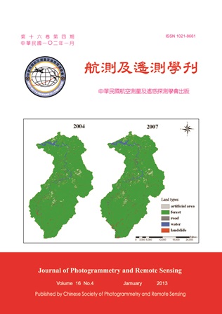
本研究旨在應用航測技術與Markov模式以分析石門水庫集水區之土地利用動態,並探討人為開發對崩塌地所產生影響。研究方法先利用航照影像及數位航測技術,以獲取2004年及2007年兩時期之土地利用、人為開發及崩塌地之分佈資訊;之後透過轉移矩陣之統計,以了解人為開發及崩塌地間的轉變;最後藉由Markov模擬以推估未來之土地利用變遷,進而探討石門地區之土地利用於時間序列上的變化情形。研究結果指出,透過數位航測之影像判釋,共將研究區劃分為森林、人為開發、道路、水體及崩塌地等五種利用型,其中人為開發及崩塌地所佔比例,在2004年至2007年間均呈現上升的趨勢;並且在所有的土地利用型中,又以人為開發轉變為崩塌地之比率最高;最後Markov模擬之結果指出,依據目前的趨勢,未來石門水庫地區之人為開發及崩塌地都將呈現上升的情形。

Abstract

This study aims to assess the land-use dynamics of Shihmen reservoir catchment using photogrammetry and Markov model. The objective was to investigate the effects of human development on landslide. First, ERDAS Leica Photogrammetric Suite (LPS) and Geographic Information System (GIS) were used to interpret the land-use types, and further to examine the land-use changes during 2004 to 2007. A transition probability matrix was then calculated to realize the dynamic relationship between human development and landslide. Finally, the Markov model was developed based on current land status for simulating the future land use changes. The results showed that the study area was classified into five land-use types (i.e., forest, human development, road, water, and landslide). Both human development and landslide areas revealed an increasing trend during 2004 to 2007. The result of transition analysis pointed out that human development has the most conversion into landslide as comparing with other land types. The simulation of future land-use change using the Markov model showed that, the occurrence of landslides in the Shihmen reservoir catchment would be increased based on the current land dynamic.

關鍵字

航測、Markov模式、土地利用、人為開發、崩塌

Keywords

Photogrammetry, Markov model, Land-use, Human development, Landslide

附件檔名

華芸線上圖書館

N / A

備註說明

201301-16-289-297

Pages:

299-315

論文名稱

影像特徵點萃取與匹配應用於福衛二號影像幾何糾正

Title

Apply Image Matching on FORMOSAT-2 Image Geo-rectification

作者

張國楨, 陳俊愷

Author

Kuo-Chen Chang, Chun-Kai Chen

中文摘要

本文探討如何改進SIFT演算法來提升遙測影像幾何糾正的效能,以福爾摩沙衛星二號(福衛二號)影像糾正為測試範例。SIFT為一種針對高解析數位影像發展出來的影像特徵點萃取方法,其優點是所萃取的特徵不易受到影像旋轉、縮放和灰度值差異而有所變化、具有良好特徵點選取與匹配,其匹配結果正確率較高並可消除影像處理中不確定性。但是原始演算法並非針對較低解析度之遙測影像所發展出來,無法直接延用於衛星影像與航空照片之幾何糾正。本研究針對遙測影像的特性,提出改善之方法並修改演算法、建立半自動化處理流程,以解決大量影像作業系統化需求。研究成果為應用修正後之SIFT演算法於多時期、不同區域、不同載具衛星影像進行影像匹配,得到足夠影像控制點。以修改過之SIFT演算法進行影像對位與影像幾何糾正,整體均方根誤差小於0.5 像素。經半自動化處理流程,可將原本需經驗累積、耗時之幾何糾正工作大幅縮短所需時間。

Abstract

In this paper, a robust feature extractor technique for FORMOSAT-2 image rectification is applied. The extracted features are required to be computationally attractive and invariant to image rotation, scale change and illumination. Modified Scale Invariant Features Transform method can find good features and matches from different areas, land cover types of FORMOSAT-2 imagery. A proposed procedure improves processing efficacy and performance of image rectification. The result got good performance, precise, and more reliable and removed uncertainty of image processing.

關鍵字

影像匹配、福衛二號、幾何糾正、影像特徵

Keywords

Image Matching, FORMOSAT-2, rectification, image feature

附件檔名

華芸線上圖書館

N / A

備註說明

201301-16-299-315

更多活動學刊