ENGLISH

17卷/2期

17卷/2期

華藝線上圖書館

Pages:

77-93

論文名稱

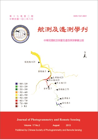
比較監督及非監督模式與共克利金法估算河川污染指標面化圖

Title

Comparison of using the Supervised and Unsupervised with the Co-kriging Methods to Develope a Surface River Pollution Index Map (RPIM)

作者

施明倫, 洪志豪, 楊政儒

Author

Min-Luen Shih, Chih-Hao Hung, Jeng-Ru Yang

中文摘要

本研究擬結合SPOT衛星遙測影像(Remote sensing, RS)及現場水質採樣分析資料,並以兩階段非監督模式分類遙測圖結合共克利金法(Co-kriging, CK)內插建立台灣河川流域水質污染指標面化圖(River Pollution Index Map, RPIM)。本研究非監督模式採用自動最佳化分類結果,藉此分類衛星遙測影像涵蓋河川水體之污染分佈情形,再加入高程,並以當日少數定點水質採樣資料為參考主要資料作共克利金空間內插,兼顧遙測及現場實測兩種方法的優點建立河川水質污染面化圖,最後再與監督式共克利金法的估算結果及傳統僅用監測站值空間內插結果作比較。綜合上述觀點非監督共克利金法具有簡單、快速及改善監督共克利金法學習建模過程複雜的優點,且準確率亦未降低,顯示非監督共克利金法取代監督共克利金法估算河川未設測站水質污染之優勢。

Abstract

The study planed to combine SPOT satellite remote sensing (RS) image and traditional fix point water quality samplings by using a two-stage unsupervised model to classify remote sensing image, then adding a few laboratory analytical water quality samplings with co-kriging (CK) interpolation method to construct an overall distributed surface river pollution index map (RPIM). This research developed an unsupervised co-kriging interpolation model (UCK) which adopting the automatic optimization method to classify the pollution of a river in a satellite image, then secondly adding digital elevation model, and on-site water quality sampling data which has the same time with the unknown existed classified satellite image in the first stage for spatially co-kriging interpolation (UCKD). The procedure took into account the merits of using spot image, digital elevation model, and on-site sampling data. Moreover its results showed the advantage when comparing to supervised co-kriging (SCK and SCKD) and traditional interpolation methods (IDW).

關鍵字

遙測(RS)、非監督模式、共克利金(CK)、河川水質污染指標面化圖(RPIM)、數值高程(DEM)

Keywords

Remote sensing, Unsupervised co-kriging model, River pollution index map, Digital elevation model

附件檔名

華芸線上圖書館

N / A

備註說明

201308-17-77-93

Pages:

95-114

論文名稱

建立航測影像稻作坵塊物件生成與時空變化模式之研究

Title

Paddy Rice Objects Generating and Mapping Model Using Aerial Digital Image Data

作者

雷祖強, 萬絢, 黃政翊, 李哲源, 歐陽志豪

Author

Tsu-Chiang Lei, Shiuan Wan, Cheng-Yi Huang, Che-Yuan Li, Chih-Hao Ou-Yang

中文摘要

水稻為台灣主要糧食作物之一,政府每年投入大量資源進行水稻坵塊面積調查,調查成果將進行農業管理上之依據。但調查過程多以人工圈選方式進行向量圖檔之建立,此過程耗時甚鉅,因此如何快速地從高解析度數值航照影像中獲取地理空間訊息,進而達到農業資訊化管理之目的,基本上就是一個重要的研究課題。本研究欲發展一個結合坵塊尺度資訊與熵分類器(Entropy Base Classifier, EBC)的區塊物件化熵分類器(Region Object-oriented Entropy Based Classifier, ROEBC),並與傳統逐像元概念之最大概似分類器(Maximum Likelihood Classifier, MLC)來進行比較。研究成果顯示,使用ROEBC分類器可在各別波段產生切割點後並計算出個別屬性的資訊增益(Information Gain, IG)值。並且可以使用IF…THEN法則成功的將複雜的影像資訊的分類問題,轉化成一階邏輯概念的程序表達形式,這個形式會比傳統的統計參數式分類法則(如MLC法),更有效的表達出影像之知識內涵。此外物件導向分類器就點檢核與面檢核的觀點來看,均同時顯示優於逐像元式分類器之成果,這也顯示本研究所使用的物件導向分類器在製作水稻主題圖上,要比傳統逐像元的方式更為理想與成功。最後,本研究以坵塊化概念呈現了本研究成果與其他GIS資料整合分析的可行性,以及同時提供了轉作休耕田與外業調查人力投入度策略之分析成果。

Abstract

Paddy rice is one of the major food crops in Taiwan. The government investigated the paddy rice area through aerial photography every year. However, paddy rice thematic maps require using much manpower which is very time-consuming and funding. How to quickly obtain this geo-information through very high-resolution aerial photographs is an important research issue. In this study, we want to develop a novel decision model (Region Object-oriented Entropy Based Classifier, ROEBC) which integrates the patch-scale information and Entropy Base Classifier. It also compares these results of traditional concept of pixel-based classifier by Maximum Likelihood Classifier (MLC). The ROEBC categories decision model can find the ideal cutting point from each spectral band through the value of attributes on Information Gain (IG). Based on these IG values, we can obtain rules from image information successfully. This method can clearly show the differences on image knowledge rule content by the traditional statistical parameter classifier (such as MLC). After that, in this study, we check the point accuracy and area accuracy at paddy rice thematic maps with MLC and ROEBC methods, respectively. It shows that the regional based classifier of ROEBC methods is better than those of the pixel based classifier of MLC. Finally, this study discussed the feasibility of paddy rice object results combine with other GIS data on the agriculture information management issues of future projects.

關鍵字

農業資訊管理、水稻萃取、最大概似分類器、熵分類器

Keywords

Agricultural Information Management, Paddy Rice Extraction, Maximum Likelihood Classifier, Entropy Base Classifier

附件檔名

華芸線上圖書館

N / A

備註說明

201308-17-95-114

Pages:

115-134

論文名稱

光學式衛星影像雲層處理之研究

Title

The Study on Cloud Processing in Optical Satellite Imagery

作者

徐逸祥, 朱子豪

Author

Yi-Shiang Shiu, Tzu-How Chu

中文摘要

利用光學式衛星影像進行土地利用判釋或農作物產量估測時,雲層覆蓋是無法避免的干擾之一。就具有厚雲層的影像而言,本研究以單時期影像及區域增長 (region growing) 之方式偵測並切除無法還原地物資訊的厚雲層及其雲影。具有薄雲的影像則以傅利葉 (Fourier) 分析建立薄雲的數學模式,再以此模型薄雲並還原薄雲底下的地物光譜資訊,雖然在模式建立階段需兩時期影像,但建立後模式對其它影像進行去雲處理時則僅需單時期資訊。研究成果顯示,厚雲及雲影偵測之整體精度皆可達到90%以上。薄雲去除方面,薄雲過濾器提升了約4%的分類精度,亦減輕薄雲對正規化差異植被指數 (normalized difference vegetation index, NDVI) 的影響,改善程度在統計上皆達到顯著性 (p < 0.01)。本研究成果可應用在土地利用判釋和農作物產量估測中的影像前處理程序,除減少去除雲層的人力,亦可增加衛星影像的利用度。

Abstract

Cloud cover is an inevitable interference when mapping land use/cover with optical satellite imagery. In this study, we apply region growing processing to delineate unrecoverable thick cloud and use Fourier analysis to recover ground information from hazy areas with single temporal imagery. Several methodologies across literature successfully solve cloud problems, but most methods require additional cloud-free reference areas or imagery, which may be unavailable in the real world. Moreover, visual methods rather than quantitative methods are used for assessing results, which can be subjective and arbitrary. Most importantly, the feasibility of applying haze-off imagery to image classification is seldom discussed. To overcome the existing limits, expert method is applied to assess the thick cloud delineation and image classification and normalized difference vegetation index (NDVI) is used to evaluate the recovery degree of ground information after the haze-off processing for quantitative verification of the results. This study revises the image enhancement and region growing algorithm to delineate unrecoverable thick cloud. Accuracy assessment shows the overall accuracy of delineation could be 90% above in each study area. For hazy areas, Fourier analysis is used to reduce haze interference and recover ground information. The proposed haze filter increases the overall accuracy of the whole scenes by about 4%. The overall accuracy of hazy areas in the imagery increases the most (by 6%), while that of shadow areas decreased slightly. The influence of haze on NDVI is also reduced with statistical significance (p < 0.01). Both thick cloud and hazy areas processing can be achieved with no cloud-free area or reference imagery required. Future applications include preprocessing of satellite imagery in land use/cover mapping, which can decrease the manpower to interpret and remove cloud areas and increase the usability of the satellite imagery.
關鍵字

去雲、光學式衛星影像、地物判釋、區域增長、傅利葉分析

Keywords

Cloud removal, land features interpretation, region growing, Fourier analysis

附件檔名

華芸線上圖書館

N / A

備註說明

201308-17-115-134

Pages:

135-148

論文名稱

運用資料探勘技術分析熱帶海水表面溫度

Title

Analysis of Tropical Sea Surface Temperature Using Data Mining Technique

作者

李永翔, 郭南榮

Author

Yung-Hsiang Lee, Nan-Jung Kuo

中文摘要

本研究應用資料探勘技術提升地球同步作業環境衛星(Geostationary Operational Environmental Satellite, GOES)的紅外線感測器所量測導出的熱帶海面溫度資料的準確度,並探討影響誤差的主要因素。由倒傳遞類神經網路(Back Propagation Network, BPN)的演算,得到日平均的海面溫度均方根誤差(Root Mean Square Error, RMSE)從0.58 K降至0.37 K,平均絕對百分比誤差(Mean Absolute Percentage Error, MAPE)為1.03%;小時的海面溫度均方根誤差從0.66 K降至0.44 K,MAPE值為1.1%,顯示倒傳遞類神經網路演算法有效改善了海面溫度估計的準確度。對於不同比例的雲層遮蔽情況下,倒傳遞類神經網路對於衛星海面溫度資料修正後之RMSE均維持在0.38 K以下,展現倒傳遞類神經演算法對於海面溫度分析時之抗雜訊能力。另外,分析結果也顯示大氣溫度是影響誤差的主要因素,其次為風速與相對溼度。

Abstract

Tropical sea surface temperature (SST) data derived from the Geostationary Operational Environmental Satellite (GOES) is analyzed by using data mining to explore the error sources of data and to further improve its accuracy. The SST data has been pre-processed into two kinds of data set, the daily mean and hourly. The root mean square error (RMSE) of daily SST estimate is reduced from 0.58 K to 0.37 K and the mean absolute percentage error (MAPE) is 1.03% by using the Back Propagation Network (BPN) algorithm. For the hourly SST estimate, its RMSE is also reduced from 0.66 K to 0.44 K and the MAPE is 1.1%. This indicates that the BPN algorithms improve the accuracy of the SST. While the proportion of cloud contamination is in different circumstances, the RMSE of retrieval satellite SST by using the BPN algorithm can be maintained below 0.38 K. This demonstrated the efficiency ability of anti-noise analysis of the neural algorithm. The factor analysis also shows that the errors are mainly caused by air temperature and then followed by wind speed and relative humidity.

關鍵字

資料探勘、倒傳遞類神經網路、紅外線感測器、海面溫度、熱帶太平洋

Keywords

Data mining, Back Propagation Network, Infrared sensor, Sea surface temperature, Tropical Pacific

附件檔名

華芸線上圖書館

N / A

備註說明

201308-17-135-148

Pages:

149-160

論文名稱

「技術短文」資料探勘技術於坡地崩塌之驗證與潛勢評估

Title

Verification and Susceptibility Assessment for Landslides using Data Mining Techniques

作者

賴哲儇, 蔡富安, 林岑彧, 陳偉堯, 林唐煌

Author

Jhe-Syuan Lai, Fuan Tsai, Tesn-Yu Lin, Walter W Chen, Tang-Huang Lin

中文摘要

基於災後以資料導向分析的觀點,本研究採用決策樹與貝氏網路兩種資料探勘的分類技術,萃取因颱風豪雨促發的淺層坡地崩塌特性,希冀建構可靠的崩塌潛勢預測模型。此外,本研究亦提出資料濾除機制,去除不確定性資料,並配合因子顯著性分析與特徵縮減技術,強化崩塌案例驗證與潛勢評估之有效性。研究成果顯示,資料濾除機制可降低模型因遷就不確定性資料造成之不可靠,提升預測能力;且貝氏網路成果優於決策樹演算法,提供較可靠的預測及潛勢成果。而特徵縮減不但改善效能問題,亦能維持一定程度的檢核及預測精度。

Abstract

This study utilized decision tree and Bayesian network algorithms to extract the knowledge of shallow landslides based on susceptibility analysis in the Shimen reservoir watershed. Furthermore, the uncertainty filter, significant analysis and feature reduction methods for landslide factors were also proposed. The objective is to develop a post- and data-driven analysis system for landslide detection and risk assessment in a regional scale. This study did not distinguish different types of landslides, and all landslides were induced by heavy rainfall. Experimental results demonstrate that the developed landslide factor model is effective for landslide detection in the study site. After filtering uncertain data, the reliability of landslides verification and susceptibility assessment has been improved significantly. Based on the experiments, Bayesian network can provide more reliable prediction and susceptibility results than decision tree in the study case. In addition, feature reduction can improve the computation efficiency while maintaining acceptable check and prediction accuracy.

關鍵字

決策樹、貝氏網路、資料探勘、崩塌潛勢

Keywords

Decision Tree, Bayesian Network, Data Mining, Landslide Susceptibility

附件檔名

華芸線上圖書館

N / A

備註說明

201308-17-149-160

更多活動學刊