ENGLISH

18卷/2期

18卷/2期

華藝線上圖書館

Pages:

探刊引言

論文名稱

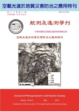
空載光達於地質災害防治之應用

Title

作者

林慶偉

Author

中文摘要

台灣位處環太平洋地震帶,板塊運動活躍且地勢陡峭,地質構造複雜破碎提供了豐富的土石材料。同時因季節性颱風豪雨常帶來豐沛的雨量,導致台灣地區崩塌和土石流災害頻傳,居民的生命財產頻受威脅。應用航測及遙測的技術有助於我們分析瞭解容易發生災害之區域,以及在某種氣候條件之下可能受災之區域,有助於我們提早進行災害防治,亦能提早疏散可能受災之居民。 因應2009年莫拉克風災所帶來的嚴重地質災害,並造成許多地區地形地貌的變動,經濟部中央地質調查所自2010年起,以3年時間利用空載光達進行地形掃瞄,產製1米高解析度數值地形及航照正射影像,藉以建立災後高精度的數值地形資料庫,並用來分析因莫拉克颱風所造成之地表地形與環境地質的變化,探討原因及評估安全性,以供相關重建單位或是各級政府對於國土保育政策推動時使用。此資料已提供相關單位及學界應用於地形與水系分析、地質敏感區調查與地質災害潛勢評估等,其中對於潛在大規模崩塌的判釋與調查結果顯示,臺灣中部、南部與東部地區可找出超過數百處可能屬於大規模崩塌的潛勢區域,未來可再針對高活動區域逐步進行細部觀測。為報導高精度空載光達的技術在判釋地形地貌上的研究分析成果,並基於推廣航測及遙測技術應用於地質調查及土石災害防治及分析之研究,乃規劃出版「空載光達於地質災害防治之應用」專刊,本刊所刊載之論文計五篇,其篇名依序為:  高解析度空載光達資料結合地形開闊度分析於構造地形特徵之應用  南部板岩地質區地震及豪雨誘發山崩之地形特徵-以隘寮溪流域為例  空載光達數值地形產製與地質災害的應用  應用數值地形及光學影像於潛在大規模崩塌地形特徵判釋  應用光達地形資料於莫拉克災後陳有蘭溪流域崩塌與土石流地質敏感地區判釋與分析 這五篇論文所探討之課題包含空載光達數值地形的產製、地形開闊度分析、潛在大規模崩塌地形特徵之判釋、地震及豪雨誘發山崩之地形特徵、以及崩塌與土石流地質敏感地區判釋與分析等,反映出高精度空載光達的技術在判釋地形地貌上的效能,以及在地質災害防治的分析成果。期望此特刊能呈現高精度高解析度空載光達資料在地質災害防治上的效用,以提供重建單位或是各級政府推動國土保育政策。

Abstract

關鍵字

Keywords

附件檔名

華芸線上圖書館

N / A

備註說明

N / A

Pages:

67-78

論文名稱

高解析度空載光達資料結合地形開闊度分析於構造地形特徵之應用

Title

Application of high-resolution LiDAR DEM for extracting terrain openness: A case study in the Tsaoling landslide area

作者

陳奕中, 侯進雄, 謝有忠, 陳柔妃, 吳若穎

Author

Yi-Zhong Chen, Chin-Shyong Hou, Yu-Chung Hsieh, Rou-Fei Chen, Ruo-Ying Wu

中文摘要

地形開闊度分析之地形計測方法能突顯地形角度變化強烈處,是分析地形資訊的利器。本研究利用1米空載光達測製數值高程模型,藉由地形開闊度計算得到正與負值兩種結果,其正值能反映山脊線、崩崖、階地,負值則為河谷、水系與蝕溝分布等構造地形,並進一步由紅色立體投影圖同時展現正負兩地形開闊度之凸凹特性,以判釋出草嶺地區之微地形特徵。最後,由負地形開闊度(灰階)搭配坡度分析(紅階)細部判釋草嶺山崩之崩塌面蝕溝於不同岩層分布,並估算出1999-2011年期間卓蘭層及錦水頁岩基岩下切侵蝕速率分別為平均每年下切31-39公分、54- 89公分,顯示錦水頁岩抗蝕力較弱。

Abstract

Openness methods can visualize the topographic character of angular measure between surface relief and horizontal distance; it is a useful tool for determining geomorphic fractures. We adopted the high-resolution Airborne LiDAR (Light Detection And Ranging) DEM to obtain the positive and negative values. Positive shows reflect ridge, scarp and terrace, whereas negative describe valley, river and gully. Red Relief Image Map (RRIM) can identify fine-scale geomorphic change when it is combines the positive and negative values. Many of the characteristics that obtained from the negative calculation (marked in gray-scale) and an analysis of stacked slope (marked in red-scale), to interpret the position of eroded gullies in the Tsaoling sliding area. In this study, we investigated the distribution of erosion gullies and calculated the bedrock incision rate for the Cholan Formation and Chishui Shale for 1999 and 2011, which were 31 to 39 cm/year and 54 to 89 cm/year on average, respectively. These results indicated that the Cholan Formation has a higher resistance to erosion than the Chishui Shale, where the erosion was more serious.

關鍵字

開闊度分析、空載光逹、數值高程模型、地形特徵、草嶺山崩

Keywords

Openness, Airborne LiDAR, Digital Elevation Model, Geomorphic fractures. Tsaoling landslide

附件檔名

華芸線上圖書館

N / A

備註說明

N / A

Pages:

79-92

論文名稱

南部板岩地質區地震及豪雨誘發山崩之地形特徵-以隘寮溪流域為例

Title

Topographic Characteristic of the Landslide induced by earthquake and Rainfall in Slate Stratum in South Taiwan – Case of Ai-Liao Catchment

作者

陳天健, 李明熹, 曾勛苑, 顏宏諭, 李宗聯, 林意修

Author

Tien-Chien Chen, Ming-Hsi Lee, Xun-Yuan Zeng, Hong-Yu Yen, Zong-Lian Li, Yi-Siou Lin

中文摘要

本文以台灣南部高屏溪支流之隘寮溪流域為研究區,應用GIS結合航照、災前後DEM或光達數值地型,就集集地震與莫拉克颱風事件之二千多筆崩塌地,進行地震及豪雨誘發山崩地形特性研究。成果顯示地震之崩塌坡度主要分佈於30 - 50度,75%位於山脊或山腹,90%崩塌之面積小於10公頃;而颱風之崩塌坡度則主要分佈於20 - 40度,81%位於山腹或坡趾,且中大型崩塌面積明顯增多,52%崩塌之面積大於10公頃;颱風引致大型崩塌之數量較地震事件顯著。就地形分析方面,斜交坡地形之崩塌趨勢為最;大型崩塌地之曲率達1×10⁻⁴時,崩塌顯著增加。大型崩塌地滑動前,坡體均已具某種程度之撓曲變形,顯示大型崩塌呈漸進式變形,其地形曲率隨時間逐漸增大,最終乃至坡體快速滑動。

Abstract

The paper draws the topographic characteristics of the landslide induced by Chi-Chi Earthquake and Typhoon Morakot in Ai-Liao catchment, in slate stratum. The result from topographic analysis on the DEM shows 90% landslides induced by earthquake are small than 10 ha, the average slope is 30-50o, and 75% of landslide locates at the ridge or the mountainside of the slope. Oppositely, the 52% landslides induced by typhoon are large than 10 ha, the average slope of landslide is gentle to the one of earthquake landslides and 81% of landslides locates at the mountainside or the toe of slope. The analysis result also demonstrated that a certain degree of deflection usually occurs before a sliding initiation that suggests the deformation (and the subsequent damage) of the massive landslide is progressive. Moreover, the profile curvatures of landslide cases are close to the curvature 1×10⁻⁴ (1/m), the landslide possibility rises up at where curvature beyond the value.

關鍵字

山崩、地震、颱風、板岩、地形

Keywords

Earthquake, rainfall, landslide, slate, topography

附件檔名

華芸線上圖書館

N / A

備註說明

N / A

Pages:

93-108

論文名稱

空載光達數值地形產製與地質災害的應用

Title

Airborne LiDAR DEM and Geohazards Applications

作者

侯進雄, 費立沅, 邱禎龍, 陳宏仁, 謝有忠, 胡植慶, 林慶偉

Author

Chin-Shyong Hou, Li-Yuan Fei, Cheng-Lung Chiu, Hung-Jen Chen, Yu-Chung Hsieh, Jyr-Ching Hu,  Ching-Wei Lin

中文摘要

因2009年莫拉克風災造成臺灣中南部地區嚴重的生命財產損失,其中以小林村重大的崩塌事件引起注意,故經濟部中央地質調查所自2010年起,以3年時間利用空載光達進行地形掃瞄,產製1米高解析度數值地形及航照正射影像,藉以建立災後高精度的數值地形資料庫,並應用於地形與水系分析、地質敏感區調查與地質災害潛勢評估等;其中對於潛在大規模崩塌的判釋與調查結果顯示,臺灣中部、南部與東部地區可找出超過數百處可能屬於大規模崩塌的潛勢區域,且對於有聚落保全對象的崩塌潛勢區域設置簡易監測儀器,藉以觀察各崩塌地之滑動趨勢,未來可再針對高活動區域逐步進行細部觀測;目前在尚未得知潛在大規模崩塌區的滑動面位置及深度前,藉由野外調查潛在崩塌區的範圍、地形、裂隙、塌陷等地表的特徵來估算滑動面的位置,以數值模擬推估崩塌的可能影響範圍,可作為後續搬遷、撤離等防災減災之參考資訊。

Abstract

The heavy rainfall of Typhoon Morakot caused severe damage to infrastructures, property and human lives in southern Taiwan in 2009. The most atrocious incident was the Hsiaolin landslide which buried more than 400 victims. Consequently the airborne LiDAR survey was carried out from 2010 to 2012 by Central Geological Survey, MOEA in Taiwan to produce 1m x 1m high resolution DEM and aerial ortho-photo images in order to build up post-disaster high resolution DEM database and apply to such as investigate and analysis for geologically sensitive areas, Geological and Topography characteristics, Potential geological disaster, River system analysis. the key projects is to investigate and analysis large-scale landslides, the result shows that there are hundreds of large-scale landslides area in central, southern and eastern Taiwan. For those potential landslides site near villages, monitoring instruments such as single-frequency GPS, rainfall recorder and electro-optical theodolite have been set up to detect the surface displacement. More monitoring instruments such as tiltmeter, inclinometer, rain gauge, extensometer and Time Domain Reflecometry (TDR) will be deployed in high susceptibility landslide area in the near future.

關鍵字

空載光達、數值地形模型、大規模崩塌、自然災害、全球衛星定位系統

Keywords

Airborne LiDAR, DEM, Catastrophic Landslides, Natural Hazard, GPS

附件檔名

華芸線上圖書館

N / A

備註說明

N / A

Pages:

109-127

論文名稱

應用數值地形及光學影像於潛在大規模崩塌地形特徵判釋

Title

Topographic Characteristics Interpretation of Potential Deep-Seated Landslides from Digital Elevation and Remote Sensing Images

作者

何岱杰, 張維恕, 林慶偉, 劉守恆

Author

Dia-Jie Ho, Wei-Shu Chang, Ching-Weei Lin, Shou-Heng Liu

中文摘要

民國98年8月莫拉克颱風重創臺灣南部地區,造成許多大規模崩塌,尤以高雄市小林里(原小林村)發生最嚴重災情。為避免類似重大災害出現,判釋潛在大規模崩塌區位是一重要工作,其提供未來防災及減災工作之重要資訊。在大規模崩塌發育過程中,地形上常有一些特徵出現,如主崩崖、次崩崖、反向坡等。本文分別使用40米、5米及1米不同解析度之數值地形資料,以其坡度圖進行判釋,並佐以8米、2米及0.25米不同解析度影像輔助判釋,結果顯示解析度1米之空載光達高精度數值地形提供更多細微地形特徵資料,並搭配解析度0.25米之航空照片以協助判釋,大大提高判釋潛在大規模崩塌特徵的能力,且再透過野外查核,以確定崩塌特徵正確判釋。

Abstract

The typhoon Morakot in 2009 August caused lots of deep-seated landslides in southern Taiwan, especially the most serious ones in Hsiaolin village. In order to prevent this kind of serious disaster, interpretation of potential deep-seated landslides is an important work that leads to disaster prevention and mitigation of future important information. During the develop of deep-seated landslides movement process, some characteristics often can be found from terrain data. We use different resolutions of the digital terrain data and images to interpret the sites of potential deep-seated landslides, the results show that high precision digital terrain data from airborne LiDAR (Light Detection And Ranging) can provide more subtle topographic characteristics, greatly improving the capability to interpret the potential deep-seated landslides, with aerial photos during the interpretation. Results of the interpretation are validated through field work to ensure the accuracy.

關鍵字

潛在大規模崩塌、空載光達、航空照片

Keywords

potential deep-seated landslides, airborne LiDAR, aerial photos

附件檔名

華芸線上圖書館

N / A

備註說明

N / A

Pages:

129-144

論文名稱

應用光達地形資料於莫拉克災後陳有蘭溪流域崩塌與土石流地質敏感地區判釋與分析

Title

Application of LiDAR Data on Identifications of Landslides and Debris Flow Geologically Sensitive Area of the Chen-Yo-Lan River Basin Post Typhoon Morakot

作者

林美聆, 陳彥澄

Author

Meei-Ling Lin, Yen-Chen Chen

中文摘要

台灣位處環太平洋地震帶,板塊運動活躍、地勢陡峭,地質構造複雜破碎提供了豐富的土石材料。季節性颱風豪雨帶來了豐沛的雨量,導致台灣地區崩塌和土石流災害頻傳。崩塌和土石流地質敏感區域常以航空照片或衛星影像進行判釋,但往往因為地形地貌、日照方向、雲覆或植被之影響導致判釋上的困難。目前高精度光達探測技術日益發展,本研究透過航空照片以及衛星影像及光達日照陰影圖,判釋研究區域崩塌及土石流等地質敏感區域。將光達資料所判釋的成果與航照及衛星影像之圈繪成果比對,並討論光達地形資料在崩塌和土石流之判釋適用性。 利用光達數值地形判釋時可以排除航照及衛星影像的不利因素,可以更精確的判釋大規模崩塌及土石流。光達數值地形所判釋的崩塌規模較大並可看出整體性,而且判釋不受植被影響。利用光達數值地形判釋土石流時,能得到河道的正確位置,土石流沖積扇也能輕易的判釋,但對於小規模及淺層崩塌則難以判釋。

Abstract

Taiwan is located on the circum-Pacific seismic zone, the active tectonic actions, steep terrain, and geological structures provide abundant debris material. The seasonal typhoons with heavy rainfall often cause landslides and debris flow .The aerial photos or satellite images are often used for interpretation of landslides, debris flow, and other geohazards, but the results are affected by topography, shades, cloud cover, and vegetation. With the development of high resolution LiDAR technique, this study uses aerial photos and satellite images as well as LiDAR shading map for identification of landslides and debris flow. Comparisons of the results from LiDAR shading maps and aerial photos are made, and differences of the interpretation results are discussed. Using LiDAR for interpretation of landslides and debris flow provides accurately large-scale landslides identifications of and can exclude unfavorable factors in using aerial photos or satellite images. The landslides interpreted by LiDAR are mostly large-scale landslides. By LiDAR also provides good results of debris flows interpretation along with river channels, and alluvial fan. However, the small-scale landslides are difficult to identify using LiDAR shading map.
關鍵字

崩塌及土石流地質敏感地區、光達地形資料、航空照片、陳有蘭溪流域、莫拉克颱風

Keywords

Landslide and debris flow geological sensitive aera, LiDAR, aerial photos, Chen-Yo-Lan river basin, typhoon Morakot

附件檔名

華芸線上圖書館

N / A

備註說明

N / A

更多活動學刊