ENGLISH

19卷/2期

19卷/2期

華藝線上圖書館

Pages:

特刊引言

論文名稱

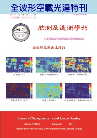
全波形空載光達

Title

作者

曾義星

Author

中文摘要

隨著光達技術的精進,商業型的空載光達系統已進化成能以密集取樣訊號強度之方式,將地物背向散射訊號波形完整記錄下來,又稱為全波形(full waveform)空載光達系統。相較於傳統光達僅能記錄少數的回波響應值(echoes),全波形光達可完整地記錄雷射光行經物體間的反射強度(intensity),且所記錄的波形除了可推算反射物距離外,亦隱含了反射物的物理性質,因此全波形光達具有更深遠的應用潛力。同樣應用全波形雷射技術於水域深度測量,稱為測深光達(Bathymetric LiDAR) ,是淺海地區水深及水底地形觀測的利器。 全波形光達回傳訊號之波形會隨地物性質而改變,如地表反射性質、面向、粗糙度、構造等,所以回波波形資料含有地物類別及性質的資訊,透過波形資料的分析有助於解讀地物表面的型態,也提供了地物分類之依據。全波形光達資料為一連串雷射反射強度資訊,可透過響應偵測及擬合等方式將波形中隱含之特性萃取出來,並透過資料分析波形特徵或波形參數(如峰值、振幅、及波寬等),來解讀地表物的性質。波形特徵也提供我們更多的指標來區分不同種類的地物,對不同類型的地物更有區別能力,能夠進一步使用此資訊來進行地物分類。由於雷射具有部分地物穿透能力,尤其是針對森林地區的林木,其波形特徵提供了分析森林內部結構的契機,因此有別於應用光學影像之分類應用。 波形分析是全波形光達研究的主要議題,波形分析的目的是瞭解全波形光達數據中所隱含的資訊。因為波形資料其實是回收到不同地物回訊的疊置,因此可使用數學函數擬合及分解波形,數學函數中的參數可視為波形參數,可分析不同參數所代表的幾何意義,研究其對應的地物類別與地形之表現。為報導全波形空載光達的研究動向,並基於推廣新的航測及遙測技術,乃規劃出版「全波形空載光達」專刊,本刊所刊載之論文計五篇,其篇名依序為:  應用空載全波形光達資料於波形分析與地物分類  Reliability Assessment of Gaussian Estimates Derived from Small-footprint Waveform Lidar  應用空載光達資料估計森林樹冠高度模型及葉面積指數  全波形空載光達資料之波形特徵分析與分類  以測深光達數據產製東沙塊礁分佈圖 這五篇論文所探討之課題包含全波形空載光達之波形分析、波形參數推導、地物分類、森林樹冠高度模型及葉面積指數估計、以及測深光達數據分析等,反映出全波形空載光達的研究與應用的面向。期望此特刊能呈現全波形空載光達目前的學術研究狀況,以推廣全波形空載光達在不同領域的應用。

Abstract

關鍵字

Keywords

附件檔名

華芸線上圖書館

N / A

備註說明

N / A

Pages:

75-91

論文名稱

應用空載全波形光達資料於波形分析與地物分類

Title

Waveform Analysis and Landcover Classification Using Airborne Full-Waveform Lidar Data

作者

林郁珊, 張智安

Author

Yu-Shan Lin, Tee-Ann Teo

中文摘要

全波形光達記錄回波的連續波形,藉由波形分析得到更多的地表反射物理特性、地表細節及變化,提供較豐富及完整的地表資訊,有助於地形重建及地物判識。本研究分別使用對稱函數(高斯函數)與不對稱函數(韋伯函數)進行擬合波形,並進行原始資料與擬合成果兩者間的精度評估,分析不同擬合函數對於全波形光達訊號處理的適用性。研究中萃取的波形參數包含波寬、振幅、背向散射參數,光達幾何參數則包含高程、高程差、回波數、多重回波百分比,結合波形及幾何參數進行地物分類。本研究以光達特徵配合人工判識選取訓練區,並使用支持式向量機(Support Vector Machine, SVM)與隨機森林(Random Forest)兩種分類器進行地物分類,並就地物分類成果進行精度評估,藉此比較使用全波形光達及多重回波光達進行分類之精度。研究結果顯示,雖然使用韋伯函數之波形擬合殘差較小,但在波形峰值位置的萃取成果與高斯函數之差異有限,因此高斯函數為一個簡易有效之擬合函數。在地物分類方面,全波形光達所提供的背向散射參數為一顯著性高的特徵,另隨機森林分類法的成果相較於支持式向量機為佳。

Abstract

Full-waveform (FWF) lidar receives one dimensional continuous signal. It offers useful information about the structure of the target. Therefore, the analysis of received signal of FWF lidar and obtaining the implicit information is helpful for land cover classification. In the processing of full waveform Lidar data, the waveform parameter extraction and analysis are the important steps. The major objective of this study is to analyze the received waveform and extract its parameters. We select Gaussian distribution as a symmetric function and Weibull distribution as an asymmetric function in waveform decomposition. Then, we calculate several accuracy assessment indicators between raw waveform data and fitting function for quality assessment. We use echo width, amplitude, backscatter cross-section coefficient, elevation, elevation difference, echo number, and echo ratio as waveform parameter of classification. After waveform parameter extraction, we employ Support Vector Machine (SVM) and Random Forests (RF) as classifier for land cover classification. This study employs echo width, amplitude, backscatter cross-section coefficients and other features for classification. Error matrix is used to compare the performance of the classifiers. The experimental results indicate that the accuracy of asymmetric function is slightly better than symmetric function. However, the extracted peak positions from the Gaussian and Weibull are very close. Moreover, Gaussian distribution is relatively simple and easy to implement in the waveform analysis. The result of land cover classification shows that waveform parameters are helpful for classification and Random Forests classifier is slightly better than SVM in our study cases.
關鍵字

空載光達、全波形光達、波形擬合、地物分類、支持式向量機、隨機森林

Keywords

附件檔名

華芸線上圖書館

N / A

備註說明

N / A

Pages:

93-106

論文名稱

空載波形光達資料之高斯估值可靠度評估

Title

Reliability Assessment of Gaussian Estimates Derived from Small-footprint Waveform Lidar

作者

林玉菁, Jon P. Mills, 林俊霖

Author

Yu-Ching Lin, Jon P. Mills, Chun-Lin Lin

中文摘要

目前在處理大足跡或小足跡波形光達資料,高斯分解回波技術扮演相當重要之角色,當以高斯函數擬合所接收之回波或地表反應,可獲算得各回波之高斯係數,主要包含對應為回波時間點之高斯波峰值、回波寬度與回波振幅值,這些屬性隱含雷射掃描目標物之特徵。然而在某些情況下,所估算得的參數具不確定性,目前僅少數研究評估高斯估算值之可靠度或不確定性,在應用波形高斯估值時,實必須考量此不確定性之指標值。本文主在研究此議題,調查波形複雜度對高斯估值可靠度之影響,測試資料為包含模擬波形資料與 Riegl LMS-Q560 真實波形資料,另掃描當天設置所設計之目標物於野外現地,觀察波形形狀隨多重回波間之距離與振幅大小之影響。模擬資料發現高斯波寬估值之均分根誤差會隨著多重回波間之距離縮短(<6ns)而增加,回波時間距離之均方根誤差則可維持一致之精度(0.04ns)。

Abstract

The Gaussian decomposition technique has to date played an important role in processing both large- and small-footprint lidar waveforms. When fitting Gaussian functions to received waveforms or the surface response estimated by a deconvolution process, Gaussian coefficients for each detected return can be estimated. These are the temporal position of the Gaussian peak, pulse width and amplitude, which indicate feature characteristics. However, in some circumstance, the estimates may not be fully certain. Little attention has been paid to assessing the reliability or uncertainty of Gaussian estimates. It is necessary to take such indicators into account when application of multiple waveform features is attempted. This study aims to fill this research gap. Whether the reliability of the estimates is affected by the complexity of the waveform shape was investigated. Waveform data collected from simulation experiment and a Riegl LMS-Q560 field campaign was analyzed. Several targets were designed and set in the field to observe how the shape of waveforms varies with the separation distance between two returns and their amplitude magnitude. It was found that the RMSE values for the pulse width estimates based on data simulation were increasingly large when the separation distance was decreased (< 6 ns). The RMSE values for the range estimates based on data simulation remained consistently small (~ 0.04 ns) when decreasing the separation distance.

關鍵字

波形、光達、高斯分解

Keywords

waveform, lidar, Gaussian decomposition

附件檔名

華芸線上圖書館

N / A

備註說明

N / A

Pages:

107-123

論文名稱

應用空載光達資料估計森林樹冠高度模型及葉面積指數

Title

Estimation of Forest Canopy Height Model and Leaf Area Index Using Airborne LiDAR data

作者

林莉萍, 王正楷, 曾義星, 朱宏杰

Author

Li-Ping Lin, Cheng-Kai Wang, Yi-Hsing Tseng, Hone-Jay Chu

中文摘要

空載光達系統可直接獲取高精度三維坐標的點雲資料,且其雷射光具有穿透樹葉縫隙的特性,能快速偵測得森林林分結構的三維空間資訊。透過其蘊涵的森林厚度及林木密度資訊,可用來估計樹冠高度模型(Canopy Height Model, CHM)和葉面積指數(Leaf Area Index, LAI)。本研究目的是探討如何應用空載光達資料估計森林地區之樹冠高度模型和葉面積指數。在推估CHM方面,本文是以點雲資料產製數值表面模型(Digital Surface Model, DSM)及數值高程模型(Digital Elevation Model, DEM),將森林區域的DSM減DEM即得CHM。並以三種不同的空載光達系統產生之原始點雲及全波型資料進行實驗,比較六個推估得的CHM,實驗結果發現,整體差異均小,少數差異較明顯的地方主要發生在森林表面高度落差較大處。在LAI方面,則是以點雲資料計算五種雷射穿透率指標(Laser Penetration Index, LPI)來推估,LPI1是地面點占全部點的比例,LPI2是地面點強度值和全部點強度值的比例,LPI3是地面點與所有雷射光束的比值,LPI4是改良自LPI1,但增加單一回波地面點的權,LPI5則是以全波形資料計算的雷射光照射地物間面積與非地面的面積比。五種LPI與實際地面量測資料迴歸後的成果顯示,在本研究測區的低航高點雲資料中,LPI4都能得到高於0.5的R2值,說明LPI4具有較穩定且準確的LAI估計能力。而相較於即時解算的多重回波點雲,使用全波形的光達點雲穿透率指標,可提升對LAI的估計,R2可達到0.8以上,增加利用小範圍地面實測資料來推估大範圍森林區資料的可行性。

Abstract

Efficiently obtaining the information in forest region such as forest structure, forest ecosystems is important for forest management. The purpose of this study is to estimate the Canopy Height Model (CHM) and the Leave Area Index (LAI) of a dense forest area by using airborne LiDAR data. CHM is estimated by taking the difference of DSM and DEM derived from LiDAR data. Estimation of LAI is achieved based on the calculation of Laser Penetration Index (LPI). Five calculations of LPI were applied in this paper: (1.) The ratio between the number of ground points and that of all the points; (2.) the ratio between the intensities of ground points and that of all the points; (3) the ratio between the number of ground points and the number of laser beams; (4) a weighting method modified from index (1); and (5) the ratio between the area of ground points and that of all the points. The study area is in a natural broadleaf forest of south Taiwan. In this study, we use three sets of airborne LiDAR data acquired with different full waveform LiDAR systems including Leica ALS60, Riegl LMS-Q680i and Optech Pegasus HD400. All of these LiDAR systems are capable of recording full waveform data, then we can get the waveform point clouds by the echo detector to do the comparison. Our experiments results show that the accuracy of CHM by different LiDAR data is about 1.5 meter. And the fourth LPI index has the highest coefficient of determination (about 0.8) and the estimation of LAI can be improved by using the waveform points.

關鍵字

樹冠高度模型、葉面積指數、空載光達、雷射穿透率、全波型

Keywords

Canopy Height Model (CHM), Leaf Area Index (LAI), Airborne LiDAR, Laser Penetration Index (LPI), Waveform

附件檔名

華芸線上圖書館

N / A

備註說明

N / A

Pages:

125-145

論文名稱

全波形空載光達資料之波形特徵分析與分類

Title

Waveform Feature Analysis and Classification of Airborne LiDAR Data

作者

洪宇佳, 王正楷, 曾義星, 朱宏杰

Author

Yu-Chia Hung, Cheng-Kai Wang, Yi-Hsing Tseng, Hone-Jay Chu

中文摘要

隨著光達技術的發展,近年來商業型的空載光達系統已經能夠記錄雷射與地物交會之完整的反射強度變化,稱為全波形(full waveform)空載光達系統。相較於傳統光達僅能記錄少數的回波響應值(echoes),全波形光達可完整地記錄雷射光行經物體間的反射強度(intensity),且所記錄的波形除了可推算反射物距離外,亦隱含了反射物的物理性質,因此全波形光達具有更深遠的應用和潛力。地物表面的反射性質、幾何結構和粗糙度皆會影響雷射的反射波形,因此透過對全波形光達資料所記錄的波形進行分析,有助於解讀地物表面的型態,這些性質也提供了地物分類之依據。本研究針對從波形資料中偵測得之所有地物響應波形,分析各類地物響應波形特徵的特性,並交叉比對不同地物類別之波形特徵的可區分性,以利於選擇有效的分類特徵,並依據其分析成果,設計一套以波形為主的全波形光達資料分類方法與流程。 實驗資料包含三個廠牌之儀器(Leica、Riegl及Optech),根據實驗區的主要地物類別,從正射影像挑選出欲分類目標類別,即植被、道路、裸露地、建物、草地農地等五類,並針對這些類別進行樣本選取與波形分類特徵分析。根據單響應及多響應的波形特徵分析結果,選擇適合的分類特徵,接著將選取的特徵輸入支持向量機(SVM)進行監督式分類。本研究之實驗方法分為三種,包含以響應為基礎、以波形為基礎與以波形為基礎並加入影像的分類法。實驗成果顯示相較於以響應為主的分類法,以波形為主的方法能提升約20%的分類精度,且加入影像後整體精度最高可達86%,對於地物的三維分類具有相當之潛力。

Abstract

Thanks to the development of LiDAR technology, recording full waveform information of return laser signal has become available. Compared with the conventional LiDAR system, waveform LiDAR further encodes the intensity of return signal along the time domain, which enables the users to utilize the continuous return signal for the interpretation of ground objects. Potential of more applications than the use of traditional LiDAR can be expected with the use of full waveform LiDAR. A LiDAR waveform is a recorded energy of the backscattered laser pulse along the time domain. The shape of a waveform is formed according as the characteristics surface reflectance, geometric structure and roughness of the laser footprint. It would be possible to extract the information of surface characteristics from waveform data, and this information can be used for the classification of ground surface. This study focuses on the analysis of LiDAR full-waveform data. The effects of various ground objects and surfaces on the waveform data will be analyzed, and the reparability of waveform features among categories of ground objects will be identified. Based on this analysis, a classification approach is developed for LiDAR full-waveform data. The estimation of classification accuracy will be reported as well. The experiment data were collected with three airborne LiDAR systems of different brands, namely Leica、Riegl and Optech. The land cover objects of the experimental area are mainly categorized into road, canopy, grass & crop, bare ground and buildings. Waveform features were analyzed with respect to the single and multiple return laser paths samples, and waveform classification features were selected according to the analysis. Then, the supervised classification by using Support Vector Machine (SVM) was performed in three defined methods which include echo-based, waveform-based and waveform-based with images. The experiment results show that the overall accuracy of waveform-based method increases about 20% comparing to echo-based method and it can achieve 86% with the images. This study reveals the potential of 3D object classification using airborne LiDAR waveform data.

關鍵字

空載光達、全波形光達、波形特徵分類

Keywords

Airborne LiDAR、Full-waveform LiDAR、Waveform feature classification

附件檔名

華芸線上圖書館

N / A

備註說明

N / A

Pages:

147-154

論文名稱

以測深光達數據產製東沙塊礁分佈圖

Title

Coral Patch Mapping with Bathymetric Lidar Data

作者

林暐尊, 史天元, 侯尚儒, 陳杰宗

Author

Wei-Tsun Lin, Tian-Yuan Shih, Shang-Ju Hou, Jie-Chung Chen

中文摘要

測深光達(Bathymetric Lidar)使用綠光雷射以掃描方式獲得水深及底質資訊,採用以航空器為載台施測時,於近岸水淺及多礁區域具有高效率及安全性之特性,極適合珊瑚礁區域之測量。本研究以地形分析方式處理測深光達獲取之地形數據,由兩種不同尺度之測深位置指標(Bathymetric Position Index, BPI)及坡度建立地形特徵分類流程,對東沙環礁測深光達測區進行地形分類,並且比較使用不同尺度BPI之成果差異。研究成果以測區人工數化塊礁檢核,顯示採用大、小尺度BPI分別為600m及50m時分類成果最佳,整體分類精度與KAPPA指標分別為92.61%與0.66。

Abstract

Bathymetric Lidar utilizes green laser and scanning mechanism to derive the water depth and substrate information. It has been proven to be effective for mapping shallow water and coral reef area due to the airborne manner. In this study, terrain analysis is performed with data collected in an airborne bathymetric Lidar mission for mapping coral patches. Classification with features such as bathymetric position index (BPI) and slope are explored for Dongsha atoll. The classification is validated with manually digitized coral patches based on human interpretation. The applied scale factors of BPI with 600m and 50m reach best result, which is 92.61% for overall accuracy and 66.01% for the KAPPA coefficient.

關鍵字

測深位置指標、海底地形、分類、坡度

Keywords

Bathymetric position index, Seafloor terrain, Classification, Slop

附件檔名

華芸線上圖書館

N / A

備註說明

N / A

更多活動學刊