ENGLISH

20卷/1期

20卷/1期

華藝線上圖書館

Pages:

特刊引言

論文名稱

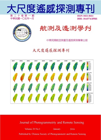
大尺度遙感探測

Title

作者

陳良健

Author

中文摘要

高速人為活動造成的環境變化讓人們對未來的生活福祉憂慮日深。故,監測環境現象與變遷從而瞭解地球的運作機能以因應未來成為迫切的任務。衛星以其特殊的空間位置,達成在地表難以完成的任務。衛星遙測則以綜觀攬要的特性,重複且大範圍快速取樣的功能,提供大尺度環境監測的最佳解決方案。逾半個世紀的遙測科技發展,研究重心已從影像處理延伸至更深化的科學分析,進而貢獻永續發展。多元的資料來源,強大的系統分析能力及知識與經驗的累積所建構的發展支柱使人們對衛星遙測已由好奇演化為不可或缺的工具。 本特刊五篇論文涵蓋生態,農業,都市環境,製圖及衛星測高與重力測量,其中四篇使用影像資料。研究內容除空間分析外,亦包括以多時序資料探索環境之變遷。光學影像除用於南海稀疏島嶼之測繪,亦經由廣域衛星MODIS影像分析植物之分佈及稻米之生產。在都市環境監測方面量化熱島效應並據以分析產業發展。衛星測高技術與重力測量雖與前述之光學影像分析有所不同,但其非接觸式之觀測方式亦屬遙測之範疇。本刊論文使用的光學衛星影像解析度從0.5公尺到1000公尺,掃描寬從十餘公里到超過二千公里,且皆使用多光譜及多時序的影像。就遙測領域的三個重要解析度:空間,時間,及光譜而言,本刊論文有全面的涵蓋。就處理技術而言,則兼容幾何與輻射資料之處理分析。 生態是永續發展的重要議題,植生分布則是生態系統建構的基礎,本刊第一篇論文「以MODIS時序資料分析台灣植被物候空間分布」分析植物各生長季節之特性,有助釐清氣候變化及環境擾動因素對植物生長之影響。第二篇論文「利用MODIS時序影像進行下湄公河盆地稻作區域監測初探」則對全球稻米重要生產區以多時序衛星影像進行監測,其成果可望推廣。第三篇論文「都市熱島效應於產業發展及其影響因子分析之研究」利用Landsat 5影像量化台中市之熱島效應並分析其與工業區間之關係。第四篇論文「應用衛星影像測繪南海島礁」使用0.5公尺解析度之衛星影像測繪南海島礁並偵測變遷,對我國疆域圖資貢獻具體。第五篇論文「利用GRACE、衛星測高、海洋模型估計地心變動」,則以非接觸式之衛星遙測概念進行衛星大地測量,再配合海洋模型估計地心變動。本刊五篇論文兼顧廣度與深度,涵蓋科學與應用,貢獻由國內到國際,內容充實,值得細讀。

Abstract

關鍵字

Keywords

附件檔名

華芸線上圖書館

N / A

備註說明

N / A

Pages:

1-15

論文名稱

以MODIS時序資料分析台灣植被物候空間分布

Title

Spatial patterns of vegetation phenology based on MODIS time-series data in Taiwan applying TIMESAT

作者

張仲德, 黃倬英

Author

Chung-Te Chang, Cho-ying Huang

中文摘要

地表植被物候反應生態系對於氣候變化的作用,本研究利用2001至2010年間由MODIS (the Moderate Resolution Imaging Spectroradiometer)波段反射率資料演算得到的月份光合作用植物(PV, photosynthetically active vegetation)資料,透過TIMESAT軟體分析台灣地區地表物候空間分布的特性,包括生長季開始時間(onset)、生長季結束時間(offset)及生長季長度(length of the growing season)。結果顯示台灣地區不同年間生長季開始時間與生長季結束時間(r = 0.67, p = 0.035)及生長季長度(r = 0.77, p = 0.009)具有顯著關係;其中生長季開始時間的延遲受到聖嬰現象(ENSO, El Niño-Southern Oscillation)影響的春季乾旱所控制,並對生態系造成負面衝擊。TIMESAT是相當穩定的物候分析工具,有助於釐清氣候變化及環境擾動因素對植物生長反應的影響。

Abstract

Land surface phenology reflects the responses of a terrestrial ecosystem to climate change. In this study, we used monthly PV (photosynthetically active vegetation) derived from MODIS (the Moderate Resolution Imaging Spectroradiometer) reflectance data between 2001 and 2010 to delineate the land surface phenology. The phenological metrics including onset, offset, and the length of the growing season were obtained from the phenological analysis toolbox TIMESAT. Results indicated that the interannual variability of onset time was significantly correlated to offset time (r = 0.67, p = 0.035) and length of the growing season (r = 0.77, p = 0.009). In addition, the shortage of spring rainfall was influenced by ENSO events and resulted in significant delayed on vegetation onset time and cause dramatic impacts on the ecosystem. TIMESAT is a robust phenological analysis tool, which can facilitate our understanding of the vegetation responses and development associated with climate change and environmental disturbances.

關鍵字

中解析度成像光譜儀、物候分析、氣候變異、聖嬰現象

Keywords

MODIS (the Moderate Resolution Imaging Spectroradiometer), Phenology analysis, Climatic anomaly, ENSO

附件檔名

華芸線上圖書館

N / A

備註說明

N / A

Pages:

17-32

論文名稱

利用MODIS時序影像進行下湄公河盆地稻作區域監測初探

Title

Delineating Rice Cropping Activities from MODIS Time- series Data in the Lower Mekong Basin

作者

陳正儒, 陳繼藩, 阮天祥, 張立雨, 林雅文

Author

Cheng-Ru Chen, Chi-Farn Chen, Nguyen-Thanh Son, Li-Yu Chang, Ya-Wen Lin

中文摘要

了解大尺度範圍的稻作耕作型態對於區域糧食作物管理與產量估測是十分重要的一環。本研究使用2010年的MODIS 8日時序衛星影像產品進行下湄公河盆地稻作區域的監測。影像反射光譜推導的指數先經過小波轉換濾除時間雜訊,並依地物物候關係與地形資訊設定閾值遮罩濾除以降低資料量與複雜度,之後以類神經網路進行稻作耕種類型分類。分類結果以混淆矩陣顯示其總體精度為84.4%,Kappa係數為0.8;利用線性迴歸分析,比較MODIS推導的稻米種植面積與政府/研究計畫的稻作生產面積統計資料(省級空間尺度),結果顯示各國的R2皆大於0.9以上,顯示分類方法有相當高的生產面積預測性。因此,本研究成果除了可以提供下湄公河盆地稻作生產面積、分布區域與稻作耕種系統等量化數據參考外,研究驗證的分析方法未來亦可推廣至世界其他區域進行稻作監測的應用。

Abstract

Delineating rice cropping activities is important for crop management and crop production estimation. This study used 8-day the time-series MODIS NDVI data in 2010 to delineate rice-cropping activities in the Lower Mekong Basin (LMB). The data were processed using the wavelet transform and artificial neural networks (ANN). The classification results assessed using the ground reference data indicated the overall accuracy and Kappa coefficient of 84.9% and 0.81, respectively. Comparisons between MODIS-derived rice area and rice area statistics at the provincial level for each country reaffirmed a close agreement between the two datasets (R2 >0.9). The results achieved from the methods used in this study confirmed the validity of mapping approach for delineating rice agriculture activities in the study region. The results could provide quantitative information on rice cropping areas and farming activities. This classification approach is thus proposed for monitoring rice cropping activities in the study region and other regions in the world.

關鍵字

MODIS、稻米、遙測影像、下湄公河盆地

Keywords

MODIS, rice crop, remote sensing image, Lower Mekong Basin

附件檔名

華芸線上圖書館

N / A

備註說明

N / A

Pages:

33-48

論文名稱

都市熱島效應於產業發展及其影響因子分析之研究

Title

The Study of Urban Heat Island Effect Change and Contribution Factors in Taichung City

作者

楊龍士, 楊倍航, 何佳薇, 葉美伶, 周天穎

Author

Lung-Shih Yang, Pei-Hang Yang, Chia-Wei Ho, Mei-Ling Yeh, Tine-Yin Chou

中文摘要

最近全球暖化議題越來越受重視,而都市熱島效應也是構成全球暖化的原因之一。由於近年來遙測影像處理的科技越來越進步,其適合與地理資訊系統進行大尺度環境之綜合分析。因此本研究應用衛星遙測技術配合地理資訊系統,進行都市整體面向溫度的監測分析。本研究應用衛星遙測技術,進行都市整體面向溫度的監測分析,取Landsat 5衛星1995、2009及2011年於臺中上空所拍攝之衛星影像,將熱紅外波段做溫度反演計算獲取地表亮度溫度,進而計算熱島強度,並配合風向、風速及洋流自然因素探討熱島效應之分布情形,以了解臺中地區都市熱島效應現況。此外,根據工業區內分析結果,各工業區內最高熱島強度約在0.6~0.7之間,調查其高溫區域之產業類別結果,包括有:金屬製造業、機械設備製造業、電子、化學、光電產業,玻璃製品業、造紙業、紡織業等,尤以機械設備及金屬相關產業所產生熱島強度最高。

Abstract

In this study, Landsat-5 satellite images in 1995, 2009 and 2011 were used to calculated the land surface temperature and explore the intensity of the heat island effect. In the results, the intensity is higher in the center of Taichung city and the northwest area. By overlaying with the population map and the industrial map, we found that these areas are the heavy concentration of people and factories. The overdevelopment enhances the urban heat island effect. Considering the different seasons, currents and the wind direction, In the summer, the change of currents and the wind direction make the heat island effect spread to multiple areas. In addition, we explored the heat island intensity in industrial areas. We found that there is no significant correlation between the type of industry and the heat island intensity. The heat island intensity is affected by the wind direction mainly and the higher temperature zone concentrates in the area and leeward.

關鍵字

熱島效應、單窗算法、溫度反演

Keywords

Heat Island Effect、Remote Sensing、Surface Temperature Retrieval

附件檔名

華芸線上圖書館

N / A

備註說明

N / A

Pages:

49-68

論文名稱

應用衛星影像測繪南海島礁

Title

Island Mapping for South China Sea Using Satellite Images

作者

劉建良, 陳良健, 王成機, 徐偉城

Author

Chien-Liang Liu, Liang-Chien Chen, Cheng-Gi Wang, Wei-Chen Hsu

中文摘要

為掌握完整且正確之島礁資訊,本研究針對南海周邊海域島礁測繪其基礎圖資,並就重要島礁持續監測其自然環境及人為開發情形。考量高解析遙測衛星影像0.5公尺級之解析能力,且在無地表控制點可供校正情況下,絕對定位精度優於5公尺,合於島礁地圖測繪使用。加以其具彈性與機動之優勢,可不受干擾自由拍攝全球各地現況影像,可替代登島實際勘測或使用航空攝影測量技術等方式,對於距臺灣遙遠之島礁地圖測繪需求,高解析遙測衛星影像成為本文選定之方案。 本文針對島礁之測繪成果包括(1)衛星影像校正、(2)向量化、(3)基本圖製作、(4)立體地形建構及(5)變遷監測。影像校正採用有理函數模型產生衛星正射影像,向量化係於正射影像描繪重要地物邊界,基本圖製作針對類比輸出規定之格式產生,立體地形建構則組合影像匹配及人工編修產生數值地形模型,變遷監測則依多時序衛星影像比對島礁之自然與人為變化。本文成果對於南海島礁現況可提供豐富之空間資訊。

Abstract

To collect complete and correct island information, this study mapped South China Sea islands and monitored the natural environment and human developments of important islands. Due to their half-meter resolution capability and 5m accuracy without ground control, high resolution satellite images are suitable for sparse island mapping. The suitability and flexibility of satellite bring certain advantages. Satellites can freely observe the world and surpass ground surveying or aerial photogrammetry for sparse islands in South China Sea. It could be the best option in this study to map islands that are far away from Taiwan. This paper reports a mapping project for islands in South China Sea. Major works include: (1) rectification of satellite images, (2) vectorization, (3) base map generation, (4)3D surface construction, and (5) change monitoring. First of all, rational function model is selected in the generation of orthoimages. Then the vector maps are digitized in the orthoimages. Base maps are generated for analogue output according to the standard format. The next step is to generate digital elevation models by means of image matching and manual editing. Finally, change monitoring is done by the comparisons of historical images. The results provide valuable geoinformation for South China Sea.

關鍵字

南海、衛星影像、島礁、基本圖、變遷監測、數值地形模型

Keywords

South China Sea, satellite images, islands, base map, change monitoring, digital terrain model

附件檔名

華芸線上圖書館

N / A

備註說明

N / A

Pages:

69-83

論文名稱

利用GRACE、衛星測高、海洋模型估計地心變動

Title

Estimation of Geocenter Motions Using GRACE Satellite Altimetry and Ocean Models

作者

鐘子淵, 郭重言, 藍文浩, 沈嗣鈞

Author

Tzu-Yuan Chung, Chung-Yen Kuo, Wen-How Lan, C K Shum

中文摘要

地心變動定義為地球質量中心(center of mass, CM)相對於幾何中心(center of figure, CF) 之位置變化,可反映出地球系統中質量之重新分佈,因此高精度地心變動資料有助於了解地球系統之質量變化。本研究結合GRACE重力衛星與衛星測高資料或海洋模型精確來估計地心變動,結合GRACE與海洋模型資料計算之成果與先前研究成果相符,然而衛星測高觀測量是參考於國際地面參考框架(International Terrestrial Reference Frame, ITRF),其原點與CF有所差異,另外測高資料和海洋模型包含誤差,因此利用測高資料計算之地心變動在趨勢及相位有明顯差異。本研究亦探討洩漏效應 (leakage effect)和冰後回彈(Post-Glacial Rebound, PGR)一階項對於地心變動估計之影響,結果發現洩漏效應之影響不可忽略,而PGR一階項僅反映於計算之地心變動趨勢速率上,造成之地心變動速率變化量約為PGR一階項改變量之80%。

Abstract

Geocenter motion, defined as the motion of center of mass (CM) of the Earth relative to the center of figure (CF), reflects the mass redistribution in Earth system, so accurately estimated geocenter motion has a significant contribution for understanding the mass variation of the Earth. In the study, geocenter motions are determined accurately using the combination of GRACE gravity solutions with altimeter observations or ocean models. The estimates derived from the combination of GRACE and ocean models agree well with previous researches. However, since the altimeter measurements refer to International Terrestrial Reference Frame (ITRF), which is different from CF, and data and models also contain errors, estimated geocenter motions from the combination of GRACE and altimeter data show the discrepancies compared to previous studies, especially in phases and trends. The study also analyzes the impacts of leakage effects and the degree one coefficients of Post-Glacial Rebound (PGR) on determining geocenter motions. The result shows that leakage effects have to be considered in computation. When non-zero degree one coefficient of PGR is applied, only about 80% of the change of assumed degree one PGR reflects on the trend of the estimated geocenter motion.
關鍵字

地心變動、衛星測高、GRACE、海洋模型

Keywords

geocenter motion, satellite altimetry, GRACE, ocean model

附件檔名

華芸線上圖書館

N / A

備註說明

N / A

更多活動學刊