ENGLISH

21卷/4期

21卷/4期

華藝線上圖書館

Pages:

213-226

論文名稱

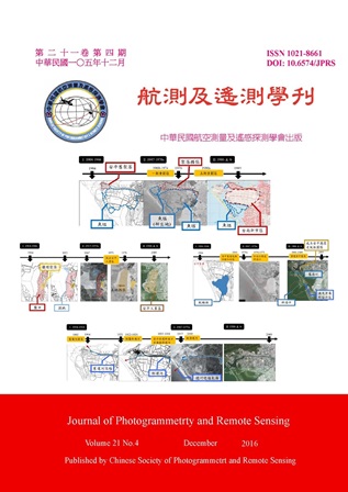
以時空資訊探討百年來台南古都沿海地區的土地利用變遷

Title

Land Use Changes of the Coastal Zone of Old Tainan City in the Past Hundred Years by Using Temporal Spatial Information

作者

江若慈, 曾義星

Author

Jo-Tzu Chiang, Yi-Hsing Tseng

中文摘要

時空資訊的紀錄,能幫助我們了解時代變遷之地理現象,自20世紀以來,台灣開始出現經過精細測量之圖資,包括地形圖及航照影像,然而欲應用時空資訊,必須將其糾正對位到一致的坐標系統上。本研究利用航測軟體(SOCET GXP 4.0)以及六參數轉換進行糾正對位,使用(1)古地圖:1904年台灣堡圖及1921年台灣地形圖(2)1947-1948年及1970年代歷史航照影像(3)1985-1989年第一版經建版地形圖(4)2009年福衛二號衛星影像(5)2010年正射影像,建立了百年圖資對位處理流程,及對其精度進行評估,其中古地圖及美軍空軍航照之精度大約可達十餘公尺,而1970年代歷史航照經過空三之正射影像精度可達約2公尺,並以台南古都沿海地區(約今安平一帶)為研究範圍,探討其土地利用的變遷,藉由影像判釋數化九項土地利用類別來量化土地利用變遷資料,以及透過轉移矩陣了解各土地利用如何轉變,並且配合文史資料探討及呈現其土地利用變遷的過程。

Abstract

Temporal spatial information is considered as a favorable data source to comprehend the changes in the past. Since 20th century, higher accuracy maps and images based on the technique of surveying has appeared in Taiwan. However, in order to retrieve these spatial information from the historical images, image registration and rectification should be done. In this study, we present a methodology of processing multi-temporal datasets during the past hundred years by commercial software (SOCET GXP 4.0) and a block adjustment with affine transformation. The temporal datasets used in this study include: (1) 1904 and 1921 ancient topographic maps; (2)1947,1948 and 1970s historical aerial images; (3)1985-1989 economic planning and development topographic map; (4) 2009 satellite images; (5) 2010 ortho-images. The accuracy was also assessed. And we focused on the coastal zone of old Tainan city (about Anping nowadays). The land use are classified into 9 categories by manual interpretation and digitization on the temporal datasets. A transition matrix is also utilized to present the land use changes referring to some historical records.

關鍵字

土地利用變遷、時空資訊、沿海地區、安平

Keywords

land use changes, temporal spatial information, coastal area, anping

附件檔名

華芸線上圖書館

http://www.airitilibrary.com/Publication/alPublicationJournal?PublicationID=10218661&IssueID=201703280021

備註說明

N / A

Pages:

227-237

論文名稱

整合式資訊重建應用於衛星影像雲遮蔽之移除

Title

Cloud Removal from Satellite Images Using Integrated Information Reconstruction

作者

賴鋼樺, 林昭宏

Author

Kang-Hua Lai, Chao-Hung Lin

中文摘要

雲層遮蔽是光學式衛星影像上不可避免的問題,此問題限制了衛星影像的使用範疇以及增加後續資料分析的困難度,為利於後續應用的拓展,如何重建遮蔽區域下的地表資訊便成為一研究議題。本研究為了拓展衛星影像之後續應用,致力於移除衛星影像上之雲層遮蔽並重建遮蔽區域下之地表資訊,藉此提升衛星影像的可用性。針對此問題,本研究提出一新的解決方法,利用衛星影像的週期性,也就是多時期影像資訊,來做為資訊重建的參考來源,再以本研究所提出之方法準確且無痕地進行地表資訊重建。基於多時期影像上的高時空相關性,本研究提出了片狀式鑲嵌法演算法,其結合了影像之時空特徵分割以及最佳鑲嵌線之選取來對遮蔽區進行資訊重建。在挑選重建資訊的來源上,本研究提出的影像之時空特徵分割依影像中擁有相似時空變化特徵的位置進行分群,各群別再依品質評估指標自多時期資訊中尋找出最佳的回填資訊來源,而後續的資訊重建則依據挑選出的最佳回填資訊來源來做為重建資訊之參考依據。此外,為了無痕且準確地進行資料重建,本研究採用解算帕森方程式(Poisson equation)來對資訊重建進行最佳化解算,與其他相關研究不同的是本研究不直接使用雲層遮罩之邊界作為鑲嵌線,而另尋一最佳鑲嵌線使之通過影像均調區來降低輻射值的不連續性,並作為帕森方程式穩定的邊界條件,從而達到更佳的無縫鑲嵌成果。總括而言,雲遮蔽區域會先經由時空特徵分割步驟切割成數塊片狀區域,依據影像品質排序的成果各自挑選出最佳的填補資訊來源,再以計算選取所得的最佳鑲嵌線輔助解算帕森方程式,準確且無痕地進行資訊重建。本研究所使用的定量分析資料是Landsat-7 ETM+衛星影像,實驗成果顯示,不論是在準確度或者視覺上,本研究所提出的方法都有優異的成果。

Abstract

Cloud covers present in optical satellite images generally limit the data usage and increase the difficulty of data analysis. Information reconstruction of could-contaminated images thus plays a fundamental step in data preprocessing. A method to accurately and consistently reconstruct information of cloud-contaminated pixels in multitemporal remote-sensing images is proposed in this study. By utilizing temporal correlation of multitemporal images, a patch-based information reconstruction that spatiotemporally segments a sequence of images into several patches with similar temporal variation is performed, and then information from cloud-free and high-similarity patches is cloned to their corresponding cloud-contaminated patches. In addition, a seam passing through homogenous regions is determined for a cloud-contaminated region to reduce radiometric inconsistency. A cloud-contaminated region is segmented into several patches and their corresponding cloud-free patches are determined by a quality assessment index, and the multi-patch information cloning is solved by an optimization process with a determined seam. These processes enable the proposed method to accurately and consistently reconstruct missing information in cloud areas. Qualitative analyses on sequences of images acquired by the Landsat-7 ETM+ sensor and a quantitative analysis on a simulated data are conducted to evaluate the proposed method. The experimental results the ability of our method to generate visually smoothing reconstruction results.

關鍵字

雲遮蔽移除、 資訊重建、 最佳鑲嵌線、 帕森方程式

Keywords

cloud removal, information reconstruction, optimal seam determination, poisson equation

附件檔名

華芸線上圖書館

http://www.airitilibrary.com/Publication/alPublicationJournal?PublicationID=10218661&IssueID=201703280021

備註說明

N / A

Pages:

239-256

論文名稱

空照影像陰影區塊之偵測和色彩修復之研究

Title

A Study on Shadow Detection and Color Restoration in Aerial Images

作者

張志瑋, 蔡展榮

Author

Chih-Wei Chang, Jaan-Rong Tsay

中文摘要

影像中每個像元的灰階值是由光照及地面反射函數來決定,當陽光照射地表時,較高的地表物(例如建物、高樹等)或大氣中的雲層將光線遮蔽使得亮度發生明顯變化而造成陰影的產生,陰影區內地物的影像資訊量因此降低甚至遺失,陰影亦會造成影像匹配失敗、不自然的顏色變化、錯誤的形狀變形等問題以及影響影像辨識。 本研究提出了一個以影像主成分分析為基礎的自動化陰影偵測方法,此方法對RGB和HSI兩種色彩空間的結果進行比較,嘗試找出最合適與有效的色彩空間。 除了陰影的偵測,陰影區的色彩修復也是很重要的一環。雖然陰影區內的資訊被降低,但陰影區附近的影像依然提供一定程度的亮度及色彩資訊可供陰影區色彩修復之用,本文除了偵測陰影外,亦對常見的兩種陰影修復方法進行主觀和客觀的評估:直方圖匹配以及局部統計法,結果顯示陰影區內的量化細節以及令人滿意的修復成果。

Abstract

The intensity value on each image pixel is determined by the functions of incident illumination and reflection of ground objects. In fact, light cast on terrain objects such as buildings and trees would cause shadows and occlusion. It is hard to restore original textures and color information in shadow areas. Many detailed information is hidden or lost due to such problems. Moreover, false color tone, shape distortion and inaccurate image matching within shadow areas also infect image recognition. This paper proposes an algorithm for automatic shadow detection based on the principal component analysis(PCA). It is tested by using both RGB and HSI bands in order to determine a proper and suitable color space for shadow detection. Besides shadow detection, color restoration in shadow areas is an important issue, too. This paper also performs subjective and objective evaluation on both histogram matching method and the local statistics method for color restoration in shadow areas. Test results demonstrate satisfied quality for restored images in shadow area.

關鍵字

陰影偵測、色彩修復、主成分分析、直方圖匹配、局部統計法、空照影像

Keywords

shadow detection, color restoration, principal component analysis, histogram matching, local statistics method, aerial images

附件檔名

華芸線上圖書館

http://www.airitilibrary.com/Publication/alPublicationJournal?PublicationID=10218661&IssueID=201703280021

備註說明

N / A

Pages:

257-269

論文名稱

無人飛行載具搭載數位相機於地質構造判釋之應用

Title

An Application of Unmanned Aerial Vehicle with an Onboard Camera to Structural Geology

作者

謝承恩, 范書睿, 林彥廷, 黃文正, 羅偉

Author

Cheng-En Hsieh, Shu-Jui Fan, Yan-Ting Lin, Wen-Jeng Huang, Wei Lo

中文摘要

隨著科技進步,野外地質調查的方法日新月異。結合現代化空間資訊技術的使用,野外資料的取得效率與精度大幅提升。本文將以近石門水庫大漢溪溪床露頭和大甲溪峭壁的三義斷層露頭為例,以無人飛行載具(Unmanned aerial vehicle, UAV)掛載數位相機,結合全球衛星定位系統(Global positioning system, GPS)靜態測量,獲取區域地面控制點坐標,處理所得之正射影像和立面影像,進行地質構造判釋。大漢溪溪床的正射影像中呈現一系列走向N20°E左移的斷層,及一振幅約90公尺、半波長約120公尺的S形褶皺。980公尺寬的大甲溪峭壁立面影像中發現三義斷層以至少三條分支的逆斷層帶出現,由西往東分別為斷層F1、 F2和 F3。F1切穿現代礫石層,判定為最活躍的斷層;F2並無切穿上覆約70公尺的階地堆積層,西側未再出現早於四百萬年形成的桂竹林層青灰色砂岩,研判為具最大錯移量的分支;F3上盤為為青灰色砂岩組成之桂竹林層,下盤為階地堆積層,近地表為風化層及植被所覆蓋。以上的地質構造判釋,皆得利於UAV所提供的影像,地面取樣距離(Ground sample distance, GSD)達4cm/pixel;GPS靜態觀測,經解算與平差後,地面控制點的平面精度達0.5公分,高程精度約為1公分內;數值地表模型(Digital surface model, DSM)的精度約莫為公分等級,足見UAV影像測繪搭配高精度地面控制點的高實用性,為未來地質調查不可或缺的工具。

Abstract

Abstract Taking advantage of spatial information technology, the efficiency of collecting data in the field and the data accuracy have been dramatically enhanced for geologists nowadays. In this research, by using UAVs (unmanned aerial vehicles) with a digital camera, and ultra-high accuracy ground control points, we produce ortho- and elevation images in order to recognize and analyze geological structures. We take a 750-meter-wide Dahan River riverbed near the Shihmen reservoir and a Dajia River cliff outcrop of the Sanyi active fault as examples to illustrate the usefulness of UAV for geologists. At the Dahan Riverbed, there are a series of left-lateral sense faults with orientation of N20°E. Furthermore, an S-shaped fold has been recognized with a 50-meter amplitude and 200-meter half-wavelength in the orthoimage. At the Dajia River cliff, a 980-meter-long elevation image has been produced. At least three fault branches can be recognized on the elevation image. They are labelled as F1, F2 and F3 from west to east in this Sanyi fault zone. F1 cutting into the modern gravelly layer has been acknowledged as the most active branch fault in the research area. F2 did not cut into the overlaid 70-meter-high terrace layer. It may be the fault branch with a maximum separation because the greenish grey sandstone of Kueichulin formation formed earlier than 4 million ago is not exposed west of F2 on the cliff. The hanging wall of F3 is composed of the greenish grey sandstone of Kueichulin formation and the footwall of F3 is composed of gravelly layer formed after 2 million years ago. The F3 is overlaid with regolith and vegetation. The results of the geologically structural analyze above all benefit from the images taken via UAV. Moreover, the GSD (ground sample distance) of the high-quality models presented in this study reaches 4 cm/pixel. With the accuracy of static GPS (global positioning system) reaches about 0.5cm in horizontal and 1cm in elevation. DSM accuracy is about in centimeters. To sum up, UAV-based photogrammetry with high accuracy ground control points, showing a high efficiency and high flexibility indispensable technology in the field survey for geologists.
關鍵字

三義斷層、構造地質、野外地質調查、攝影測量、UAV影像測繪、無人飛行載具

Keywords

Sanyi fault, geological field survey, structural geology, photogrammetry, UAV mapping and unmanned aerial vehicle (UAV)

附件檔名

華芸線上圖書館

http://www.airitilibrary.com/Publication/alPublicationJournal?PublicationID=10218661&IssueID=201703280021

備註說明

N / A

Pages:

271-279

論文名稱

導入專業測繪成果於開放街圖

Title

Considering professional survey results in OpenStreetMap

作者

朱宏杰, 曾義星, 江凱偉

Author

Hone-Jay Chu, Yi-Hsing Tseng, Kai-Wei Chiang

中文摘要

「開放街圖」OSM(OpenStreetMap),於2004年由英國Steve Coast發起,其為一群眾計劃任何人皆可參與,經由貢獻者主動編輯周遭與家鄉的地圖。然而開放街圖的精度是一值得探討的議題,所以將使用測量專業知識,例如:控制測量、水準測量、GPS測量等專業技術以提高OSM精度,使OSM能夠更加精確。 本研究主要是讓專業測量成果融入於OSM,以「台南市台南公園」為例,測量的時間為2014年7至8月,並匯入專業測量成果於JOSM編輯器,進行OSM編修。透過實際進行編修前後OSM比對,可瞭解專業測量結果確實豐富了開放街圖,也透過OSM,讓大眾看到測量製圖結果,因此除了內容豐富之外,編修前後建物與水池位置、數量、面積與形狀確實有大幅改變。

Abstract

Steve Coast created the OpenStreetMap (OSM) in 2004 in the United Kingdom. OSM is a community project in which everyone can participate. Active contributors can map out their neighborhoods and countries. However, the quality of the OSM is a critical topic. Combining the surveying technologies, such as control surveying, leveling, and Global Positioning System measurement with OSM will make it more accurate. This study integrates topographical surveying into the OSM. The case study was conducted in Tainan Park, Tainan City in July and August 2014. The maps from professional surveying were imported into the Java OSM Editor and the OSM was edited. A comparison between the OSM before and after editing shows that the surveying results enriched the OSM. The professional surveying results can be demonstrated by the OSM. The results also indicate that location, number, area, and shape of buildings and pool differ dramatically before and after the OSM editing.

關鍵字

測量、製圖、開放街圖

Keywords

surveying, mapping, OSM

附件檔名

華芸線上圖書館

http://www.airitilibrary.com/Publication/alPublicationJournal?PublicationID=10218661&IssueID=201703280021

備註說明

N / A

更多活動學刊