ENGLISH

24卷/1期

24卷/1期

華藝線上圖書館

Pages:

特刊引言

論文名稱

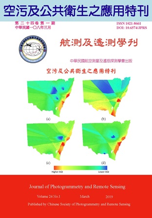
空污及公共衛生之應用特刊

Title

Special Issue on the Application of Air Pollution Monitoring and Public Health

作者

吳治達

Author

Chih-Da Wu

中文摘要

近年隨著全球化及經濟發展迅速,工業化及都市化帶給人類許多便利,但同時亦造成許多新的環境問題及威脅,其中人人每分每秒均會接觸、無可迴避之空氣污染問題,為近年最受重視的環境污染議題之一。世界衛生組織(World Health Organization, WHO)於2018年之報告中亦指出,全球將近有90%的族群直接暴露在有害的空氣污染下,並且空污已間接導致每年約700萬人之死亡;而在各種空氣污染物質中,細懸浮微粒(Fine Particulate Matter, PM2.5)為空氣中粒徑小於2.5μm的極微小粒子,其可透過鼻腔、支氣管以及肺泡組織,甚至進一步深入微血管,經由血液循環影響人體各個不同器官,進而與這些器官發生刺激反應並排放有毒成分,造成過敏、氣喘、肺病等呼吸道以及心血管疾病。有鑑於此,了解空氣污染及細懸浮微粒對人體健康之影響,進而研擬相關政策,以降低甚至預防這些環境有害物質對民眾健康之影響,實為當前公共衛生所面臨的重要挑戰。 航測及遙測技術於國外已廣泛被運用在跨領域之研究上,舉凡醫療、教育、犯罪等領域皆可見相關之研究成果,其中近期又以空氣污染以及公共衛生議題之應用最受重視。透過地理資訊系統之空間分析功能、以及航照、衛星光譜資訊以及地理空間資料庫等資訊,除可於大尺度之空間上觀察空氣污染之整體變化與濃度趨勢外,如進一步結合健康資料與統計模式,即可分析空氣污染與人類健康之關聯性,並藉以推論空氣品質變化對公共衛生是否有所影響,進而提出規劃與建議,達到改善民眾之生活及健康之效果。反觀台灣近年在交通、都市化、工商業均成長迅速,然而空氣品質卻常耳聞紫爆之情況,若能結合航遙測資料之優勢與特性,將其應用於國內之相關議題,進而積極點出台灣在空氣污染及公共衛生之問題點並提出改善方案,對於改善國人之生活品質與健康環境,將具有實質之助益。 在經歷多面的努力後,「空污及公共衛生之應用特刊」終於問世,本次特刊收錄之研究報告涵括衛星技術與空間資料於細懸浮微粒空間變異推估之應用、以及空污對於健康甚至犯罪率之影響與關聯分析,不論在研究主題之深度及廣度上均已兼備。在此感謝所有協助之人員,希望本特刊之發行,可為國內航遙測技術之應用開展新的主題與方向,並使國人了解航遙測之用途並非僅僅侷限在測繪上,並且透過航遙測資訊之協助,亦使得更多過去尚未理解之環境問題得以被釐清;同時希望經由特刊中各項之研究成果,使台灣民眾與政府皆能理解並注重空氣污染之嚴重性,積極擬定未來之改善方向,使台灣更加進步。

Abstract

關鍵字

Keywords

附件檔名

華芸線上圖書館

http://www.airitilibrary.com/Publication/Index/10218661-201903-201903290005-201903290005-i-i/

備註說明

N / A

Pages:

1-12

論文名稱

空氣污染與不同類型犯罪行為之空間相關性—以澳洲新南威爾斯州為例

Title

Defining the Spatial Relationship between Air Pollution and Crime Behavior-A Case Study of New South Wales, Australia

作者

陳徐賢、尹杰德、郭佩棻

Author

Hsu-Hsien Chen, I Gede Brawiswa Putra, Pei-Fen Kuo

中文摘要

空氣品質好壞會影響人類身心及日常行為模式。現有文獻多主張空氣污染將增加焦慮、壓力與發炎反應,而導致暴力犯罪風險增加;然而,空污亦可能降低戶外活動意願並減少街頭犯罪。因此本研究著眼現有文獻之不一致性,建議將犯罪類型分為室內與室外,並假設空污將減少室外街頭犯罪,並轉為增加室內家暴風險。以澳洲新南威爾斯州為例,應用地理加權迴歸模型分別探討空污程度與家暴事件及搶劫的關係。結果顯示,該區空污程度越嚴重(空氣質量指數(AQI)越高),其家庭暴力數越多,但搶劫數越少。推論空污對室內室外犯罪行為應會有不同影響。

Abstract

In recent years, air quality has gradually deteriorated, which has affected human behavior patterns, and made air pollution become an important issue. This study took New South Wales, Australia as our study area to define the spatial relationship between air pollution levels and indoor- and outdoor- crimes. By using the Ordinary Least Square (OLS) and Geographically Weighted Regression model (GWR), the Air Quality Index (AQI) and other relevant factors are used to predict the number of crimes. The results show that the areas with severer degree of air pollution tend to have more domestic violence (indoor crimes) but less robberies (outdoor crimes).

關鍵字

空氣污染、犯罪行為、地理加權迴歸模型、空氣質量指數

Keywords

Air Pollution, Robbery, Domestic Violence, Geographically Weighted Regression, Air Quality Index

附件檔名

華芸線上圖書館

http://www.airitilibrary.com/Publication/Index/10218661-201903-201903290005-201903290005-1-12/

備註說明

N / A

Pages:

13-24

論文名稱

應用空間資訊技術以探討環境綠蔽度與肺癌發生之關聯:以大台北及大嘉義地區為例

Title

Association between Surrounding Greenness and Lung Cancer Incidence using Geospatial Information Technologies: A Case Study of Taipei and Chiayi areas

作者

黃群茵、張奕彩、陳映融、龍世俊、陳穆貞、吳治達

Author

Chun-Yin Huang, Yi-Tsai Chang, Yinq-Rong Chern, Shih-Chun Candice Lung, Mu-Jean Chen, Chih-Da Wu

中文摘要

肺癌為國內癌症死因前三位,由於早期診斷不易,大部分患者預後不佳,故為重要之癌症疾病。與此同時,現今已有許多研究指出,植物所組成之環境綠蔽度對人體身心健康具有正面影響功效,因此了解環境綠蔽度對於肺癌發生之影響,對預防醫學之發展實為一重要議題。本研究結合地理資訊系統、遙感探測等空間資訊技術,以2003 至2012 年全民健康保險資料庫抽樣歸人檔為材料,選擇大台北及大嘉義地區為研究試區,首先利用全域型Moran's I 指標以了解肺癌之發生是否具有空間群聚之效應;其中在校正可取得之肺癌風險因子的情況下,利用廣義加乘混合模型,以探討環境綠蔽度及地區肺癌發生之關聯性。空間群聚分析之結果指出,研究期間肺癌之發生確實具有空間群聚的現象;並且由模型分析結果可知,當常態化差異植生指標(Normalized Difference Vegetation Index, NDVI)增加1 個單位之四分位距(NDVI Interquartile Range (IQR) = 0.27))時,將使得該地區肺癌發生風險減少32% (相對風險:0.68;95%信賴區間:0.66 - 0.70;P < 0.01),此統計結果於生活環境差異頗大的大嘉義地區及大台北地區,均達到顯著水準。由此可知環境綠蔽度對於肺癌之發生具有統計上的保護效力。

Abstract

Lung cancer was ranked as the top-3 leading cause of cancer-related deaths in Taiwan in the last decade. Signs and symptoms of lung cancer typically occur only when the disease is advanced, therefore elevating the difficulties in early-stage diagnosis. Moreover, the prognosis is usually poor for most patients. Recently, studies have suggested that exposure to areas with higher amounts of distributed community vegetation has health benefits. To understand the cardiovascular health effects related to greenness exposures is important in developing the lung cancer preventive medicine. In this study, township level lung cancer incidence from 2000 to 2010 for Taipei and Chiayi areas were obtained from the Longitudinal Health Insurance Database (LHID). The MODIS Normalized Difference Vegetation Index (NDVI) database was used to identify the long-term exposure to greenness of the study population. A global Moran’s I was used to examine the spatial clustering effects of lung cancer incidence during the study period. Then, a Generalized Additive Mixed Model (GAMM) was applied to assess the association between surrounding greenness and lung cancer incidence. While all the calculated Moran’s I achieved statistical significance (p < 0.01), lung cancer represented a spatial clustering trend regardless the season or study year. The results of GAMM indicates that, greenness exposures showed a negative association with lung cancer. The adjusted relative risk for NDVI was 0.68 (95% confidence interval [CI] = 0.66 to 0.70; p < 0.01) per NDVI interquartile range (IQR) increment (0.27) exposure. Consistently negative association was found regardless the study cities. The results demonstrated long-term greenness exposure decreased the risk for lung cancer.

關鍵字

肺癌、環境綠蔽度、空間資訊技術、常態化差異植生指標、廣義加乘混合模型

Keywords

Lung Cancer, Surrounding Greenness, Geospatial Information Technologies, Normalized Difference Vegetation Index (NDVI), Generalized Additive Mixed Model (GAMM)

附件檔名

華芸線上圖書館

http://www.airitilibrary.com/Publication/Index/10218661-201903-201903290005-201903290005-13-24/

備註說明

N / A

Pages:

25-43

論文名稱

應用空間迴歸模式探討都市綠地、PM2.5 與地表溫度之關聯

Title

Applying Spatial Regression Model to Explore the Relationship among Urban Green Areas, PM2.5 and Land Surface Temperature

作者

張晏菁、徐逸祥、林峰正

Author

Yen-Ching Chang, Yi-Shiang Shiu, Feng-Cheng Lin

中文摘要

本文利用MODIS 衛星影像與政府開放資料取得相關的資料變數,加入五種空間單元個別討論地表溫度與PM2.5 濃度的空間關係,試圖從中找出冬夏季台中地區綠地環境、細懸浮微粒與地表溫度三者的關聯性。以一般空間模式的分析結果得到地表溫度與PM2.5 濃度存在一定之關係,彼此都有提升另一變數的效果。透過Moran's I 等指標評比,建議以500 m 空間單元探討因子與地表溫度之關係較能處理空間自相關問題,其冬夏季Moran's I 值分別為0.008 與0.018;細懸浮微粒PM2.5 則以250 m 較適當,其冬夏季Moran's I 值分別為-0.046 與-0.032。此外,本研究發現植生指數NDVI 對於PM2.5 濃度的正負向相關性在冬夏季節出現不同的結果,推測冬季枯水期與市地重劃的土地裸露所造成地表揚塵,是可能造成植栽滯塵原理無法有效發揮的原因。

Abstract

This study used MODIS satellite imagery and government open data to discuss the relationships among urban green areas, PM2.5 and land surface temperature in the former Taichung city in winter and summer. We demonstrated the relationships with five different grid sizes in the general spatial model. According to the results of the general spatial model, there was a certain relationship between land surface temperature and PM2.5 concentration and also a positive effect on each other. The Moran’s I index indicates that 500 m is the most suitable grid size to demonstrate the relationships between factors and land surface temperature and deal with the influence of spatial autocorrelation; the values of Moran’s I is 0.008 and 0.018 in winter and summer, respectively. As for PM2.5, the most suitable grid size is 250 m with the values of Moran’s I -0.046 and -0.032 in winter and summer, respectively. In addition, we found that the positive and negative effects of NDVI on PM2.5 concentrations were different in the winter and summer seasons. It is speculated that dry riverbed during the low flow season and barren land in land consolidation area in winter caused raised dust pollution, which is the reason why the dust retention with plants could not be effectively exerted.

關鍵字

空間自相關、一般空間模式、植栽滯塵

Keywords

spatial autocorrelation, general spatial model, dust retention

附件檔名

華芸線上圖書館

http://www.airitilibrary.com/Publication/Index/10218661-201903-201903290005-201903290005-25-43/

備註說明

N / A

Pages:

45-58

論文名稱

大台北地區空氣汙染及土地利用型態對極低出生體重早產兒六個月大時神經發展之影響

Title

The Effects of Air Pollution and Land Use Types on Neurodevelopment at Six Months among Very Low Birth Weight Preterm Children in the Greater Taipei Area

作者

楊喻婷、江椿彬、簡伶朱、吳治達、趙馨

Author

Yu-Ting Yang, Chuen-Bin Jiang, Ling-Chu Chien, Chih-Da Wu, Hsing Jasmine Chao

中文摘要

空氣汙染是全球性的環境問題,造成多種健康危害。近年來有研究調查發現,出生前後的空氣汙染物暴露會影響兒童神經功能的發展。因此本研究評估在大台北地區出生的極低出生體重早產兒,出生前後空氣汙染物暴露及住家附近土地利用型態與六個月時(矯正年齡)神經功能發展間的相關性。本研究利用地理資訊系統,評估受訪兒童在媽媽懷孕期間及出生至六個月住家戶外空氣汙染物濃度以及土地利用特性。在受訪兒童神經發展評估部份,利用第三版貝萊嬰幼兒發展量表進行。其他受訪兒童相關資料,如出生前後居住地、基本社會人口學特徵、家中汙染物暴露等等,則利用結構式問卷及病歷收集。受訪兒童空氣汙染物暴露及住家附近土地利用特性與神經功能發展間的相關性,以多變項迴歸分析評估。根據迴歸分析結果,多項空氣汙染物(O3、PM10、NO 及NO2)對兒童神經功能發展有不良的影響,其中又以媽媽懷孕期間的空氣汙染物暴露濃度對兒童影響較大。在土地利用型態方面,受訪兒童神經發展與住家附近國道面積有顯著負相關,與住家鄰近公園綠地則有正相關。根據本研究的結果,減少空氣汙染物排放、增加都巿中的綠地面積,可以增進極低出生體重早產兒的神經發展。

Abstract

Air pollution is a global environmental problem and causes numerous adverse health effects. Recent studies indicated that prenatal and perinatal air pollution exposure decreased the neurodevelopment of children. Thus, we conducted a study to evaluate the effects of prenatal and early childhood exposure to air pollution and land use characteristics near residence on neurodevelopment at six months old (adjusted age) among very low birth weight (VLBW) preterm children in the Greater Taipei area. We used geographic information system to estimate air pollution concentrations and land use types around the study children’s residences during pregnancy and in the first six months of life. Neurodevelopment of the study children were evaluated using Bayley Scales of Infant and Toddler Development (Bayley-III). Other important information of the children were collected using a structured questionnaire and medical records including prenatal and postnatal residential addresses, basic social demographic characteristics, pollutants at home, etc. We used multiple regressions to examine the relationships of interest. According to the results of regression analyses, several air pollutants (O3, PM10, NO, and NO2) had adverse effects on children’s neurodevelopment. Among different exposure periods, air pollutant exposure during pregnancy had the most significant impact on children’s neurodevelopment. In addition, children’s neurodevelopment was negatively associated with area of freeways near residence, and positively related to living near parks and greens. Based on the results of this study, reduction of air pollution emission and increase of greenbelts in the urban areas can promote the neurodevelopment of VLBW preterm children.
關鍵字

土地利用型態、神經發展、戶外空氣汙染、早產、極低出生體重

Keywords

Land Use Types, Neurodevelopment, Outdoor Air Pollution, Preterm Birth, Very Low Birth Weight

附件檔名

華芸線上圖書館

http://www.airitilibrary.com/Publication/Index/10218661-201903-201903290005-201903290005-45-58/

備註說明

N / A

Pages:

59-77

論文名稱

利用Landsat 8 OLI 影像反演氣溶膠光學厚度之成果論證臺中市交通流量對PM2.5 之影響

Title

Using the Aerosol Optical Depth Data Retrieved from Landsat 8 OLI Imagery to Demonstrate the Influence of Traffic Flow on PM2.5 in Taichung

作者

吳兆鴻、徐逸祥、張晏菁

Author

Chao-Hung Wu, Yi-Shiang Shiu, Yen-Ching Chang

中文摘要

細懸浮微粒PM2.5 為臺灣中南部地區最關切的環境議題之一,其成因目前仍眾說紛云,除臺中火力發電廠之外,汽機車排放的廢氣亦常被歸咎為主因。然PM2.5 和交通量的監測常因僅有點狀監測的數據而無法全面探討交通量是否對PM2.5 有直接影響。因此本研究利用Landsat 8 OLI 影像及離散係數法反演氣溶膠光學厚度,再結合臺中及鄰近縣市共25 個空氣品質測站推估原臺中市假日及非假日的PM2.5;而交通量方面以Google 地圖一般路況車流量的平均壅塞程度與實際車道的車道寬、路口停滯秒數等推算成估計的小客車當量來表達交通的壅塞程度。最後再考量空間自相關和不同空間單元的前提下,以空間迴歸模型決策模式找出最適合的迴歸模型,來解釋當地PM2.5 受本身及鄰近區域因子影響的情形。

Abstract

Fine particulate matter PM2.5 is one of the most concerned environmental issues in central and southern Taiwan. Except for Taichung Thermal Power Plant, the exhaust emissions from motor vehicle are often attributed to the main cause. The ground and point monitoring approaches of air quality and traffic flow are generally used while may not fully explore whether traffic flow has a significant impact on PM2.5. Therefore, this study used Landsat 8 OLI image and dispersion coefficient method to retrieve aerosol optical depth. We also included 25 air quality stations in Taichung and neighboring counties as the reference to estimate PM2.5 for holiday and normal day in Taichung City. The passenger car equivalent was estimated with average congestion level from Google Map general road traffic as well as actual road width and the seconds of stopped-time to estimate the congestion of the traffic. Finally, considering the spatial autocorrelation and different spatial units, the spatial regression model decision process is used to explore the most suitable regression model to explain the local PM2.5 affected by the local and neighboring factors.

關鍵字

氣溶膠光學厚度、小客車當量、空間迴歸模式

Keywords

aerosol optical depth, passenger car equivalent, spatial regression model

附件檔名

華芸線上圖書館

http://www.airitilibrary.com/Publication/Index/10218661-201903-201903290005-201903290005-59-77/

備註說明

N / A

更多活動學刊