ENGLISH

24卷/4期

24卷/4期

華藝線上圖書館

Pages:

211-222

論文名稱

合成孔徑雷達影像於颱風豪雨後淹水之偵測

Title

A Study for Inundation Mapping After Typhoon and Heavy Rainfall by Using SAR Imagery

作者

邱俊穎、謝嘉聲、黃宗仁、葉堃生、管立豪、胡植慶

Author

Chun-Ying Chiu, Chia-Shen Hsieh, Tsung-Jen Huang, Kuen-Sheng Yeh, Li-Hao Kuan, Jyr-Ching Hu

中文摘要

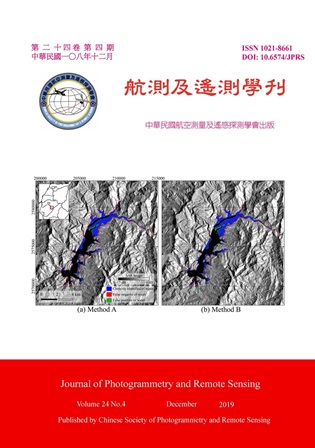
合成孔徑雷達影像 (SAR) 可以穿透雲霧、日夜皆可運作,可克服光學遙測影像在不良天候觀測的不足,對於颱風豪雨後的災情偵測有相當的優勢。本研究先以SAR 影像對曾文水庫的水體進行辨識,進一步配合理論雷達陰影區與相對高程模型HAND (Height Above the Nearest Drainage) 之資訊,可大幅降低誤判。結果顯示水體的辨識精確性 (F1-Measure) 從66.6%提升至92.0%。淹水區域則可透過兩張SAR 影像中相對應像素間的差異作為判定,這個差異在6.2 dB 有最佳的辨釋精確性約82.6%。本研究提出一個SAR 影像淹水偵測流程,並以實際水災事件作為案例,進行淹水範圍影響之估測,分析的結果對於應變災情資訊提供有相當助益。

Abstract

Comparing to optical remote sensor, Synthetic Aperture Radar (SAR) is an active sensor and radar signal can penetrate clouds for working in near all-weather/day-night. Therefore, SAR damage assessment methods enable useful disaster response in typhoon and heavy rainfall. This study first uses SAR images to detect change of surface water area in Zengwen Reservoir and limits surface water areas by HAND (Height Above the Nearest Drainage) mask and radar layover & shadow mask. The result’s F1-Measure increase from 66.6% to 92.0% after using mask data. Backscatter decreases due to totally flooding, therefore threshold values can be used for separating flooded area. The best detected result: F1-Measure 82.6% occurs when the threshold is 6.2dB. This study proposes a flood detection process by SAR image, and uses actual flood events as a case to estimate the impact of flooding range. The results of the analysis are quite helpful for providing the assessment and quick response after a hazardous event.

關鍵字

遙測、合成孔徑雷達、淹水

Keywords

Remote Sensing, SAR, Inundation

附件檔名

華芸線上圖書館

http://www.airitilibrary.com/Publication/alDetailedMesh?DocID=10218661-201912-202001030001-202001030001-211-222

備註說明

N / A

Pages:

223-233

論文名稱

以MODIS 與Landsat 8 影像評估都市冷島強度

Title

Applying MODIS and Landsat 8 Images for Evaluating Urban Cool Island Effect

作者

周孜恆、林毓琪、王聖鐸

Author

Tzu-Heng Chou, Yu-Qi Lin, Sendo Wang

中文摘要

本研究以臺北市為研究區,利用多時期MODIS 和Landsat 8 影像所提供之大尺度地表溫度,觀察臺北市中心綠地分布、大小和都市冷島效應的關係,進而評估都市冷島強度,並分析其差異性。此外也利用氣象局地面氣象站所提供的氣溫驗證,評估兩種影像是否能應用於評估都市冷島強度。研究結果顯示Landsat 8 和MODIS 影像所反演之地表溫度與地面氣象站氣溫皆為高度正相關。以Landsat 8 影像計算之結果顯示,臺北市公園都市冷島強度在春天和夏天較高,其中大安森林公園在春天的冷島強度達到1.92°C。最後分析都市公園面積和該公園都市冷島強度之相關性,R2 值為0.4852 為中度相關。

Abstract

Both MODIS and Landsat 8 provide the land surface temperature (LST) images, but their images are slightly different both in the spatial resolution and in the calculation of LST. The MODIS retrieves LST from thermal infrared response at the spatial resolution of 1 kilometer, whereas the Landsat 8 images retrieve LST from band 10 and 11 thermal infrared response with the spatial resolution of 30 meters. These differences are the focus of this paper and are evaluated in the process of finding urban cool islands (UCI). Taipei City is selected as our research area. The heat generated from high-rise buildings and artificial impervious surfaces in Taipei results in the urban heat islands. Yet, there are also several urban parks with high-density vegetation coverage where can cool down the surface temperature of the city. Thus, we expect to acquire large-scale LST by multi-temporal MODIS and Landsat 8 images, considering the relationship between the green area in downtown and the spatial resolution of images, and assessing how large the green area may result in the UCI. Finally, we also use the temperature actually measured by the ground weather station for validation, analyzing whether both of two images can be used to evaluate the UCI effect.

關鍵字

MODIS、Landsat 8、地表溫度、都市冷島

Keywords

MODIS, Landsat 8, Land Surface Temperature (LST), Urban Cool Island (UCI)

附件檔名

華芸線上圖書館

http://www.airitilibrary.com/Publication/alDetailedMesh?DocID=10218661-201912-202001030001-202001030001-223-233

備註說明

N / A

Pages:

235-244

論文名稱

臭氧空間暴露推估模型之比較—以六輕工業區為例

Title

Comparison of Geospatial-Temporal Modeling Approaches in Ozone Pollution Estimations

作者

曾于庭、吳治達、陳裕政、許金玉、陳穆貞

Author

Yu-Ting Zeng, Chih-Da Wu, Yu-Cheng Chen, Chin-Yu Hsu

中文摘要

隨著地理資訊系統以及遙感探測技術上的純熟,空氣汙染空間暴露推估模型的發展更具多樣性。在過去研究中,已有許多應用單一模型進行空氣汙染物時空分布推估的案例,但系統性的比較不同推估模型解釋能力之研究仍不多見。基於此,本研究以環保署於雲林及嘉義所設置之十個特殊性工業區測站,於2015 至2018 年之空汙觀測資料為材料,選擇多元逐步迴歸為基礎之土地利用迴歸、地理加權迴歸及地理時間加權迴歸等三種統計建模方法,綜合比較不同方法學於O3 汙染物分布推估能力之差異。研究結果顯示,O3 模型R2 值介於0.51-0.64,並且以時間地理加權迴歸之模型結果最佳。

Abstract

Recent advancements in the geographic information systems and remote sensing technology have supported the development of geospatial-temporal modeling approaches for air pollution. Previous studies estimated the spatial-temporal variability of air pollutants using a single model, but only a few studies considered exposure assessment using multiple models and compared model performance. In this study, O3 data during 2015 to 2018 was collected from specific industrial monitoring stations provided by the Taiwan Environmental Protection Agency. Three geospatial-temporal modeling approaches including land-use regression (LUR), geographically weighted regression (GWR), and geographically and temporally weighted regression (GTWR) were used to predict O3 for our comparison. The results showed that R2 obtained from all models were 0.51 to 0.64. Furthermore, the GTWR model has the greatest performances compared to LUR, and GWR models.

關鍵字

臭氧、土地利用迴歸、地理加權迴歸、時間地理加權迴歸

Keywords

Ozone, Geographically and Temporally Weighted Regression (GTWR), Geographically Weighted Regression (GWR), Land-use Regression (LUR)

附件檔名

華芸線上圖書館

http://www.airitilibrary.com/Publication/alDetailedMesh?DocID=10218661-201912-202001030001-202001030001-235-244

備註說明

N / A

Pages:

245-255

論文名稱

以開放街圖與開放資料分析公共自行車使用率—以臺北市為例

Title

Using OpenStreetMap and Open Data for the Location Analysis on Public Bicycle Stations-A Case Study on the YouBike System in Downtown Taipei City

作者

趙家芸、王聖鐸

Author

Chia-Yun Chao, Sendo Wang

中文摘要

臺北市的第一項公共自行車服務 - YouBike 營運至今,已超過106,895,634 租借次數。臺北市的公共自行車設置在全臺已較為完整,但以使用者經驗觀察,現有政策的新設站三項標準仍不足以符合公共自行車使用者租借需求,因此以微笑單車 (YouBike) 租借使用者端的需求為來源,利用開放街圖(OpenStreetMap, OSM) 中自發性地理資訊 (Volunteered Geographic Information, VGI) 找出站點周遭對公共自行車站使用率影響較大的因素,推估在何種特性地點下的YouBike 租借站使用率較高,針對不同道路品質:自行車道與人行道的有無;與不同租借地:捷運站、學校、河濱自行車道入口,評估公共自行車租借站營運的效率與使用者便利性。

Abstract

The first public bicycle system of Taipei City, YouBike, has the total rented over 106,895,634 times. Taipei is the city providing most well-developed public transportation systems and public bicycle systems in Taiwan. Currently, Taipei government builds new YouBike systems with 3 standards, but it still not enough to fit the need of YouBike riders. This study is based on the need of YouBike user, we extracted geographic data from OpenStreetMap(OSM) and the volunteered geographic information (VGI) such as roads, sidewalks, bicycle lanes, and popular destinations in Taipei city. These data were treated as the influence factors for location analysis of stations. The statistics is used to evaluate the efficiency of the circulation of bicycles, in order to find out the suggested location of the docking stations and improve the efficiency and stimulate more usage.
關鍵字

使用率分析、公共自行車、開放街圖、開放資料、微笑單車

Keywords

Location Analysis, Public Bicycle System, OpenStreetMap, Volunteered Geographic Information, YouBike

附件檔名

華芸線上圖書館

http://www.airitilibrary.com/Publication/alDetailedMesh?DocID=10218661-201912-202001030001-202001030001-245-255

備註說明

N / A

更多活動學刊