ENGLISH

25卷/4期

25卷/4期

華藝線上圖書館

Pages:

193-209

論文名稱

整合數值航測與空間統計技術於遺址土地利用變遷與文化層破壞相關因子偵測之研究

Title

Integrating Digital Photogrammetry Techniques and Spatial Statistics to Explore the Related Factors of Land-Use Change and Destruction Degree of Cultural Layer in Archaeological Sites

作者

莊永忠、何彥陞

Author

Yung-Chung Chuang, Yen-Sheng Ho

中文摘要

本研究以臺灣三處遺址範圍為研究區,整合1976~1978 與2016~2017 年航空照片與數值航測技術,進行土地利用與地形變遷對遺址破壞程度偵測之研究,並分析影響文化層擾動之空間關聯顯著因子。研究結果顯示各遺址於1976 年至2017 年間普遍受到高密度土地使用影響,人為屯墾、風水災害與工程建設所造成之地形變動為遺址文化層受破壞主因,其中又以私有土地為甚。基於此,以都市計畫手段進行土地徵收與土地管制有其必要性。未來將可應用此技術提高遺址管理成效並有效針對問題因子進行檢討。

Abstract

Current situation and accumulated development of archaeological sites have very high impacts on the preservation value of the site. This research set 3 archaeological sites in Taiwan as study areas. Assessment of the degree of destruction of cultural layers due to land use change and morphological change were conducted with aerial photographs (1976~1978; 2016~2017) and digital aerial survey technology. The results showed that the archaeological sites were all seriously influenced due to the high land use intensity between 1976~2017. Morphological changes caused by human cultivation and engineering construction were main causes of site destruction, especially in private lands. Therefore, urban planning methods for land acquisition or land regulation are necessary. The prediction model of the destruction degree of the cultural layers of the site developed by the research team has also achieved good predictive ability. In the future, this technology can be applied to improve the effectiveness of archaeological sites management and effectively review the problem factors.

關鍵字

遺址、數值航測、文化層、地形變動、都市計畫

Keywords

Archaeological Sites, Digital Aerial Survey Technology, Cultural Layers, Morphological Changes, Urban Planning

附件檔名

華芸線上圖書館

https://www.airitilibrary.com/Publication/alDetailedMesh?DocID=10218661-202012-202101070008-202101070008-193-209

備註說明

N / A

Pages:

211-225

論文名稱

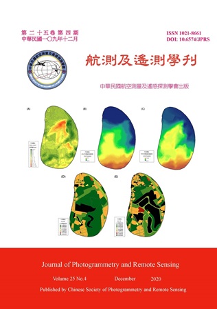
車禍發生與都市地表溫度之相關性探討

Title

A Study on the Correlation between Car Accidents and Urban Surface Temperature

作者

劉蕙慈、徐逸祥

Author

Hui-Tzu Liu, Yi-Shiang Shiu

中文摘要

本研究分析環境溫度與車禍發生次數之關聯,環境溫度來源為MODIS 衛星影像,而車禍紀錄則取自政府開放資料平台 (open data)。而為了確認道路型態是否也與車禍發生有關,因此以空間句法 (space syntax) 分析相對不對稱性 (relative asymmetry, RA) 指標。之後以雙變數空間自相關 (bivariate local indicators of spatial association, BiLISA) 及卜瓦松迴歸 (Poisson regression),分別對地表溫度、RA 值與和車禍次數進行空間及非空間關聯性分析。結果顯示雙變數空間自相關分析或是卜瓦松迴歸分析都證明車禍發生次數與地表溫度呈現正相關,後續可提供給都市計畫以及地方警政單位做為未來通盤檢討、都市設計、車禍防治、市容整理及交通執法等方面做參考。

Abstract

This study analyzed the relationship between the environmental temperature and the number of car accidents from the perspectives of space and time. The environmental temperature was retrieved by satellite images and the car accident records were based on the open data provided by the government open data platform. After sorting out the location data, three grid cells of different sizes were used to calculate the average surface temperature of the city and the number of car accidents. In order to confirm whether other factors are also related to the occurrence of car accidents, we added index related to road types, and analyzed relative asymmetry (RA) indicators through the concept of space syntax using road network diagrams to calculate the integration of the road. After the above pre-processing was completed, the bivariate local indicators of spatial association (BiLISA) and Poisson regression were used to analyze the spatial and non-spatial correlations between the surface temperature and the RA value and the number of accidents. The results help us to clarify whether there is a correlation between the location of the car accident and the urban surface temperature or road pattern. The results showed that both BiLISA and Poisson regression proved that the number of car accidents is positively correlated with the surface temperature, which can be provided to urban planning and local police units for future comprehensive review, urban design, car accident prevention, city appearance arrangement and traffic law enforcement etc. as the reference.
關鍵字

MODIS影像、地表溫度、開放資料、雙變數空間自相關、卜瓦松迴歸

Keywords

MODIS Images, Surface Temperature, Open Data, Bivariate Local Indicators of Spatial Association, Poisson Regression

附件檔名

華芸線上圖書館

https://www.airitilibrary.com/Publication/alDetailedMesh?DocID=10218661-202012-202101070008-202101070008-211-225

備註說明

N / A

Pages:

227-240

論文名稱

利用常態化差異植生指數並配合監督式分類進行臺中市西部土地利用變遷之探討

Title

Employing the NDVI and Supervised Classification to Study the Land Use Change in Western Taichung City

作者

林委億、陳子曦、洪承鈞

Author

Wei-Yi Lin, Zi-Xi Chen, Cheng-Chun Hung

中文摘要

本研究使用臺中市西部地區之福衛五號衛星影像進行光譜分析及影像分類,利用GIS 計算同一地不同時間的常態化差異植生指數及監督式分類,討論研究區自2018 年至2019 年的地表覆蓋變化情形,進而偵測土地利用變異區位。並搭配現地實察,探討不同的土地利用與光譜特性、影像分類結果之差異。配合臺中市國土計畫法內容,討論國土計畫與土地利用變遷之關係,探討土地利用變異的可能原因。研究結果指出受國土計畫法規之影響,鄰近市區的郊區地帶為土地利用變遷之熱區,土地利用的型態多由農業用地、林地變更為工商住宅用地。

Abstract

This paper contributes on an understanding of the relationship between municipal spatial plan and land use. We used FS-5 images as the material to discuss the spectrum features between different land uses based through NDVI analysis and supervised classification. The results show that A. the land use hot spots distribute over the suburbs closing to cities; B. the land use types change from agricultural and forestry to industrial, commercial and residential.

關鍵字

福衛五號影像、常態化差異植生指數、影像分類、土地利用變遷

Keywords

FORMOSAT-5, NDVI, Supervised Classification, Land Use Change

附件檔名

華芸線上圖書館

https://www.airitilibrary.com/Publication/alDetailedMesh?DocID=10218661-202012-202101070008-202101070008-227-240

備註說明

N / A

Pages:

241-252

論文名稱

應用低成本雙頻GNSS RTK技術於無人機定位定向之研究

Title

UAV Positioning and Heading Angle Estimation Using Low-Cost Dual-Frequency GNSS Receivers

作者

王士益、劉瑋傑、顏永哲、歐陽盟、林修國

Author

Shi-I Wang, Wei-Chieh Liu, Yung-Jhe Yan, Mang Ou-Yang, Shiou-Gwo Lin

中文摘要

無人機在戶外定位仰賴全球衛星導航系統 (Global Navigation Satellite System, GNSS),透過即時動態定位 (Real-Time Kinematic, RTK) 技術可達到公分等級的定位精度。無人機利用電子羅盤 (E-compass) 來取得載具的方向角,但磁力感測器易受干擾產生明顯誤差。若是透過兩組GNSS 接收機求得高精度坐標即可求得載具方向角,這可與慣性感測元件 (Inertial Measurement Unit, IMU) 搭配,經由卡爾曼濾波器輸出穩定的方向角。 本文使用兩組PMGN1 GNSS 接收機,靜態實驗中RTK 定位成功率可達99%,坐標誤差約為1 cm;動態實驗中RTK 定位成功率為97%,在兩GNSS 都為固定解的情況下能提供精度3 度的航向角,使無人機的航向角判別能不單依靠磁力計運作。

Abstract

Real-Time Kinematic (RTK) technology can provide centimeter level positioning accuracy. In this study, using RTK technology on UAV navigation control is very helpful. Two RTK GNSS receivers place on UAV can provide a heading angle measurement. It can co-work with E-compass to obtain the heading angle of the vehicle. GNSS compass can avoid magnetic disturbance problem. This article uses two sets of PMGN1 GNSS receivers. In static experiment, RTK fix rates can reach to 99%, and the coordinate error is about 1 cm. In dynamic experiment, RTK fix rates are 97%. The accuracy of the heading angle is less than 3 degrees when the baseline of two antenna is about 20 cm. This result can let the UAV heading angle determination not only rely on E-compass.

關鍵字

全球衛星導航系統、即時動態定位、無人機、航向角

Keywords

GNSS, RTK, UAV, Heading

附件檔名

華芸線上圖書館

https://www.airitilibrary.com/Publication/alDetailedMesh?DocID=10218661-202012-202101070008-202101070008-241-252

備註說明

N / A

更多活動學刊