ENGLISH

26卷/3期

26卷/3期

華藝線上圖書館

Pages:

127-141

論文名稱

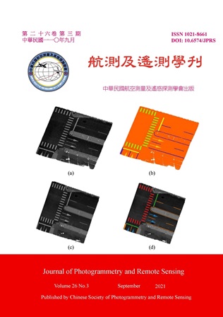
應用轉移學習從移動式光達點雲影像中萃取並分類路面標記

Title

Road Marking Extraction and Classification from Mobile LiDAR Point Clouds Derived Imagery Using Transfer Learning

作者

賴格陸、曾義星

Author

Miguel Luis R. Lagahit, Yi-Hsing Tseng

中文摘要

高精地圖是輔助自動駕駛車所需的高精度3D地圖,目前應用移動式測繪資料自動化測製高精地圖仍是挑戰,本文提出應用轉移學習 (Transfer Learning) 從移動式光達點雲自動萃取並分類道路標記的方法,其資料處理流程包括前處理、訓練、萃取分類、及精度評估,前處理是先過濾非路面點雲再將點雲轉換為網格式的強度值影像。訓練過程是從選取的訓練資料進行手動註釋和拆分,建立訓練和測試數據集,訓練數據集可採既有的公開資料庫,再利用現有訓練資料擴充。之後運用訓練好的機器學習模型從光達強度影像中萃取分類路面標記,然後以人工判讀的成果為參考評估測試成果精度,先評估萃取的正確度、錯誤率、及F1指標,進而評估分類的誤差率,最後將分類的點雲向量化。結果顯示,以5 cm解析度的光達強度影像來預訓練U-Net模型最好。基於F1指標低且誤差率低於15%,驗證所提方法可成功萃取並分類道路標記,其測試成效與最近發表的論文成果相當。然而,所提方法之萃取完整度優於所比較的方法,但分類精度則不如所比較的方法,主要原因是本研究同時進行萃取及分類,而比較的方法則先萃取,進而濾除雜訊點群後再進行分類。建議未來研究可將萃取和分類過程分開,增加濾除機制,以降低分類誤差率。

Abstract

High Definition (HD) Maps are highly accurate 3D maps that contain features on or nearby the road that assist with navigation in Autonomous Vehicles (AVs). One of the main challenges when making such maps is the automatic extraction and classification of road markings from mobile mapping data. In this paper, a methodology is proposed to use transfer learning to extract and classify road markings from mobile LiDAR. The data procedure includes preprocessing, training, class extraction and accuracy assessment. Initially, point clouds were filtered and converted to intensity-based images using several grid-cell sizes. Then, it was manually annotated and split to create the training and testing datasets. The training dataset has undergone augmentation before serving as input for evaluating multiple openly available pre-trained neural network models. The models were then applied to the testing dataset and assessed based on their precision, recall, and F1 scores for extraction as well as their error rates for classification. Further processing generated classified point clouds and polygonal vector shapefiles. The results indicate that the best model is the pre-trained U-Net model trained from the intensity-based images with a 5 cm resolution among the other models and training sets that were used. It was able to achieve F1 scores that are comparable with recent work and error rates that are below 15%. However, the classification results are still around two to four times greater than those of recent work and as such, it is recommended to separate the extraction and classification procedures, having a step in between to remove misclassifications.
關鍵字

移動光達、道路標記、萃取、分類、轉移學習

Keywords

Mobile LiDAR, Road Marking, Extraction, Classification, Transfer Learning

附件檔名

華芸線上圖書館

https://www.airitilibrary.com/Publication/alDetailedMesh?DocID=10218661-202109-202109290002-202109290002-127-141

備註說明

N / A

Pages:

143-162

論文名稱

以生物序列演算法進行UAV影像幾何校正控制點匹配新型模式之探索性研究

Title

Exploratory Research of a Novel GCPs Matching Model for UAV Image Geometric Correction through Biological Sequence Algorithms

作者

雷祖強、吳仕傑、李哲源、曾國欣

Author

Tsu-Chiang Lei, Shih-Chieh Wu, Che-Yuan Li, Guo-Shin Tzeng

中文摘要

本研究開發了一種新穎的半自動地面控制點 (Ground Control Points, GCPs) 匹配模型來解決UAV影像校正問題。我們使用生物序列演算法 (Biological sequence algorithms) 為概念來進行影像匹配程序,其概念則是透過Needleman-Wunsch algorithm (NWA) 的全局特徵對齊技術,匹配兩個影像 (基準影像和待校正影像) 中的物件對象,在識別成功匹配的物件對象後,再利用Smith-Waterman algorithm (SWA) 的局部特徵對齊技術,從匹配成功的物件對象中提取GCPs,最後,再使用多項式模型方法對於所提出GCPs進行幾何校正與價值評估。研究的案例成果顯示,除了可從本研究中所使用的影像中自動提取適當的GCPs之外,而影像進行幾何校正後,經由人工刪去殘差值大於1個單位的控制點後,剩餘控制點的RMSE (均方根誤差) 值為0.52418,可證明本研究之方法未來可適用於高解析度影像之GCPs校正問題。

Abstract

This study developed a novel semi-automatic ground control point (GCPs) matching model, which can resolve the problem of GCPs matching when carrying out geometric correction for two UAV images. This research methods utilized the concept of the Biological Sequence Algorithms (BSA) to present image matching procedures. More specifically, the Needleman-Wunsch algorithm (NWA) was first used as a global object alignment technique to match objects in the two images (corrected image and uncorrected image). After identifying the successfully matched objects, the Smith-Waterman Algorithm (SWA) was used as a local features alignment technique to extract the GCPs from matched objects. Finally, the polynomial model method was applied for geometric correction and assessment of the proposed model. Finally, the results of this case showed that appropriate GCPs were automatically extracted from the images used in this study. After the geometric correction, the RMSE (Root-Mean-Square Error) value was 0.52418, indicating the method of this study is appropriate for the application on high-resolution images.

關鍵字

影像幾何校正、生物序列分析、自動化匹配、無人載具

Keywords

Image Geometric Correction, Biological Sequence Algorithms, GCPs Automatically Matching Procedure

附件檔名

華芸線上圖書館

https://www.airitilibrary.com/Publication/alDetailedMesh?DocID=10218661-202109-202109290002-202109290002-143-162

備註說明

N / A

Pages:

163-179

論文名稱

無人機遙測平台於金門野郊地區有形文化資產環境風險測圖-以陳健墓與陳禎墓為例

Title

Using a UAV Imaging Platform to Produce Environmental Risk Maps for the Physical Cultural Heritages in the Wilderness Areas of Kinmen, As the Chen-Jian and Chen-Zhen Monuments for Example

作者

蘇東青

Author

Tung-Ching Su

中文摘要

近年來文化資產維護保存議題已普遍受到重視,然而野郊地區有形文化資產因地形與環境影響,長久下來將對其結構體產生破壞威脅。本研究利用無人機可對小區域範圍監測之機動性,搭載多光譜感測器對金門野郊地區國定古蹟陳健墓與陳禎墓周圍地物進行資料蒐集,並提出一套環境風險評估模式。該模式考量氣象與土壤含水量作為危害度因子,以及地形坡度為脆弱度因子,將監測分析資料以四分位距統計劃分為四級距,以產製不同時期兩墓園環境風險等級圖。研究結果顯示,所產製的多時期環境風險等級圖,可細緻化呈現有形文化資產各部位承受之環境風險等級,除了作為辦理修復計畫時設置減災設施參考外,並有效指出兩墓園有形文化資產不同季節承受環境風險之差異。

Abstract

Recently, the issue of maintenance and preservation of cultural heritage has been widely given attention. However, physical cultural heritage in wilderness areas would suffer from the threat of destruction due to the long-term terrain and environmental influences. This paper considered the flexibility of a multispectral sensor mounted by an Unmanned Aerial Vehicle (UAV) for small-scale monitoring to acquire the multi-temporal UAV images for the two national historic sites (i.e., the Chen-Jian and Chen-Zhen monuments) in the wilderness areas of Kinmen and propose an environmental risk assessment model. In the model, meteorology and soil moisture are regarded as the hazard factors, while the slope of terrains is regarded as the vulnerability factor. By an inter-quartile range statistic for the analyses of the monitoring dataset, the environment risk was described into four grades to produce the thematic maps of environment risk. The experimental result demonstrates that the produced multi-temporal thematic maps of environment risk can present the environment risk grades borne by the different portions of the two monuments in detail. Thus, the thematic maps not only can serve as references for installing the mitigation facilities while performing a restoration plan, but it can also effectively indicate the seasonal differences in the environment risk grades between the Chen-Jian monument and the Chen-Zhen monument.

關鍵字

有形文化資產、無人機、多光譜感測、環境風險評估、維護管理

Keywords

Physical Cultural Heritages, Unmanned Aerial Vehicle (UAV), Multispectral Sensor, Environment Risk Assessment, Maintenance and Preservation

附件檔名

華芸線上圖書館

https://www.airitilibrary.com/Publication/alDetailedMesh?DocID=10218661-202109-202109290002-202109290002-163-179

備註說明

N / A

Pages:

181-192

論文名稱

基於整體學習演算法於航攝正射影像之物件分類探索-以海岸廢棄物為例

Title

The Study of Orthophoto Image Classification through Ensemble Learning Based on the Aerial Photos: A Case Study on Coastal Waste Image Classification

作者

劉奕洋、萬絢

Author

Yi-Yang Liu, Shiuan Wan

中文摘要

近年臺灣在氣候變遷及海洋垃圾成長的環境下,多樣化的海岸樣貌正遭受威脅,在海岸廢棄物的議題上刻不容緩。有鑑於當今GIS的蓬勃發展,及遙測技術能夠在短時間內擷取大範圍的量化資訊,能看到有越來越多取代傳統調查方式的實際應用。本研究屬遙測技術結合機器學習的應用,以整體學習 (Ensemble learning) 之模型訓練方式在海岸廢棄物上進行物件分類實作的可行性,使用隨機森林 (Random Forest) 演算法及極限樹 (Extra Trees) 演算法所建構之模型,探討其分類成效差異,將機器分類後的數據將資料空間視覺化以繪製出主題圖。研究成果可應用於海岸廢棄物相關環境保育作業上,將為一經濟且有效的解決方案。

Abstract

Presently, coastal features of Taiwan are threatened under the environment of climate change and the growth of the marine waste. The issue of coastal waste cannot be delayed any more. The most traditional method of disposing of coastal waste is to organize beach cleaning activities by coastal government agencies. That is, the private environmental groups using a large amount of manpower to manage the coast. The comparison of time cost and implementation efficiency is not ideal. In view of the development of GIS, the ability of remote sensing technology can capture a wide range of data in a short period of time. On the other hands, we can see many practical applications that replace traditional survey methods. This research is based on the application of remote sensing technology combined with machine learning to display the observation of our seashore. In this study, the Ensemble learning model is used to implement object classification. More specifically, Random Forest (RF) algorithm and Extra Trees (ET) algorithm are applied to explore different algorithms. The classification effects of the model constructed by established process are different. The data for the machine learning classification is visualized by the thematic map. The contributions can be applied to coastal waste related environmental studies effectively and practically.

關鍵字

整體學習、影像物件分類、資料空間視覺化

Keywords

Ensemble Learning, Image Object Classification, Visual Data Space

附件檔名

華芸線上圖書館

https://www.airitilibrary.com/Publication/alDetailedMesh?DocID=10218661-202109-202109290002-202109290002-181-192

備註說明

N / A

更多活動學刊