ENGLISH

27卷/2期

27卷/2期

華藝線上圖書館

Pages:

61-77

論文名稱

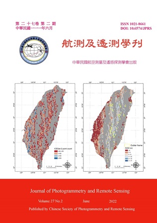
ICESat-2於臺灣本島地形高程之特性分析

Title

Characteristic Analysis of ICESat-2 Land Elevation in Taiwan

作者

林美佑、林士淵

Author

Mei-Yu Lin, Shih-Yuan Lin

中文摘要

ICESat-2 (The Ice, Clouds, and Land Elevation Satellite-2) 為 NASA 於 2018 年發射之雷射測高衛星,目標提供全球性近年高程資料,未來或可作為臺灣大範圍高程資料的另一選擇,故評估其高程於臺灣之精度與特性有其必要性。本研究分析 ICESat-2 ATL08 地形高程於臺灣本島之精度表現,並針對土地覆蓋類別、坡度及海拔高度此三種影響因子分析其高程特性。研究成果指出高程誤差平均值、標準差、均分根誤差分別為-0.337、9.560、9.565 m,且高程誤差隨無植被變為完全植被覆蓋而增加;誤差與坡度具正向關係,整體誤差趨勢線呈持續上升之現象;與海拔高度亦同,然誤差趨勢具轉折處。成果可供 ICESat-2 高程資料應用於臺灣之參考。

Abstract

ICESat-2, a laser altimetry satellite launched by NASA in 2018, was designed to provide global elevation data (ATL08). Together with the existing global DEMs, it can be considered as an alternative for users in Taiwan. To understand the performance of this product, the accuracy of the elevation derived from ICESat-2 ATL08 was firstly evaluated in this study. Then the factors influencing elevation accuracy, including land cover type, slope and altitude, were analyzed based on different spatial units. It was indicated that the elevation error increases as the land cover changes from no vegetation to full vegetation coverage. Overall, elevation error increases with slope and elevation. The results are expected to be helpful for the applications of ICESat-2 elevation data in Taiwan as a reference.

關鍵字

ICESat-2、ATL08、衛星測高技術、高程誤差特性

Keywords

附件檔名

華芸線上圖書館

https://www.airitilibrary.com/Publication/Index/10218661-202206-202207010005-202207010005-61-77

備註說明

N / A

Pages:

79-99

論文名稱

綠地結構與思覺失調症之關聯

Title

Relationships between Green Space Structures and Schizophrenia

作者

張皓庭、吳治達、王榮德、陳柏熹、龍世俊、趙馨、潘文驥、王應然、Samuel Herianto、蘇慧貞

Author

Hao-Ting Chang, Chih-Da Wu, Jung-Der Wang, Po-See Chen, Shih-Chun Candice Lung, Hsing Jasmine Chao, Wen-Chi Pan, Ying-Jan Wang, Samuel Herianto, Huey-Jen Su

中文摘要

近年研究揭示綠地暴露對思覺失調症的益處,然而大多以植生指數做為綠地暴露指標,但實際上仍有許多綠地相關的因子可能與疾病有關,例如:綠地的大小、形狀、近鄰性等 (綠地結構指標),不過鮮少有人探討,且還未有研究進一步了解暴露不同綠地結構指標後,可能節省的終身醫療費用。本研究使用健保資料庫、NASA MODIS 衛星影像、第二次國土利用調查資料、地理資訊系統 (ArcGIS) 和 FRAGSTATS 4 來進行研究。研究結果發現暴露的綠地愈綠、面積愈大、形狀愈複雜、綠地彼此之間愈靠近,可能降低罹病風險,且可能節省 0.10 至 0.52 百萬美金的終身醫療費用。

Abstract

Recent studies have revealed the benefits of green space exposure for schizophrenia. However, vegetation index is mostly used as indices of green space exposure, but in fact there are still many green space-related factors that may be related to mental disorder, such as the size, shape, and proximity of green spaces (called green space structures), but few studies have investigated it, and there is no research to further estimate the lifetime healthcare costs that may be saved after different indices of green space structure are exposed. This research uses the health insurance database, NASA MODIS satellite images, the second national land survey database, geographic information system (ArcGIS) and FRAGSTATS 4 for research. The results of this study found that the greener the exposed green space is, the larger the area, the more complex the shape, and the closer the green spaces are to each other, which may reduce the risk of schizophrenia and may save 0.10 to 0.52 million US dollars in lifetime healthcare costs.
關鍵字

思覺失調症、綠地結構指標、植生指標、終身醫療費用、健保資料庫

Keywords

Schizophrenia, Green Space Structures, Vegetation Index, Lifetime Healthcare Costs, National Health Insurance Research Database

附件檔名

華芸線上圖書館

https://www.airitilibrary.com/Publication/Index/10218661-202206-202207010005-202207010005-79-99

備註說明

N / A

Pages:

101-119

論文名稱

以高時空影像融合技術監測臺東地區焚風現象

Title

Monitoring with High Temporal and Spatial Image Fusion for Foehn Wind Phenomenon in Taitung Area

作者

賴咨岑、徐逸祥

Author

Tzu-Tsen Lai, Yi-Shiang Shiu

中文摘要

目前監測焚風方式皆以地面氣象站為主,以溫度與相對濕度作為指標,本研究利用遙測技術,以STARFM模型 (spatial and temporal adaptive reflectance fusion model),將Landsat-8 30 m空間解析度與Himawari-8 10分鐘時間解析度的波段融合,其可改善一般衛星影像分析時可能會遇到無法取得發生當日及當時之遙測資料,以便達到更為密集之監測。融合後影像之TIR (thermal infrared) 波段進行反演產生地表溫度 (land surface temperature, LST);相對濕度使用有關評估地表乾旱程度的植生指標。結果顯示對於週期短的焚風現象可適用於監測,但雲覆仍是較困難突破,LST與植生指標變動皆符合焚風發生的時序變化,尤其大武溪流域範圍的變化較為顯著。

Abstract

At present, Foehn winds monitoring methods are mainly based on surface weather stations. The weather stations identified as Foehn winds mainly with two indicators: one is temperature, and the other is relative humidity. This study tried to use remote sensing technology and the spatial and temporal adaptive reflectance fusion model (STARFM), which fused 30-meter spatial resolution of Landsat-8 and 10 minutes temporal resolution of Himawari-8 with a high-temporal image fusion method. The STARFM was supposed to improve the problems which is hard to acquire the remote sensing data on the day and the time of the Foehn winds occurrence. The analysis results were expected to achieve the intensive monitoring effects. In terms of temperature, land surface temperature (LST) is generated by using fused thermal infrared (TIR). For humidity, it is difficult to directly observe relative humidity with remote sensing data at this stage, so this study used the related indicators, vegetation indices, which have been widely used for land surface drought monitoring. The results show that for the short-period Foehn phenomenon, the image fusion method can be applied to monitor, but cloud cover is still a difficult factor to overcome. Both the change trend of LST and vegetation indices correspond with the temporal change caused by Foehn winds, and the change of Dawu river basin is especially more obvious than other areas.

關鍵字

焚風、時空影像融合、地表溫度、植生指標

Keywords

Foehn Wind, Image Fusion, Land Surface Temperature, Vegetation Index

附件檔名

華芸線上圖書館

https://www.airitilibrary.com/Publication/Index/10218661-202206-202207010005-202207010005-101-119

備註說明

N / A

Pages:

121-129

論文名稱

利用海岸攝影機影像遙測瘋狗浪之研究

Title

A Study on the Measurement of Coastal Freak Waves

作者

陳盈智、王敘民、董東璟、蔡政翰、滕春慈

Author

Ying-Chih Chen, Shu-Ming Wang, Dong-Jiing Doong, Cheng-Han Tsai, Chuen-Teyr Terng

中文摘要

瘋狗浪 (freak wave) 是海中突然發生的大浪,它大都在海洋中出現,也頻繁出現於海岸邊,對民眾從事海域遊憩活動帶來很大的危害風險。過去對瘋狗浪的研究大都採用數值方式進行,觀測研究甚少,主要是因為瘋狗浪不知發生於何時何地,很難觀測。本研究於海岸邊設置光學影像監視站,並發展一個影像處理方法與浪花流量與穿越速度計算方法,藉以判識瘋狗浪之發生,驗證結果顯示準確性可達八成以上,與過去實際發生意外事件之比較也相當一致。另外,分析結果也發現,海岸瘋狗浪之發生與入射波高未具有高度相關性,這代表瘋狗浪之發生除入射波浪外,尚有其它影響因子。本研究發展之瘋狗浪監測與分析技術可廣泛應用於各地,藉以蒐集更多瘋狗浪資料,對於掌握瘋狗浪特性與預警模式之建置帶來很大之助益。

Abstract

Freak wave is a wave with large wave height generated suddenly. It mostly occurs in the sea, however it also occurs frequently in the coast. Many people drop into sea due to coastal freak wave attacked in Taiwan. In the past, most of the studies on coastal freak waves were carried out with numerical simulations because of lack of field data. This study aims to develop a measurement and analysis method for coastal freak wave. It is based on the image process technique. The proposed image process method derives the shape of the splash trigger by coastal freak water. The flow rate and throw speed of the splash were estimated. The parameter Flood Hazard (FH) was used to identify the coastal freak wave. The verification results show that the accuracy of the identification of the coastal freak wave is more than 80%. The result is also agreed with actual accidents reported in media. In addition, the analysis found that the occurrence of coastal freak waves is not only correlated with incident waves. The wave interaction with structure plays an important role for the generation of coastal freak wave. The measurement method for coastal freak waves developed in this study is helpful for establishment of warning system for coastal freak waves.

關鍵字

瘋狗浪、光學影像、觀測

Keywords

Coastal Freak Wave, Optical Image, Measurement

附件檔名

華芸線上圖書館

https://www.airitilibrary.com/Publication/Index/10218661-202206-202207010005-202207010005-121-129

備註說明

N / A

更多活動學刊