ENGLISH

28卷/3期

28卷/3期

華藝線上圖書館

Pages:

141-155

論文名稱

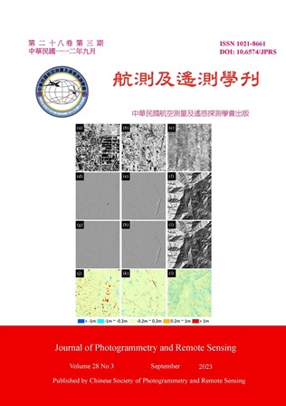
基於幾何特徵以UNet分類空載光達地面點

Title

Using UNet with Geometric Features to Classify Airborne Laser Scanning Ground Points

作者

林緯程、王驥魁、林昭宏、勞宏斌、許育維、王敏雄、湯凱佩

Author

Wei-Cheng Lin, Chi-Kuei Wang, Chao-Hung Lin, Hong-Ping Lo, Yu-Wei Hsu, Ming-Hsiung Wang, Kai-Pei Tang

中文摘要

空載光達為我國建立數值高程模型 (Digital Elevation Model, DEM) 之資料來源,然既有點雲分類演算法能力有限,使各廠商需投入大量人力編修點雲分類成果,以維持 DEM 品質。為加速地面點分類,本研究建立了一套基於幾何特徵的空載光達地面點人工智慧 (Artificial Intelligence, AI) 分類模式,光達點雲之幾何特徵資訊經投影至影像網格,以建立特徵影像,訓練 UNet 架構之神經網路。最後透過反投影機制,回饋影像分類成果至點雲,達成點雲分類。以城市區、農田區、森林區三個測試圖幅為例,使用 AI 分類之地面點產生之 DEM 與測繪廠商經檢核後之 DEM,二者之高程差,分別有 85.5%、94.6%、74.3%圖幅面積在空載光達觀測精度範圍 ± 20 cm 內。本研究亦建議 AI 模型輸出之信心值,依地表環境設定不同地面點分類門檻值,提升人機協作效率。

Abstract

Airborne Laser Scanning (ALS) can efficiently acquire large-scale point cloud data with high accuracy, which has become the major data source for Taiwan Digital Elevation Model (DEM). When generating ALS DEM, a significant amount of manual editing is needed to ensure the ground point classification, which are later used for DEM interpolation. In order to alleviate the manual burden, this research proposed an artificial intelligence (AI) ground classification workflow based on the geometric features from the ALS data. The geometric features are calculated and orthogonally projected to compose a “feature image”, which was further used as the training data for UNet. Then, by back-projecting the image classification results, the ground point within the ALS data can be classified. Three example datasets, including city, county, and forest scenes, were examined. The results showed that, in terms of areal percentage, 85.5%, 94.6%, and 74.3% of the AI-derived DEM are within ± 20 cm of the QC-inspected DEM for city, county, and forest scene, respectively. We further suggested that the confidence value output from the AI classifier can be used as an adaptive parameter to facilitate manually point cloud editing. Different threshold can be devised for different scene.
關鍵字

空載光達、點雲分類、影像分類、人工智慧

Keywords

Airborne Laser Scanning, Point Cloud Classification, Image Classification, Artificial Intelligence

附件檔名

華芸線上圖書館

https://www.airitilibrary.com/Publication/Index?DocID=10218661-N202309220007-00001

備註說明

N / A

Pages:

157-175

論文名稱

森林崩塌復育及影響因子分析

Title

Analysis of Forest Restoration after Landslide and the Influencing Factors

作者

林國聖、宋承恩、王素芬

Author

Guo-Sheng Lin, Cheng-En Song, Su-Fen Wang

中文摘要

多時序光學遙測影像已廣泛運用在植生恢復監測研究中,各類植生指標也經常被應用於評估複雜的復育過程。本研究利用Landsat衛星影像觀測神木村集水區2009年莫拉克風災崩塌後的植生恢復,比較不同崩塌規模與邊坡位置的復育差異,並分析影響復育的重要因子。研究結果顯示,常態化差異植生指標的復育趨勢較常態化燃燒比快。對比災前植生狀況,大型崩塌地復育速率明顯低於中小型崩塌,而崩塌上、中、下段位置的植生恢復具有相似的趨勢。在復育影響因子方面,經迴歸分析顯示,殘留植被對於長期的恢復最具有影響力,干擾前植生量與種源距離也是重要因素,地形特性對於植被定殖再生提供間接影響。

Abstract

Multi-temporal optical satellite imagery is widely used in vegetation restoration monitoring research, and various vegetation indices are used to evaluate complex restoration processes. In this study, Landsat imagery was used to observe the vegetation recovery after the landslide of the typhoon Morakot in the Shenmu Village watershed area in 2009. Meanwhile, the differences in restoration of different landslide scales and slope locations, and the important factors affecting restoration were analyzed. The result shows that the recovery trend of Normalized Differential Vegetation Index is faster than Normalized Burn Ratio. The recovery rate of large-scale landslides is significantly lower than that of small and medium-sized landslides, while the vegetation restoration at the top, middle and lower part of the landslides have similar trends. Regression analysis shows that residual vegetation is the most important factor that affect the long-term restoration, and the vegetation before disturbance and the distance to the forest are also important factors; topographic characteristics provide indirect effects on vegetation colonization and restoration.

關鍵字

植生指標、植被復育、崩塌地規模、崩塌地位置、地形參數

Keywords

Vegetation index, Vegetation restoration, Landslide scale, Landslide location, Terrain parameters

附件檔名

華芸線上圖書館

https://www.airitilibrary.com/Publication/Index?DocID=10218661-N202309220007-00002

備註說明

N / A

Pages:

177-193

論文名稱

地面光達於都市林木材積式之建構

Title

Using Ground-based LiDAR for Tree Volume Estimation

作者

邱祈榮、鄧翔耀

Author

Chyi-Rong Chiou, Xiang-Yao Deng

中文摘要

一般估算樹木的材積,常利用材積式進行推估,其過程需伐倒林木分段量測,屬破壞性調查且不但耗時費力。近來地面光達技術快速發展,利用光達點雲建立林木立體模型,進行材積估算,可避免砍伐林木,更能精確量測,可快速建立材積式。本研究旨在探討光達點雲資料在都市林木材積測計之應用,驗證TreeQSM演算法是否適用建立臺灣都市林木材積推估模式,及驗證準確性。結果顯示,比較現地量測、點雲人工量測與TreeQSM估算的胸高直徑、樹高及主幹材積皆無顯著差異,證實TreeQSM確可應用於都市林木材積推估,並建立配適良好的材積式,成為都市林木測計重要工具。

Abstract

Generally, the volume of trees is often estimated using the tree volume equations, and the process of establishing the volume equations requires the measurement of the felled timber segments, which is a destructive investigation that is not only time-consuming and laborious, but also loses valuable trees. Due to the rapid development of Ground-based LiDAR technology, the use of LiDAR point cloud to establish a three-dimensional model of forest trees for volume estimation not only avoids felling trees, but also can accurately measure and quickly calculate tree volume. This study aims to explore the application of lidar point cloud data in urban tree volume measurement, and verify whether the TreeQSM algorithm is suitable for establishing an urban tree volume estimation model and verifying accuracy in Taiwan. The results showed that there were no significant differences in chest height diameter, tree height and trunk timber volume between in-situ measurement, point clouds manual measurement and TreeQSM estimation, which confirmed that TreeQSM could indeed be applied to urban tree volume estimation and establish a well-adapted timber volume equations, which can conform to the estimation and use of urban tree volume, and become an important tool for urban tree measurement.

關鍵字

都市林木、點雲、TreeQSM演算法、材積式、胸高形數

Keywords

Urban Trees, Point Cloud, TreeQSM Algorithm, Tree Volume Equations, Breast Height Form Factor

附件檔名

華芸線上圖書館

https://www.airitilibrary.com/Publication/Index?DocID=10218661-N202309220007-00003

備註說明

N / A

Pages:

195-208

論文名稱

利用深度學習模型Mask R-CNN辨識鋼結構橋梁鏽蝕之研究

Title

Research on Identifying Corrosion of Steel Structure Bridges Using Deep Learning Model Mask R-CNN

作者

黎俊成、高書屏、王豐良、林志憲

Author

Jyun-Cheng Li, Szu-Pyng Kao, Feng-Liang Wang, Jhih-Sian Lin

中文摘要

近幾年,鋼結構橋梁在臺灣逐漸盛行,但臺灣為容易發生鏽蝕的環境,因此橋梁的鏽蝕檢測必須投入大量成本進行維護。而本研究利用UAV結合Mask R-CNN進行鏽蝕辨識實驗,而結果表示該方法可以改善傳統橋梁檢測的缺點。而目前臺灣無適合本研究的鏽蝕數據集,故本研究自行建立了鏽蝕數據集;其匯入Mask R-CNN進行訓練,並經過本研究的實驗,揀選出最佳的超參數配置,即「優化器SGD搭配學習率1×10⁻³」,而模型訓練的評估指標結果為:Recall可達97.1%、Precision可達90.4%、mAP可達91.0%以及mIoU可達89.0%;再經過辨識結果的分析,發現影像中的背景雜訊會影響鏽蝕的辨識。

Abstract

In recent years, steel structure bridges have become increasingly popular in Taiwan, but Taiwan is prone to corrosion, so a lot of costs must be invested in the maintenance of bridge corrosion detection. In this study, UAV and Mask R-CNN are used to conduct corrosion identification experiments, and the results show that this method can improve the shortcomings of traditional bridge detection. At present, there is no corrosion dataset suitable for this study in Taiwan, so this study has established a corrosion data set by itself; It is imported into Mask R-CNN for training, and through the experiment of this study, the best super-parameter configuration is selected, that is, “optimizer SGD collocation learning rate 1 × 10⁻³ ”, and the evaluation index results of model training are: Recall can reach 97.1%, Precision can reach 90.4%, mAP can reach 91.0% and mIoU can reach 89.0%; After the analysis of the identification results, it is found that the background noise in the image will affect the identification of corrosion.

關鍵字

鋼結構橋梁、橋梁檢測、無人機、鏽蝕、Mask R-CNN

Keywords

Steel Structure Bridge, Bridge Detection, UAV, Corrosion, Mask R-CNN

附件檔名

華芸線上圖書館

https://www.airitilibrary.com/Publication/Index?DocID=10218661-N202309220007-00004

備註說明

N / A

更多活動學刊