ENGLISH

29卷/2期

29卷/2期

華藝線上圖書館

Pages:

65-75

論文名稱

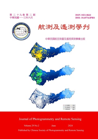
使用空間混合模型分析PM2.5的長期變化趨勢(1994年至2020年)-以臺中市為例

Title

The Long-term Trend Analysis of PM2.5 Variability From 1994 to 2020 Using a Hybrid Spatial Model: A Case Study of Taichung City, Taiwan

作者

林祐如、許家瑋、李佳禾、曾于庭、翁佩詒、陳保中、陳裕政、吳治達

Author

Yu-Ju Lin, Chia-Wei Hsu, Chia-Ho Lee, Yu-Ting Zeng, Pei-Yi Wong, Pau-Chung Chen, Yu-Cheng Chen, Chih-Da Wu

中文摘要

研究以臺中市為例,利用空間模型推估1994至2020年PM2.5濃度趨勢,並評估城市開發對空氣品質的影響。研究使用PM2.5相關汙染物、氣象資料、土地利用、地標、路網、地形、植生指數等作為預測變數。結合土地利用迴歸和機器學習方法,使用隨機森林、梯度提升機、極限梯度提升、輕量梯度提升機和基於梯度提升的決策樹模型擬合預測模型。通過數據拆分、十折交叉和外部驗證確認模型穩健性,結果顯示模型穩定且可信,Adj-R2為0.93。結果表明多數地點的「年份」變數係數為負,顯示過去25年空氣污染顯著改善。研究強調在城市開發規劃中管理和控制空氣污染的重要性。

Abstract

This study takes Taichung City as an example and aims to investigate the long-term impact of urban development on air pollution. By establishing a spatial model, we estimate the concentration trends of fine particulate matter (Particulate Matter 2.5, PM2.5) over the past 25 years (from 1994 to 2020) and further assess the influence of urban development on air quality. Various databases were utilized as sources of spatial predictor variables, including the Environmental Resources Database, meteorological database, land-use inventory, landmark database, digital road network map, digital terrain model, MODIS Normalized Difference Vegetation Index (NDVI) database, and power plant distribution database. The spatial hybrid model in this study combines Hybrid Kriging/Land-Use Regression and machine learning methods. Initially, important predictor variables were determined using traditional Land-Use Regression (LUR) and Hybrid Kriging-LUR. Subsequently, prediction models based on the selected variables from LUR models were fitted using Random Forest (RF), Gradient Boosting Machine (GBM), eXtreme Gradient Boosting (XGBoost), Light Gradient Boosting Machine (Light GBM), and CatBoost algorithms. Validation methods such as data splitting, 10-fold cross-validation, and external data verification were employed to confirm the robustness of the developed models. The results indicate that the model is stable and reliable, with an Adj-R2 of 0.93. Through linear regression, it was observed that the estimated values of the predictor variable ‘year’ for most locations in the city are negative, indicating a significant improvement in air pollution over the past 25 years. This study emphasizes the importance of managing and controlling air pollution in urban development planning.
關鍵字

PM2.5、都市開發、空間混合模型、趨勢分析

Keywords

PM2.5, Urban Development, Hybrid Spatial Model, Trend Analysis

附件檔名

華芸線上圖書館

https://www.airitilibrary.com/Article/Detail?DocID=10218661-N202406250003-00001

備註說明

N / A

Pages:

77-90

論文名稱

應用地理人工智慧技術分析國小學區NO2濃度分布-以嘉義市為例

Title

Estimating Nitrogen Dioxide Concentration Distribution within Elementary School Districts Using Geo-AI Technology: A Case Study of Chiayi City

作者

王信棻、吳治達

Author

Hsin-Fen Wan, Chih-Da Wu

中文摘要

二氧化氮 (NO2) 污染為都市重要公共健康議題,對兒童的負面健康影響更深遠。每日上午通勤時段為室外NO2排放量高峰期。然而有限監測站難以反映學童上學過程暴露的NO2污染濃度。為了準確掌握國小學童就學通勤時的NO2污染分布,本研究以嘉義市為例,運用地理人工智慧 (Geo-AI) 技術模擬NO2濃度分布。蒐集2015-2020年空氣污染監測數據,以及土地利用空間相關變數,並以機器學習演算法建立推估模型。結果顯示,主模型以及嘉義市皆有高等解釋能力 (分別為R2=0.94以及0.93),推估成果準確可靠。NO2高濃度地區位於嘉義市中心偏南側,且西區濃度略高於東區。國小學區內道路及住宅區密度與NO2濃度呈正向關聯。

Abstract

Nitrogen dioxide (NO2) pollution is a concerned public health issue in urban areas. Children may experience more severe health effects when exposed to NO2. Furthermore, heavy traffic during the morning commuting time leads to peak outdoor NO2 emissions. The limited number of monitoring stations poses a challenge in assessing NO2 exposure during children's school commutes. To accurately depict the spatial distribution and variation of NO2 concentration during elementary school children's commutes, this study estimated NO2 distribution in Chiayi City using Geo-AI technology. Air pollution monitoring data during morning commuting time from 2015 to 2020, land use and potential geospatial-related variables were collected. Machine learning algorithm were then used for variable selection and model development. The results reveal that the main model and Chiayi City both had high explanatory power, with R2 values of 0.94 and 0.93, respectively. The estimations are accurate and reliable. Higher NO2 concentrations are clustered in the southern-central part of Chiayi City. The averaged NO2 levels in Western District is slightly higher compared to the Eastern District. Furthermore, concerning the land use distribution patterns within elementary school districts, a positive correlation was observed between NO2 concentrations around schools and road density and residential area density.

關鍵字

二氧化氮、空氣污染、機器學習、地理人工智慧、國小學童

Keywords

Nitrogen Dioxide, Air Pollutant, Machine Learning, Geo-AI, Elementary School Children

附件檔名

華芸線上圖書館

https://www.airitilibrary.com/Article/Detail?DocID=10218661-N202406250003-00002

備註說明

N / A

Pages:

91-114

論文名稱

結合地面與無人空中載具光達推估大葉桃花心木人工林林分材積

Title

Integrating Terrestrial and Airborne Laser Scanning to Estimate Stand Volume of Swietenia macrophylla King Plantations

作者

劉鎮毅、陳建璋、魏浚紘

Author

Chen-Yi Liu, Jan-Chang Chen, Chun-Hung Wei

中文摘要

本研究區域位於雲林縣古坑鄉大葉桃花心木 (Swietenia macrophylla King) 之平地人工林,以地面及無人空中載具光達 (以下簡稱空載光達) 推估林分性態值並評估其使用效率與準確度,並建立此樹種之樹高曲線式及地方材積式,最後藉由空載光達建立空中材積式推估蓄積量。研究結果顯示,點雲結合後可彌補地面光達對於獲取樹高及空載光達獲取胸徑及立木位置的不足,結合點雲後獲取資料的效率也有所提升,亦可透過結合點雲建立樹高曲線式及地方材積式。單獨使用空載光達也可建立空中材積式。因應不同調查目的及樣區現況選擇合適之光達系統,結合地面及空載光達點雲可有效提高調查林分性態值之效率及準確性。

Abstract

The study area is located in the flat artificial forest of Swietenia macrophylla King in Guken Township, Yunlin County. TLS and ALS were used to estimate the stand structure and evaluate their efficiency and accuracy. Height-diameter equations and local volume equations for this tree species were established, and the ALS was used to estimate the volume. The results showed that the point cloud can compensate for the limitations of TLS in obtaining tree height and ALS in obtaining diameter at breast height and tree position. The efficiency of data acquisition was also improved by combining the point cloud, and height-diameter equations and local volume equations were established using the point cloud. Using ALS alone can also establish the airborne volume equation. Choosing the appropriate LiDAR system according to different survey purposes and site conditions, and combining TLS and ALS point clouds can effectively improve the efficiency and accuracy of surveying stand structure.

關鍵字

森林資源調查、遙感探測、林分蓄積、地面光達、無人空中載具光達

Keywords

Airborne Laser Scanning, Forest Resource Inventory, Remote Sensing, Stand Stock, Terrestrial Laser Scanning

附件檔名

華芸線上圖書館

https://www.airitilibrary.com/Article/Detail?DocID=10218661-N202406250003-00003

備註說明

N / A

Pages:

115-127

論文名稱

考量距離與空氣污染暴露之國小學童通勤路徑規劃

Title

Commuter Route Planning for Elementary School Children Considering Multiple Air Pollution Exposures

作者

何吉庭、翁佩詒、吳治達

Author

Ji-Ting Ho, Pei-Yi Wong, Chih-Da Wu

中文摘要

全球約99%的人口居住地空氣污染高於世界衛生組織標準,而學童因免疫系統尚未成熟,對污染更為敏感。本研究以2022年招募之臺南市62名學童為對象,污染物資料為前人已發表於期刊的PM2.5濃度推估,成果具有94%的高度解釋力。通勤路徑規劃中,最低PM2.5暴露路徑平均可減少6.84%的PM2.5暴露,與6.13%的通勤距離。將學童依通勤方式分類,機車接送為大宗 (37位),其次為汽車接送 (23位)、走路 (2位),其中走路通勤平均距離雖較近,但暴露於室外的時間較機車長;而機車通勤則更容易接觸到汽機車廢氣,上述皆會導致潛在空氣污染暴露提高,需給予適當的路徑建議改善。

Abstract

Approximately 99% of the global population resides in areas with air pollution higher than World Health Organization (WHO) guidelines. Among these, school children are particularly vulnerable due to their immature immune systems. This study focused on 62 school children recruited in 2022 from Tainan city. For air pollutant data, it was based on the estimated concentrations of PM2.5 model. from previous study. It had been published to the journal and its R2 is about 94%, which demonstrated high explanatory power. In commuter route planning, the least PM2.5 exposure routes can not only reduce average PM2.5 exposure by 6.84% but also 6.13% decrease in commuting distance. If we divide school children into 3 categories with different commute modes, we found that 37 school students go to school by motorcycle, which is the predominant way, followed by car and walking those 23 and 2 students travel by these ways. Among these commute modes, walking commute featured its shorter distances, however, it also has longer outdoor exposure time, while motorcycle commute is more directly exposed to vehicular emissions. These factors mentioned above collectively contribute to increasing potential air pollution exposure. Thus, we need to give school children proper route suggestion to improve this situation.

關鍵字

空氣污染、學童、通勤路徑規劃、潛在空氣污染暴露、路徑建議

Keywords

Air Pollution, School Children, Commuter Route Planning, Potential Air Pollution Exposure, Route Suggestion

附件檔名

華芸線上圖書館

https://www.airitilibrary.com/Article/Detail?DocID=10218661-N202406250003-00004

備註說明

N / A

更多活動學刊