31卷/3期

31卷/3期

華藝線上圖書館

Pages:

137-159

論文名稱

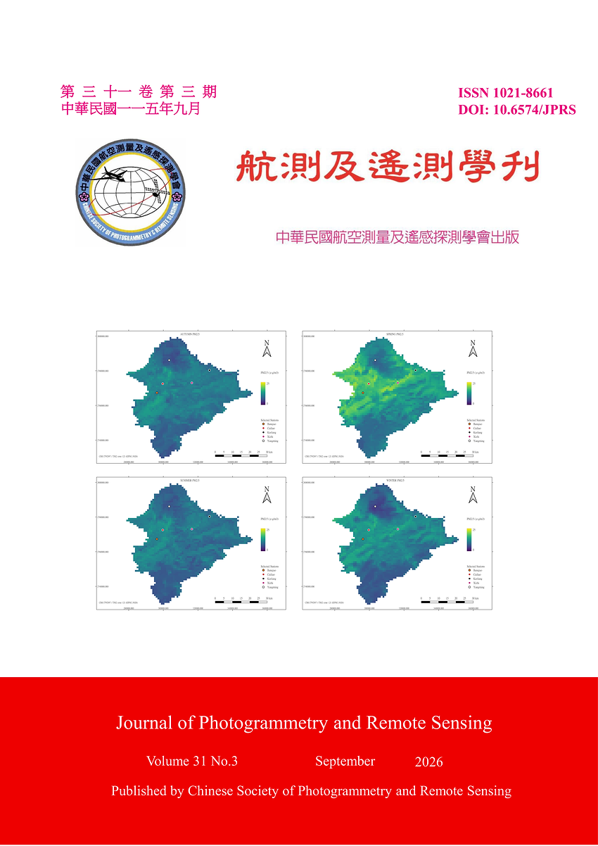
基於遙測之都會區 PM2.5 濃度估測之深度學習方法:以大臺北地區為例

Title

A Deep Learning Approach for Spatiotemporal Estimation of PM2.5 Concentration in Urban Areas: A Case Study of Greater Taipei Area

作者

魏文森、任玄、林唐煌

Author

Vincent Wiso, Hsuan Ren, Tang-Huang Lin

中文摘要

都市空氣污染仍為重要環境威脅,細懸浮微粒(PM2.5)對人體健康具有不利影響,因此提升其估算精度十分重要。本研究提出時間卷積網路與雙向長短期記憶網路(TCN–Bi-LSTM)混合模型,使用臺灣環境部2015年7月至2022年12月歷史空氣品質、氣象及土地利用資料,估算2023年逐月PM2.5,並以K近鄰–反距離加權法(KNN–IDW)產製1 km濃度圖。GroupKFold交叉驗證顯示,本模型優於CNN與LSTM,R2 = 0.7960,RMSE = 2.1606 μg/m3。本研究整合多源環境資料,以降低對衛星AOD直接推估PM2.5的依賴,並減少雲層造成的AOD缺值影響,建立連續 PM2.5暴露圖。未來將納入獨立地表 PM2.5觀測資料,以進一步驗證模型表現。

Abstract

Air pollution in urban areas remains a threat, with particulate matter being one of the key indicators of pollution. Numerous studies show that particulate matter with a diameter of 2.5 μm or smaller (PM2.5) affects public health, hence the need for more accurate models. Traditional numerical methods fail to capture pollutants’ spatiotemporal patterns; however, neural networks can learn from environmental data inputs to obtain correlations. In this study, a Temporal Convolutional Network–Bidirectional Long Short-Term Memory (TCN–Bi-LSTM) hybrid model is proposed. TCN- Bi-LSTM is for PM2.5 monthly estimation in 2023 using Taiwan’s Ministry of Environment air quality historical data from July 2015 to December 2022 – including weather parameters and land use data – to produce 1km PM2.5 maps via k nearest neighbors – inverse distance weighting (KNN – IDW). The results compare the proposed model against classical models like Convolution Neural Network and Long Short-Term Memory. The proposed model performs better compared to the others with a metric evaluation of R2 = 0.7960 and root mean square error (RMSE) = 2.1606 μg/m3 in the GroupKFold cross-validation. This study aims to contribute to air quality monitoring research by reducing reliance on aerosol optical depth (AOD) derived PM2.5 estimates, which are usually affected by cloud cover gaps during satellite AOD retrieval. This study, therefore, addresses the missing data issue by producing continuous PM2.5 concentration exposure maps. Future work aims to incorporate independent surface PM2.5 observations to check whether new findings and results will be obtained.

關鍵字

懸浮微粒(PM)、時空變化、時間卷積網路(TCN)、長短期記憶(LSTM)、雙向長短期記憶(Bi-LSTM)

Keywords

Particulate Matter (PM), Spatiotemporal, Temporal Convolutional Network, Long Short-Term Memory

附件檔名

華芸線上圖書館

https://www.airitilibrary.com/Article/Detail?DocID=10218661-N202611030002-00001

備註說明

N / A

Pages:

161-171

論文名稱

台灣北部地區使用 LightGBM 回歸模型進行碳氫化合物估計

Title

Hydrocarbon Estimation in Northern Taiwan Using the LightGBM Regression Model

作者

帕斯蒂、古曼寧、曾于庭、吳治達

Author

Thia Prahesti, Aji Kusumaning Asri, Yu-Ting Zeng, Chih-Da Wu

中文摘要

總碳氫化合物(THC)是重要的大氣污染物,主要來自交通、工業活動及燃料燃燒。本研究採用 LightGBM 模型估計 2015 年 6 月至 2020 年 12 月台灣北部空氣品質區的 THC 濃度,並以 2021 年資料進行外部驗證。模型訓練、測試及外部驗證的 R2 分別為 0.84、0.82 及 0.77,研究區域平均 THC 濃度為 2.07 ppm。SHAP 分析顯示,NO? 與 NOx 是主要影響因子,其次為人口密度、林地、水田及風速。空間分析發現,西部 THC 濃度高於東部,可能與都市化及工業活動的空間差異有關。本研究顯示,LightGBM 結合 SHAP 可有效估計 THC 濃度並辨識重要影響因子,為空氣品質評估及環境管理提供參考。

Abstract

Total Hydrocarbon (THC) is a critical air pollutant composed of various hydrocarbon compounds, commonly emitted from vehicle exhaust, industrial activities, and fuel combustion. Accurate estimation of THC concentrations is essential for understanding pollution patterns and supporting environmental management. This study applies a Light Gradient Boosting Machine (LightGBM) model to estimate the spatiotemporal variation of THC levels in a part of the Northern Air Quality Zone (AQZ) from June 25, 2015, to December 31, 2020, with 2021 used for testing with unseen data. LightGBM, a machine learning algorithm known for its high accuracy and computational efficiency, achieved strong predictive performance with R2 values of 0.84 for training, 0.82 for validation, and 0.77 for testing. The average THC concentration in the study area was 2.07 ppm. SHAP (SHapley Additive exPlanations) analysis revealed that nitrogen dioxide (NO?) and nitrogen oxides (NOx) were the most influential predictors, highlighting their close association with combustion-related emissions. Other important variables included population density, land use types such as plantation forests and paddy fields, and wind speed. Spatially, THC concentrations were higher in the western part of the study area, which is more urbanized and industrialized, compared to the more rural eastern region. These results demonstrate the potential of LightGBM to model complex air pollution patterns and support data-driven air quality strategies.
關鍵字

Light Gradient Boosting Machine Regression(LightGBM)、空間預測模型、總碳氫化合物(THC)

Keywords

Light Gradient Boosting Machine Regression (LightGBM), Spatial Prediction Model, Total Hydrocarbon (THC)

附件檔名

華芸線上圖書館

https://www.airitilibrary.com/Article/Detail?DocID=10218661-N202611030002-00002

備註說明

N / A

Pages:

173-191

論文名稱

整合深度學習與資料整合技術於地表變遷偵測

Title

Leveraging Deep Learning and Data Integration Techniques for Land Surface Change Detection

作者

陳聿新、朱宏杰

Author

Yu-Xin Chen, Hone-Jay Chu

中文摘要

本研究探討深度學習模型於地表變遷增益損失偵測之應用,採用雙時期影像(bi-temporal image)為輸入,透過端對端架構直接分析變遷前後之差異。研究主要以Densely Attentive Refinement Network (DARNet)模型為基礎,發展多類別辨識模型架構,並引入統計匹配與超解析技術以提升不同來源影像(Landsat與Sentinel-2)間的一致性。以海岸線變遷為案例,評估比較多種深度學習變遷偵測模型於多類別地景變化資料集的偵測表現,分析不同模型架構於變遷類別識別能力、邊界判釋精度與整體分類效果的差異,作為後續模型選用與改良之依據。研究結果顯示多分類DARNet結合資料整合技術於細尺度地物變遷上具優勢,考量超解析處理與統計匹配能提升模型精度與泛化性,有助於變遷偵測之實務效能。

Abstract

This study investigates the application of deep learning models for gain–loss detection in land surface change using bi-temporal satellite imagery. An end-to-end framework is adopted to directly capture semantic and spectral differences between pre- and post-change images. The proposed approach is based on the Densely Attentive Refinement Network (DARNet) and extends it to a multi-class change detection architecture. To improve consistency between multi-source imagery, including Landsat and Sentinel-2, statistical matching and super-resolution techniques are incorporated into the preprocessing workflow. Coastal change detection is selected as the case study to evaluate and compare the performance of several state-of-the-art deep learning models on a multi-class land-cover change dataset. The analysis focuses on class discrimination capability, boundary delineation accuracy, and overall classification performance to provide guidance for future model selection and development. Experimental results demonstrate that the multi-class DARNet integrated with statistical matching and super-resolution achieves superior performance in detecting fine-scale land changes. Furthermore, the proposed data integration strategy enhances both model accuracy and generalization, indicating its strong potential for practical applications in land change detection.

關鍵字

衛星影像、深度學習模型、增益損失、變遷偵測

Keywords

Satellite Imagery, Deep Learning, Gain and Loss, Change Detection

附件檔名

華芸線上圖書館

https://www.airitilibrary.com/Article/Detail?DocID=10218661-N202611030002-00003

備註說明

N / A

Pages:

193-211

論文名稱

應用低成本光達於大葉桃花心木人工林測計之可行性評估研究

Title

Feasibility Study of Using Low-cost LiDAR to Measure the Swietenia macrophylla King Plantation's Characteristics

作者

郭哲源、魏浚紘、陳建璋

Author

Che-Yuan Kuo, Chun-Hung Wei, Jan-Chang Chen

中文摘要

隨科技日新月異,光學雷達感測器已內建於部分智慧型行動裝置,本研究測試iPhone 15 Pro與viDoc RTK Rover兩設備於大葉桃花心木人工林進行林下定位及掃瞄可行性試驗。結果顯示,該設備能使手機定位誤差縮小至公分級,可替代傳統RTK GNSS 接收儀於林下定位採點;有效點雲資料需連接viDoc掃瞄,標記地面控制點可提高準確度,胸徑量測以重疊度90% 為最佳,立木位置則為重疊度75%,經邊際效應分析運算時長與各測計結果,建議以連接viDoc於重疊度70% 並標記地面控制點為最佳組合。此設備於減少成本同時取得有效點雲資料,然仍受限於掃瞄範圍且對立木胸徑小於5 cm偵測能力較弱。

Abstract

With technological advancements, LiDAR sensors have been integrated into some Smart handheld devices. This study assesses the feasibility of using the iPhone 15 Pro paired with the viDoc RTK Rover for under-canopy positioning and scanning within a Swietenia macrophylla plantation. The results indicate that this setup can reduce smartphone positioning error to centimeter-level accuracy, demonstrating its potential to replace traditional RTK GNSS receivers for under-canopy point collection. To obtain valid point cloud data, connection to the viDoc for scanning is necessary, and marking ground control points (GCPs) can improve accuracy. Regarding specific measurements, a 90% overlap rate yielded optimal results for Diameter at Breast Height (DBH) estimation, while a 75% overlap was optimal for determining tree positions. Based on a marginal effect analysis of processing time and various measurement outcomes, the recommended configuration is to connect the viDoc with a 70% overlap rate and mark ground control points. This equipment combination effectively reduces costs while acquiring usable point cloud data, though it remains constrained by scanning range and shows limited detection capability for trees with DBH less than 5 cm.

關鍵字

低成本光達、智慧型行動裝置、點雲分析、RTK GNSS

Keywords

Low-cost LiDAR, Smart Handheld Devices, Point Clouds Analysis, RTK GNSS

附件檔名

華芸線上圖書館

https://www.airitilibrary.com/Article/Detail?DocID=10218661-N202611030002-00004

備註說明

N / A

更多學刊論文