ENGLISH

4卷/2期

4卷/2期

華藝線上圖書館

Pages:

1-14

論文名稱

以色彩資訊協助影像特徵之萃取

Title

Features Extraction from Color Information

作者

蔡玉慧, 王蜀嘉

Author

Yu-Hui Tsai 1, Shue-Chia Wang

中文摘要

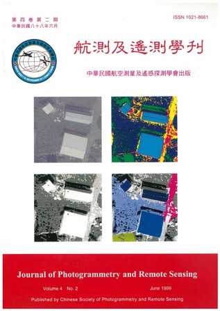
欲於大比例尺航空像片中自動辨識出房屋並重建其三維的幾何模型時,第一步的工作就是要先找出何處可能有房屋。有很多方法都可用來近似找出可能是房屋的地點,但是當航空影像為彩色時,則顯然還可用彩色資訊來協助找出房屋之位置。因為在一般的情況下單獨的一個屋頂大多具有一致的顏色,且與周圍的背景,如草地、柏油路面的顏色有很大的差異。 本研究由兩個方向來研究色彩資訊所可能提供的輔助。第一個方向是應用色彩資訊增加線特徵萃取的完整性,另一個研究方向則是以色彩資訊直接協助房屋面狀區塊之萃取。為了測試本文所提方法之可行性,我們選用了三種類型的房屋影像來做實驗,其型態為獨立房屋、連棟屋、以及高樓。由實驗結果得知,色彩資訊確實可增加線特徵萃取之完整性。而在面狀建物區塊的萃取方面,當屋頂之色彩一致時,可成功地找出建物之位置及近似邊界線。證實了色彩確可輔助影像特徵之萃取。

Abstract

The first of the automatic reconstruction of buildings from aerial images is to find where the buildings are. Many methods can be used for this work, but if the aerial photo is color, it is a very useful information for finding the houses because usually the color of one single roof is uniform and is different from the color of adjacent objects likes grass,roads,etc. Two aspects are researched here to study the possible usage of color information. First, we try to use color information to enhance linear feature extraction. Second, we try to omit the step of linear feature extraction and use the color information to extract building regions directly. In order to test the feasibility of the thought, we choose three different types of building images for experiment. The first type includes isolated buildings, the second type includes aggregation of buildings, and in the third type there are high apartment buildings. The results of the experiment show that in one hand color information do help to extract more complete linear features, and in the other hand,color information can very effectively be used to extract building regions, presumed the color of each individual roof is uniform. It proves that color information is indeed helpful for feature extraction.
關鍵字

彩色資訊、特徵萃取、色彩模型、區塊成長、影像分類

Keywords

Color information, Feature extraction, Color model , Region growing, Image classification

附件檔名

華芸線上圖書館

N / A

備註說明

199906-4-2-1-14

Pages:

15-32

論文名稱

模稜求定與時鐘偏差估計應用於

Title

Ambiguity Resolution and Clock Bias Estimation Applied to Satellite Relative Positioning and Attitude Determination

作者

林修國, 吳究

Author

S.-G. Lin , J. Wu

中文摘要

本文的研究方向在高效率且具高精度的定位方式,因此包含快速靜態定位及動態定位。文中利用約六十米至二十六公里的基線分析快速靜態定位的定位精度,動態定位則利用一約十公里的基線驗證其可行性及定位精度,並選擇一衛星高程測量案,實際驗證衛星定位的成效:用於 5 x 6 km2平坦實驗區的 25 個檢核點時,快速靜態及動態衛星測量分別獲得 ±1.1cm 及±1.3cm 的高程精度。另外,特別針對時鐘偏差量提出一套解相關的做法,當應用此做法於 Ashtech 3DF 的資料上時,於該實驗例可大幅提昇高程精度。

Abstract

In this paper we study the positioning technologies which have high efficiency and precision, therefore our objects of study include both rapid static positioning and kinematic positioning. We analyze the rapid static positioning by various baseline length from about 50m to 26km, and evaluate the kinematic positioning with respect to its repeatability and feasibility by a baseline of about 10km. These technologies are applied to satellite leveling and experimentally verified. For 25 check points in a 6km × 5km flat test area, the rapid state and kinematic satellite surveying technologies can yield ± 1.1cm and ± 1.3cm height accuracy. Besides, a technique of the decorrelation method to improve the accuracy by calibration the receiver clock bias is offered in this paper, and using Ashtech 3DF data to prove it. From experiment we know the height component is improved about 300%.

關鍵字

快速靜態定位、動態定位、姿態求解

Keywords

Rapid static positioning, Kinematic positioning, Attitude determination

附件檔名

華芸線上圖書館

N / A

備註說明

199906-4-2-15-32

Pages:

33-53

論文名稱

地理資訊系統和碎形維度於森林地景空間變化上之應用

Title

Application of Geographic Information System and Fractal Dimension in Forest Landscape Spatial Variability

作者

王素芬 , 陳永寬 , 鄭祈全

Author

Su-Fen Wang , Yeong-Kuan Chen , Chi-Chuan Cheng

中文摘要

航空照片為森林地景研究上之有利工具,地景單元的分布情形,可由照片判釋之。本研究以配合生態多樣性觀念的修正碎形維度為指標,分別以模擬的地景資料,和六龜試驗區航空照片為分析之材料,了解各種經營作業下,對地景可能造成的影響,以及真實地景資料之維度情形。 本研究結果如下: (1) 在森林伐採時,沿著二個區塊的邊界作業,以及採用不規則形狀的作業 方式,可以減少人為干擾對地景多樣性產生的影響。 (2) 道路對森林地景而言為一種干擾,會降低修正碎形維度,故林道開闢時 要考慮地景的完整性,不宜任意穿越地景區塊。

Abstract

Aerial photograph is a very useful tool for forest landscape studies. Interpretation of aerial photograph is very helpful for studying the distribution of landscape units. In this research, a modified fractal dimension was used as an index to study the effects on landscape resulted from various management activities using simulated data. In addition, the Luku experimental forest was selected as the study site to understand the fractal dimension in real landscape. The results indicate that: (1) When harvesting timber, the effect on landscape diversity can be reduced if the harvesting sites, with irregular shapes, are selected along the boundary between two patches. (2) Road development is a disturbance to the forest landscape, and it will reduce the modified fractal dimension. Therefore the roads should not pass through the landscape, in order to preserve the integrity of the landscape.

關鍵字

地理資訊系統、碎形維度、地景、多樣性

Keywords

GIS, Fractal dimension, Landscape, Diversity

附件檔名

華芸線上圖書館

N / A

備註說明

199906-4-2-33-53

Pages:

55-64

論文名稱

「科技短文」視域計算不同程式集差異之探討

Title

The Implementation Variation of Viewshed Computation in GIS Packages

作者

鄭卓斌 , 史天元

Author

Cho-Pin Cheng , Tian-Yuan Shih

中文摘要

視域計算為空間分析的一種作業。由於視線之解析模式有多種,在計算時因演算法之差異、及不同程式書寫技巧之連用,會導致更進一步之差異。本研究以 ARC/INFO 6.0、GRASS 4.1 中之相應功能與自行開發之視域軟體 ViewShed (計算方法為簡易直線法)以實例進行比較測試。以目視法、差異點數法、相關係數法評估所產生之視域圖,得到三者之間相似程度之量度。

Abstract

Viewshed is a useful operation for terrain analysis. Due to the plausibility of the line­ of-sight definition, the application of different computational algorithm and coding techniques, the viewsheds computed from different implementations are different. In this study, the differences of viewshed resulting from ARC/INFO (visibility), GRASS (r.los) are compared with a self-developed program ViewShed with real terrain data sets. The evaluation is performed with visual inspection, pixel count for the differences, and correlation coefficients.

關鍵字

視域、視線

Keywords

Viewshed, Line of sight

附件檔名

華芸線上圖書館

N / A

備註說明

199906-4-2-55-64

更多活動學刊