ENGLISH

6卷/1期

6卷/1期

華藝線上圖書館

Pages:

1-20

論文名稱

Microwave Remote Sensing of Atmospheric Parameters: Modeling and Retrieval

Title

Microwave Remote Sensing of Atmospheric Parameters: Modeling and Retrieval

作者

A.T.C. Chang

Author

A.T.C. Chang

中文摘要

The interaction of microwave energy with the atmosphere is considered in detail. Absorption, scattering and emission properties of the gases, and hydrometeors are reviewed. Geophysical parameter retrieval tech­niques for integrated parameters and profiles are discussed. Although this paper is meant to be a review paper however, many topics were not discussed in any details. It is recommended that those who are interested to pursuit this subject further should refer to a set of three volumes of book entitled “Microwave Remote Sensing"(Ulaby et al.1981, 1982 and 1986). For deriving integrated atmospheric parameters and profiles of temperature and moisture, a large arsenal of instrumental and mathematical techniques is available. At present, there is no single sensor yields all the information that is required. Combining data from active, passive and in situ sensors is probably the most promising way, in the nearest future, to improve the quality of retrieval. Cost of sensors and availability of data is always an issue, especially for the operational algorithms. For research, a much wider range of possibilities is available. Therefore, new and innovative retrieval techniques will be developed in the research environment.

Abstract

The interaction of microwave energy with the atmosphere is considered in detail. Absorption, scattering and emission properties of the gases, and hydrometeors are reviewed. Geophysical parameter retrieval tech­niques for integrated parameters and profiles are discussed. Although this paper is meant to be a review paper however, many topics were not discussed in any details. It is recommended that those who are interested to pursuit this subject further should refer to a set of three volumes of book entitled “Microwave Remote Sensing"(Ulaby et al.1981, 1982 and 1986). For deriving integrated atmospheric parameters and profiles of temperature and moisture, a large arsenal of instrumental and mathematical techniques is available. At present, there is no single sensor yields all the information that is required. Combining data from active, passive and in situ sensors is probably the most promising way, in the nearest future, to improve the quality of retrieval. Cost of sensors and availability of data is always an issue, especially for the operational algorithms. For research, a much wider range of possibilities is available. Therefore, new and innovative retrieval techniques will be developed in the research environment.

關鍵字

Keywords

附件檔名

華芸線上圖書館

N / A

備註說明

200104-6-1-1-20

Pages:

21-30

論文名稱

顯著 SAR 影像方位參數之統計檢定+

Title

Statistical Testings for Determining Significant SAR-Image Orientation Parameters +

作者

吳究 , 劉家鈞 , 林德誠 , 蘇文榮

Author

Joz Wu , Chia-Jun Liu , De-Chen Lin , Wen-Rong Su

中文摘要

對側視 SAR 影像幾何分析而言,存在著求定飛行路徑上時變雷達天線位置參數之任務。本文使用能合理收斂的高階(四階)時間多項式,以記述該位置/方位參數;並將之併入於基本的測距與Dopp1er(雷達測量)條件式中。循例,用最小二乘平差法,能獲得多項式參數改正量及觀測殘差量。所估計的改正量與其統計方差能反映各對應參數之顯著性。同等必要地,理論上所估計觀測殘差之二次形應反映最小數值。文章明確地表達所應用的顯著參數檢定式與模式最佳化準則。在國內空載 SAR 斜距影像實驗例中,印證此顯著性統計推論之理念有令人滿意的表現。

Abstract

For geometric analysis of side-looking SAR imagery, it is frequently of interest to deter­ mine the time-varying radar antenna's position parameters along a flight path. This paper employs converging higher (fourth)-order time polynomials to model the position/orientation parameters; and the polynomials are incorporated into the basic ranging/Doppler (radargrammetric) conditions. As usual, an iterative least-squares adjustment yields both poly-nomial parameter corrections and measurement residuals. The estimated corrections and their statistical variances can be used to investigate their respective parametric significance. Equally essential are the estimated measurement residuals because the corresponding residual quadratic-form should theoretically reflect a minimum value. Explicitly, the paper expresses the parameter significance testing and the model optimization criteria. The results of an experi­mental airborne SAR slant-range image indicate that the proposed methodology satisfactorily works.

關鍵字

空載 SAR 影像、時間多項式、顯著性/最佳化

Keywords

Airborne SAR-Image, Time Polynomials, Significance/Optimization

附件檔名

華芸線上圖書館

N / A

備註說明

200104-6-1-21-30

Pages:

31-40

論文名稱

「科技短文」雷達差分干涉法應用於地層下陷研究

Title

A Study On Differential Interferometry in Subsidence

作者

王志添 , 王顯達 , 陳滌清 , 陳乃宇 , 梁隆鑫

Author

C.T. Wang , H. T. Wang , D. C. Chern , N. Y. Chen , L.S. Liang

中文摘要

本研究是利用合成口徑雷達(SAR)之差分干涉測量法,求取地表位移量,估算台灣東南部東港沿海地區(約45公里 x 25公里)地表下陷情形。如此方式將可成功有效監測臺灣地區大面積之地層下陷之變動。我們是以三軌道差分干涉方式,選用 ERS1與ERS2之合成口徑雷達資料分別為1996 年1 月 31 日、 2 月 1 日、5 月 16 日。前兩張影像日期差一天為 Tandem Mode 資料,具有高同調性,以此產生地形之干涉圖像及數位地形,與選擇另一張影像,具有同調性且時間差為105 天之影像,產生差分干涉圖像,求取地表位移量估算地表下陷情形。 將求出之地層下陷與同年下半年中央地調所於該地區以GPS作地面觀測資料比較分析,得到一致之下陷趨勢外,最大下陷速度約為 2 公分/月,首次證明差分干涉法於亞熱帶多植物的台灣地區之下陷監測具有實用價值。

Abstract

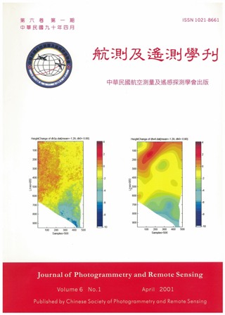
In this work, the technique of differential interferometry is used to find the displacement field and to estimate the terrain subsidence of a 45 km x 25 km coastal area, Ton-Kang, of west-south Taiwan. We perform a three-pass differential interferometry, using three SAR images from ERS1 and ERS2, dated Jan. 31, 1996, Feb. 1, 1996, and May 16, 1996, respectively. The first two images are taken on two consecutive days in tandem mode, thus having relatively high coherence. We use them to obtain a DEM, fairly accurate except for the mountainous area. The third image is taken much later, and it is used to produce the displacement filed for this period. The subsidence of this area has been the subject of a previous GPS study (Central Geological Survey), dated November 1996 to July 1997. Comparison shows that our result is consistent with it, both in the pattern of subsidence and in its magnitude (about 2cm/month). We conclude that, given suitable SAR images, the differential interferometry can be a useful tool for monitoring the earth surface displacement even for a subtropical, densely vegetative area like Taiwan.
關鍵字

差分干涉法、地層下陷

Keywords

Differential Interferometry, Subsidence

附件檔名

華芸線上圖書館

N / A

備註說明

200104-6-1-31-40

Pages:

41-58

論文名稱

「科技短文」應用監督性類神經網路於衛星影像分類技術之探討

Title

The Application of Supervised Neural Network Technique on Satellite Image Classification

作者

林文賜 , 周天穎 , 林昭遠

Author

中文摘要

本研究係應用監督性類神經網路(Supervised Neural Network)之理論,發展萃取(extract)衛星影像特徵值(feature)之程式介面,以進行遙測影像之分類。在運用之技術上,係將具有空間分布之影像資料,導入已發展成熟且適合樣本分類之倒傳遞網路(Back-Propagation Network)中,對影像樣本進行重複的訓練及學習,並由類神經網路提供之評估方法如網路收斂程度、誤差函數及總錯率等,來提昇影像分類之品質及精度。由於監督性類神經網路係透過非線性轉換函式來分析影像特徵,不僅可提高衛星影像分類之準確度(達 89.46%),由分類的結果亦顯示,類神經網路更能有效地判釋糢糊地帶之影像,可彌補傳統之衛星影像分類方法之盲點。

Abstract

This paper uses theory of supervised neural network to develop the program interface for classifying satellite image. This technique can be used to analyze and extract the spatially distributed image patterns by using Back-Propagation Network (BPN). At present, the BPN approach is adapted for image pattern classification, and can continue learning by repeatedly training sites sampling. The BPN approach provides some methods such as convergence degree of network, error function and ratio of total error to enhance the quality and accuracy of image classification. Because BPN approach uses non-linear mathematical function to classify the image pattern, it not only can promote the accuracy of image classification (up to 89.46%) but also can effectively distinguish patterns of fuzzy zone image. The result shows that BPN approach can solve the blind spot from traditional image classification.

關鍵字

監督性類神經網路、總錯率、倒傳遞網路 (BPN)

Keywords

Supervised Neural Network, Ratio of Total Error, Back-Propagation Network (BPN)

附件檔名

華芸線上圖書館

N / A

備註說明

200104-6-1-41-58

更多活動學刊