ENGLISH

8卷/1期

8卷/1期

華藝線上圖書館

Pages:

1-14

論文名稱

利用數學形態學方法於高程空間區隔地貌與地物之研究

Title

Object Segmentation in Elevation Space Using Mathematic Morphology

作者

邵怡誠;陳良健

Author

Yi-Chen Shao;Liang-Chien Chen

中文摘要

在數位航測工作站中以自動影像匹配,或利用空載雷射掃描儀獲取地表面的數值高程,原為混雜有地貌以及人工物、樹木等地物的高程資料,本文嘗試同時引用兩種數學形態學方法來處理此種原始數值表面模型,在高程空間中分離地貌與地物的點位。文中主要的處理程序有二,第一是利用開放操作來濾除高程空間的雜訊,第二再利用H-Dome轉換區隔高程空間的局部較高區,也就是本文所定義的地物區。文中以中央大學及瑞士聯邦工業大學附近的區域為實驗區,為評估地物區隔能力是否良好,先取房屋部份進行比對,在網格密度為lm的DSM測試實驗中,90%以上的房屋落在高度3m以上的地物區塊內。為進一步完整評估,則檢核能否獲取地貌的DTM。但基於lm網格高程資料的雜訊過多且點位高程的連續情形嚴重,不易完整區隔出地物,故另外取網格密度10m的DSM來產生DTM 。二實驗區的操作結果與人工量測成果相比較,得高程均值誤差分別為0.21m及0.22m、均方根誤差分別為l.04m及l.45m 。

Abstract

The original Digital Surface Model (DSM) produced from image matching in Digital Photogrammetric Workstation (DPW) or from scanning by Airborne Laser Scanner (ALS) are the mixing representation for ground, buildings, trees and many others. We propose two mathematic morphology methods, Opening Operation and H-Dome Transformation, to reconstruct DSM in elevation space to separate the ground surface from those objects above ground. The procedure of the proposed methods includes: (1)Opening Operation to filter out the noise in elevation space. (2)H-Dome Transformation to detect the local regional maxima where the objects above ground locate. NCU area and ETH area are used for test data in this experiment. There are over 90% of buildings locate on the segmented areas. And for strict assessment by generating DTM from DSM, the results of two test data compared with manual measurement show that the mean errors are 0.21m and 0.22m, and the RIVISE are l.04m and l.45m, respectively.

關鍵字

數學形態學,數值地表模型,數值地形模型

Keywords

Mathematic Morphology,Digital Surface Model,Digital Terrain Model

附件檔名

華芸線上圖書館

N / A

備註說明

200303-8-1-1-14

Pages:

15-34

論文名稱

應用Hough Transform與主軸分析法於快速直線偵測之研究

Title

Fast Straight Lines Detection Using Hough Transform with Principal Axis Analysis

作者

饒見有;陳良健

Author

Jiann-Yeou Rau;Liang-Chien Chen

中文摘要

本文針對都會區數位航空照片中具有棋盤式排列之矩形建築物,以及一般具有結構性直線特徵之近景影像中,進行高效率之直線偵測。文中提出-「主軸分析法」來設定尖峰偵測時之優先次序,以加速直線偵測並獲取更正確之結果。「主軸分析法」是將二維之Hough參數空間轉換為一維之「角度-累計量直方圖」,分析此直方圖可得到影像中特徵物之第一主軸。對影像內容具有矩形結構之都會區而言,其次主軸即為主軸之正交方向。接著在進行Hough直線偵測時,即可將尖峰偵測之主要優先次序設定在此二主軸上。而對一般不具有矩形結構之線形特徵影像,則可根據線性主要分佈之角度為尖峰偵測之主要優先次序以進行直線偵測,實驗結果顯示,本文所提出之「主軸分析法」可顯著提昇直線偵測之效率,而且得到更正確的結果。

Abstract

Hough Transform is a sound method for detecting straight lines in digital images. Considering an image with lattice structure, we modify the procedure in detecting straight lines using Hough Transform. We propose a Principal Axis Analysis Method to speed up the extraction of straight lines and increase the accuracy of the detected lines. We first transfer the parameters to a one-dimensional angle-count histogram, and then analyze the dominated distribution of image features. In peak detection, the searching priority is set according to the principal axis. Experimental results indicate that the accuracy and the efficiency for all of the cases are improved. The efficiency is better improved when the objects in an image are with more regularity.

關鍵字

Hough轉換,直線偵測,主軸分析法

Keywords

Hough Transform,Straight Lines Detection,Principal Axis Analysis Method

附件檔名

華芸線上圖書館

N / A

備註說明

200303-8-1-15-34

Pages:

34-46

論文名稱

應用遙測於台北都會區綠地環境變遷分析

Title

On the Study of Vegetation Changes in Taipei Urban Area Using Remote Sensing

作者

曾義星;賴志恆

Author

Yi-Hsing Tseng;Chih-Heng Lai

中文摘要

應用遙測技術來監測地表土地利用情況,具有即時觀測大範圍的土地之優勢,能夠迅速有效地獲得土地利用的資訊。經由分析不同時間取得的影像資料,可以找出土地利用的發展與變遷趨勢。本研究以多時段Landsat TM衛星影像對台北都會區進行綠地環境變遷之研究,利用多光譜影像監督式分類法萃取出攝影日期之綠地分佈情形,分析都會區內綠地的變遷狀況。從分類的成果中,可以監控1984至1995年之十一間,台北都會區內綠地環境變遷的概況。針對這十一年間重要的建設及地表利用紀錄,主要的研究方向為:(l)台北市區綠地環境變遷概況的分析;(2)基隆河截彎取直對鄰近綠地的影響;(3)五股溼地變遷與鄰近都會區發展之分析。從分析結果得知1984至1995間台北市區綠地變遷與行政區位置政策的推行有著極密切的關係,且重大水利建設對週遭綠地的環境亦有影響,此資訊可供都市計劃決策者或環境保護決策者參考。

Abstract

The greatest advantage of utilizing remotely sensed image data is being capable of observing larger land section and its information of land use. By means of analyzing image data within certain period of time, it becomes easier to find out the development and transitional trend of land use. This study applied the Landsat TM satellite images obtained during 1984-1995 to analyze the transition of green land in urban area. The image data set enable us to supervise green land transition in Taipei within the ten years. According to important constructions and land use record, our main research directions are:(1)Analysis of green land transition in Taipei city; (2)The influences of river straitening project of Ki-long River to neighbor area; (3)Analysis of wet land transition and trend of urban development in Wu-Gu. From the transition of green land in Taipei city between 1984-1995, we could find the affinity between green, civil region, and the promotion of policies. Besides, the influences of past large hydraulic constructions to neighbor green land are also investigated.

關鍵字

遙感探測,分類,變遷分析,綠地,環境保護

Keywords

Remote sensing,Classification,Change analysis,Green land,Environmental protection

附件檔名

華芸線上圖書館

N / A

備註說明

200303-8-1-35-46

Pages:

47-56

論文名稱

雷達影像多時處理研究

Title

Study of Multi-temporal Processing of SAR Imagery

作者

王志添;陳錕山

Author

C. T. Wang;K. S. Chen

中文摘要

就合成孔徑雷達(SAR)影像觀點而言,因為雷達波同調的干涉現象所引起的斑駁雜訊常使得SAR影像在應用上受到相當之限制。因此,必須有效地對斑駁雜訊加以濾除或降低以提昇SAR影像之判斷力,通常的作法是以空間平均以提高影像之有效觀點數,但也無可避免地犧牲了空間解析力。在此我們以一時序列影像先作幾何套疊並引進統計模式在不改變區域平均值的約制條件下家將訊號雜訊比最佳化。作法為將訊號在不同時間下分別求取各區域平均值,作為於時間軸上之權重,同時處理此多張影像。利用中央大學太遙中心於1998年接收歐洲太空總署ERS-2衛星於臺灣高屏地區不同時間獲取之六張SAR影像作測試。處理後發現其等效觀點數可由原來約4觀點數大幅提升至約20觀點數,除有效減抑斑駁雜訊,改善原有單張SAR影像之輻射品質外,由其空間相關係數顯示處理後之影像仍保有原空間之解析力。

Abstract

Synthetic Aperture Radar (SAR) is a microwave sensor that can penetrate the clouds and rains. It can be operated day and night, because it provides its own illumination. Consequently , such a sensor bears numerous advantages for remote sensing applications. But a SAR generates the images by coherently processing the backscattered signals. ,hence, they are highly susceptible to the speckle noise. The speckle substantially reduces the effectiveness of image interpretation and target recognition. To reduce the speckle level , while maintain the spatial resolution, in this paper, we use a set of multi-temporal ERS-2 SAR images. The six scenes of different dates were first co-registered with minimal geometric shift error. By taking the time-space correlation properties, a temporal filter is used by means of multivariate analysis. We found that the equivalent number of looks (ENL) of the resulting image is improved from 4 to 20. The process of multi-temporal process greatly enhances the capability of land cover classification and change detection using SAR image.

關鍵字

合成孔徑雷達,多時處理,斑駁雜訊,等效觀點數

Keywords

Synthetic Aperture Radar SAR,Multi-temporal Processing,speckle noise,Equivalent number of looks ENL

附件檔名

華芸線上圖書館

N / A

備註說明

200303-8-1-47-56

Pages:

57-66

論文名稱

「科技短文」應用衛星資料推求水線位置之研究

Title

Applying Satellite Data for Shoreline Detection in Tideland Areas

作者

林唐煌;劉振榮;陳哲俊;郭宗華

Author

Tang-Huang Lin;Gin-Rong Liu;A. J. Chen;Tsung-Hua Kuo

中文摘要

本研究利用水體和陸地在衛星遙測頻道反射特性上的差異,建立由衛星觀測資料快速地求取水線位置之模式。在研究的過程中,配合衛星觀測同步使用GPS(Global Positioning System)量測水線位置是非常重要的一個步驟。藉由GPS實測的水線資料,一方面可提供水線位置計算模式之參數,另一方面亦可用以驗證模式之研究結果。本研究所使用的SPOT HRV感測器觀測資料的三個頻道均在可見光波段之範圍內,易受大氣散射之影響而模糊了水線的位置。因此,若非晴空的衛星觀測資料,則需先經大氣校正後始能獲得較準確之結果。研究中分別使用SPOT衛星在不同地區的觀測資料,配合GPS實測的水線位置,利用簡單的梯度法(gradieni method)建立快速的水線位置求取之計算模式,均獲不錯之研究結果。從二個晴空個案之研究結果獲知,由SPOT第三頻道資料計算水線的位置可獲得最佳的準確度,而其梯度值約為3.4。如能收集足夠資料建立具代表性之水線位置梯度值,則可應用SPOT HRV衛星資料快速而準確地計算出水線的位置所在。

Abstract

A simple model in determining the location of the shoreline on coastal zones by remote sensing data is presented in this study. The main concept involves using the reflectance difference between the coastal land and its adjacent waters in the visible and near infrared spectral bands. Concurrent shoreline position measurements by GPS are also employed to construct and improve our approach. Three sets of SPOT HRV images, acquired in the clear sky condition, are used in this study. The results show that the gradient criteria of the shoreline position are stable, and can be used to find the shoreline easily in the clear sky cases. More examples should be investigated for constructing a database of gradient values for further applications around tideland areas in the future.

關鍵字

衛星遙測,水線位置,GPS

Keywords

Remote sensing,Shoreline position,GPS

附件檔名

華芸線上圖書館

N / A

備註說明

200303-8-1-57-66

Pages:

67-90

論文名稱

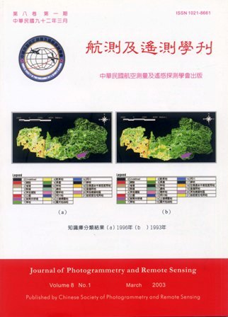
「科技短文」知識庫輔助都市地區土地利用變遷偵測之研究

Title

The Study of Using GIS Knowledge Database for Urban Land Use Change Detection

作者

周天穎;簡甫任;雷祖強

Author

Tine-Yin Chou;Fu-Jen Chien;Tsu-Chiang Lei

中文摘要

為有效量化偵測都市地區土地利用變遷情形,本研究應用專家知識庫(Experts' knowledge Base)的技術,協助判釋都市土地利用變遷及解釋各式交錯影響之複雜程序。研究的結果顯示,透過知識庫處理方式,可整合不同類型土地變遷資料與解決費時複雜的處理過程。利用專家知識與經驗並配合知識庫邏輯推論的機制,可快速偵測都市土地利用變遷。另一方面為探討多時段之土地利用變遷型態,研究中架構出偵測都市土地利用變遷模式,其處理過程主要區分為:影像分類、變遷偵測二個部分。研究的成果顯示,運用此流程可達到變遷自動化偵測之目的,適合探討都市地區環境變遷分析之使用。

Abstract

In order to identify the spatial pattern of urban land use change, this research designed a study applying the technique of Experts' Knowledge Base. The result shows: with the aid of GIS spatial database, it is feasible to integrate various infrastructures of data (RS,GIS), and simplified traditional time-consuming and sophisticated process. The use of experts knowledge and experiences, accompanied with the mechanism of logical inference extract from database, we can rapidly and efficient perform urban land use change identification. On the other hand, for probing into the multi-temporal land use change form, the research also build up a model to semi-auto detect the classification output. The processing stage can be divided into two major parts: image classification and land used change detection. This study concludes, using this process can achieve the goal of semi-auto land use change detection, and it's suitable to analyze the urban land use change.

關鍵字

遙感探測,地理資訊系統,專家知識庫,土地利用變遷,影像分類

Keywords

Expert Knowledge Base,RS Remote Sensing,GIS Geographic Information System,Land Use Change Analysis,Image Classification

附件檔名

華芸線上圖書館

N / A

備註說明

200303-8-1-67-90

更多活動學刊