30卷/3期

30卷/3期

華藝線上圖書館

Pages:

論文名稱

航測及遙測工程應用

Title

Engineering Applications of Photogrammetry and Remote Sensing

作者

鄭宏逵

Author

Hong-Kuei Cheng

中文摘要

航遙測及空間資訊科技的發展日新月異空間資訊是各項工程建設的重要基礎資訊,也是發展智慧國土不可或缺的重要基礎元素,正確及完善的空間資訊可以提升都市建設與工程規劃、設計、建設、及經營管理之效用,並可作為支援決策參考。空間資訊的內容主要包含位置、圖形及屬性等資訊,其資料來源可以從測量、調查、拍照…等各種方式得到,但後續要達到有效的應用則須透過輸入、建檔、繪圖、系統化處理後方能提供最佳的使用效果,所以空間資訊技術涵蓋所有測繪學的內容,以及計算機運算對空間數據和資訊處理的過程。 隨著測繪技術的發展及電腦科技的應用,航遙測資料使用日趨多元。過往因使用需求層面較低,加上軟體與儀器設備之限制,工程使用上多以採用二維地形圖資為主。現今資訊數位科技發展,地形圖資已導向三維空間資訊的方式呈現,包括三維地形圖、城市模型、建築資訊模型(Building Information Modeling, BIM)、三維管線模型(3D Utility Pipeline Model)、三維地理資訊系統(3 Dimensions Geographic Information System, 3D GIS)、自駕車高精地圖(High Definition Map, HDmap)等,因此測繪產業面對的環境有很大的改變。 筆者很高興於2024年10月接到中華民國航空測量及遙感探測學會的邀請,客編航測及遙測工程應用,隨後立即開始著手進行邀稿,本學刊總編輯收錄6篇論文(學術論著2篇、技術短文4篇),內容包括:應用InSAR技術監測大地變位、多視角車載影像匹配之研究、公共設施管線BIM之養護管理、自來水智慧化管理及水理分析、整合多元遙測技術於高速公路邊坡救災、高精度圖資及三維實景於數位孿生之應用等,歷時近1年,本特刊終於完成。 回顧近50年來隨著測繪科技進步,測量工作從傳統地測發展到多元遙測技術的空間測繪。又鑒於資訊產業快速發展,通訊網路已由5G邁向即將到來6G,以及大數據(Big data)、物聯網(IoT)、雲端平台、人工智慧(AI)、虛擬實境(VR)及擴增實境(AR)等技術整合應用,發展數位孿生(Digital Twin)對於空間資訊使用將更為廣泛,而資料使用量亦將暴增,因此使用端的應用效益將是未來發展重點,展望6G及大數據時代來臨,空間資訊應用發展將不可限量。 期待經由本期航測及遙測工程應用特刊的出版,能夠讓國內產官學界瞭解臺灣在航遙測工程應用與防救災等相關技術的發展現況,並希望未來能有更多人能夠投入航遙測及空間資訊於工程應用行列,提升國家工程建設品質。

Abstract

關鍵字

Keywords

附件檔名

華芸線上圖書館

N / A

備註說明

N / A

Pages:

139-152

論文名稱

應用深度特徵於多視角車載影像匹配之研究

Title

Deep Feature Matching for Multi-View Images in Mobile Mapping Systems

作者

張智安、陳沛丞、陳亭霓、楊軒、林展慶、李冠毅、洪愷頡、呂振永

Author

Tee-Ann Teo, Pei-Cheng Chen, Ting-Ni Chen, Hsuan Yang, Zhan-Qing Lin, Kuan-Yi Lee, Kai-Chieh Hung, Chen-Yung Lu

中文摘要

隨著移動測繪技術的進步,多視角車載影像逐漸成為道路觀測的重要資料來源,然而,傳統的匹配方法,不易克服影像之間的畸變和視角變化差異問題。為了提升影像匹配的精度和泛化能力,本研究探討基於深度學習的深度特徵匹配技術 (Deep Feature Matching, DFM),透過CNN卷積神經網路萃取深度特徵,以達成多視角車載影像的精確匹配和物空間三維定位。研究中,採用基於VGG19預訓練模型的深度特徵匹配技術,透過兩階段匹配策略及RANSAC隨機抽樣一致性演算法,過濾匹配錯誤點,確保匹配成果的可靠性。實驗資料使用三相機車載多視角影像,並採用交通標誌作為影像匹配及定位目標。研究成果顯示,與傳統的 SIFT 方法相比,DFM 在不同影像情境下 (尺度差異、形變差異和遮蔽情境) 中均表現出更高的匹配成功率和定位精度,特別在形變和遮蔽情境下,DFM的匹配點數顯著高於SIFT。此外,對交通標誌的定位分析顯示,定位成功率可接近 70%,且成功定位點的平均誤差小於0.5 m,表明DFM在多視角車載影像的三維定位中具備實際應用潛力。本研究證實,DFM在應對多視角車載影像匹配的場景時,具有較高的成功率和精準性。

Abstract

With the advancement of mobile mapping technology, multi-view imagery has become an important source for road observation. However, traditional matching methods struggle to overcome the challenges posed by distortions and variations in viewing angles between images. To enhance the precision and reliability of image matching, this study investigates a deep feature matching technique based on deep learning. By utilizing convolutional neural networks (CNN) to extract deep features, accurate matching and 3D spatial positioning of multi-view images can be achieved. The study employs Deep Feature Matching (DFM) technology, which is based on the pre-trained VGG19 model. Through a two-stage matching strategy and the RANSAC (Random Sample Consensus) algorithm, erroneous matching points are filtered out to ensure the reliability of the matching results. The experimental data consists of multi-view images, with traffic signs serving as the target objects for image matching and positioning. The research results reveal that, compared with the traditional SIFT method, DFM demonstrates a higher success rate and improved positioning accuracy in various image scenarios, including scale differences, shape distortions, and occlusion conditions. Notably, DFM achieves significantly more matching points than SIFT in distortion and occlusion scenarios. Furthermore, the analysis of traffic sign positioning indicates that the success rate of traffic sign positioning reaches 70%, with an average error of less than 0.5 m for successfully located points. This finding highlights the practical application potential of DFM in 3D positioning using multi-view images in complex scenarios and confirms that it achieves higher success rates and accuracy.
關鍵字

深度學習、深度特徵、影像匹配、多視角影像、交通標誌

Keywords

Deep Learning, Deep Features, Image Matching, Multi-View Images, Traffic Signboard

附件檔名

華芸線上圖書館

https://www.airitilibrary.com/Article/Detail?DocID=10218661-N202507220001-00001

備註說明

N / A

Pages:

153-166

論文名稱

PSInSAR技術監測臺灣乾旱與地層下陷相關性之研究

Title

Monitoring Drought and Land Subsidence with InSAR Technology

作者

張耘僑、曾國欣、戴于恒

Author

Yun-Chiao Chang, Kuo-Hsin Tseng, Yu-Heng Tai

中文摘要

臺灣西部平原長期依賴地下水,加上氣候變遷造成的降雨不均與乾旱,易引發地層下陷。2021與2023年嚴重乾旱更使沉陷情形加劇。本研究運用永久散射體干涉合成孔徑雷達技術(PSInSAR),分析2019-2023年 Sentinel-1 影像,並結合降雨資料,探討乾旱對下陷速率的影響。結果顯示,乾旱期降水量大幅減少,與沉陷速率高度相關,最嚴重地區乾季下陷速率達 7.8 cm/year。為驗證結果,引入 GNSS 站點進行多重參考點克利金內插校正,並以獨立站比對,相關係數達 0.98;另與水利署公告之顯著下陷面積比較,差異約 ±10%。顯示 PSInSAR 在監測細部地表形變具良好精度與穩定性,未來可作為水資源管理及地層下陷防治之重要依據。

Abstract

The western plains of Taiwan have long relied on groundwater, and combined with uneven rainfall and droughts caused by climate change, land subsidence is easily triggered. Severe droughts in 2021 and 2023 further intensified subsidence during those years. This study applies the Persistent Scatterer Interferometric Synthetic Aperture Radar (PSInSAR) technique to analyze Sentinel-1 images from 2019 to 2023, integrated with rainfall data, to examine the impact of drought on subsidence rates. Results indicate that precipitation decreased sharply during drought periods and showed strong correlation with accelerated subsidence, with seasonal subsidence rates reaching up to 7.8 cm/year in severely water-stressed areas. To validate the results, GNSS stations were incorporated using multi-reference kriging interpolation, with independent stations used for comparison, yielding a correlation coefficient of 0.98. Furthermore, comparisons with significant subsidence areas published by the Water Resources Agency revealed differences of about ±10% between 2020 and 2023. These findings demonstrate that PSInSAR provides high accuracy and stability in monitoring detailed surface deformation and can serve as a valuable scientific basis for future water resource management, groundwater regulation, and land subsidence prevention.

關鍵字

永久散射體合成孔徑雷達差分干涉、地層下陷、降水

Keywords

Persistent Scatterer InSAR, Land Subsidence, Precipitation

附件檔名

華芸線上圖書館

https://www.airitilibrary.com/Article/Detail?DocID=10218661-N202507220001-00002

備註說明

N / A

Pages:

167-186

論文名稱

整合多元遙測技術於高速公路邊坡救災之應用

Title

Integration of Multi-Remote Sensing Technologies for Slope Disaster Recovery on Highways

作者

鄭宏逵、李魁士、姜興華、闕文鏈

Author

Hong-Kuei Cheng, Kweishr Li, Hsing-Hua Chiang, Wen-Liang Chueh

中文摘要

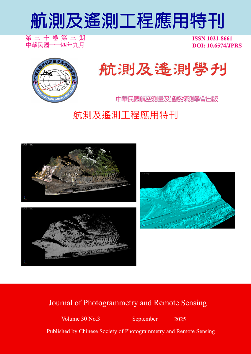
臺灣地區因地形環境因素,常有天然災害發生並造成環境損害,對民眾生命財產造成影響,故災害搶救具有急迫的時效性,對於災區的受害資訊須立即掌握,且對於潛在可能發生的二次災害更是不可忽略,所以對於災區空間資訊收集是非常重要的工作,資訊收集越完整對於救災任務越是有幫助。而如何能有效的針對不同的使用需求,採取因應的技術做法,提供可用的資訊實為一項重要的課題。本案例應用無人機(Unmanned Aerial Vehicle, UAV)進行空拍及3D建模、光達(Light Detection And Ranging, LiDAR)掃描點雲(Point Cloud)建模及經緯儀等多元遙測技術獲取災區空間資訊,提供災區搶修及復建使用。

Abstract

Taiwan's unique topography and environmental conditions make it highly susceptible to natural disasters, which often result in significant environmental damage and pose threats to human lives and property. Given the urgent nature of disaster response, it is imperative to obtain timely and accurate information regarding affected areas. Furthermore, the risk of secondary disasters must not be underestimated, underscoring the importance of comprehensive spatial data collection in disaster-stricken regions. The completeness and accuracy of such data directly influence the efficiency and effectiveness of emergency response and recovery operations. This study presents a case in which a combination of remote sensing technologies—including Unmanned Aerial Vehicles (UAVs) for aerial imagery and 3D reconstruction, Light Detection and Ranging (LiDAR) for point cloud modeling, and total stations for geodetic surveying—was employed to rapidly acquire spatial information in disaster areas. The integrated approach provided critical support for emergency repair and post-disaster reconstruction, demonstrating the value of adopting diverse technologies to meet varying operational requirements.

關鍵字

無人機、光達、3D建模、點雲

Keywords

Unmanned Aerial Vehicle (UAV), Light Detection and Ranging(LiDAR), 3D Modeling, Point Cloud

附件檔名

華芸線上圖書館

https://www.airitilibrary.com/Article/Detail?DocID=10218661-N202507220001-00003

備註說明

N / A

Pages:

187-199

論文名稱

從公共設施管線之養護需求探討竣工圖資建置管理-以桃園航空城區段徵收案為例

Title

Exploring As-Built Data Management for Maintenance Needs of Public Utility Pipelines: A Case Study of the Taoyuan Aerotropolis Zone Expropriation Project

作者

藍士堯、李元良、黃于峰、劉新達、林秋芬、陳竣璿

Author

Shih-Yao Lan, Yuan-Liang Lee, Yu-Feng Huang, Hsin-Ta Liu, Chiu-Fen Lin, Jun-Xuan Chen

中文摘要

道路施工常因圖資不準確導致管線挖損,主因為施工單位以設計圖代替竣工圖,主要多為管線空間位置、埋設深度等資訊的不正確,其原因為施工單位使用設計圖當作竣工圖提交給養護單位,導致管線位置及埋深等資訊與現場狀況不相符。 為克服以上問題,桃園市航空城工程處導入3D GIS系統,整合BIM設計圖、管線實測點位及GML交換格式資料,藉以提升圖資準確性。 為確保圖資的品質,竣工圖資需通過系統合理化檢核機制的驗證,確保上傳資料合理性,並由監造單位以人工檢核管線圖資之「連續性」、「完整性」、「正確性」三個面向,再將竣工圖資匯入至三維公共管線資料庫,以有效提升圖資品質,完善未來航空城計畫區域管線養護需求,減少挖掘時管損機會及生命財產損失。

Abstract

Road construction often results in utility damage due to inaccurate mapping data, primarily because contractors submit design drawings as-built drawings. This leads to discrepancies in pipeline spatial location and burial depth, as the submitted data does not accurately reflect on-site conditions. To address this issue, the Taoyuan Aerotropolis Engineering Office has implemented a 3D Geographic Information System (3D GIS) that integrates BIM design models, surveyed pipeline points, and data in Geography Markup Language (GML) format to enhance the accuracy of utility mapping. To ensure data quality, the as-built drawings must pass a system-based rationality verification process. In addition, supervising engineers manually inspect the pipeline data for continuity, completeness, and accuracy. The validated data is then integrated into a 3D public utility database to improve overall mapping quality, meet future utility maintenance needs within the Aerotropolis project area, and reduce the risk of utility damage and associated threats to life and property during excavation.

關鍵字

三維地理資訊系統、竣工圖資源頭管理、公共管線圖資品質

Keywords

3D Geographic Information System(3D GIS), As-built Data Source Management, Public Pipeline Data Quality

附件檔名

華芸線上圖書館

https://www.airitilibrary.com/Article/Detail?DocID=10218661-N202507220001-00004

備註說明

N / A

Pages:

201-214

論文名稱

自來水智慧化管理及水理分析於工程實務應用

Title

Integration of Smart Water and Hydraulic Models in Construction Management

作者

黃裕泰、黃欽稜、李承鴻、許家成、陳勳融

Author

Yu-Tai Huang, Chin-Ling Huang, Cheng-Hung Li, Chia-Cheng Shiu, Hsun-Jung Chen

中文摘要

都市水資源管理的重要性日益提升,為協助維運管理與分析決策,需導入人工智慧、水理模型與地理資訊技術。以自來水管線為例,本研究結合水理分析與空間分析,克服過去無法精準評估受影響用戶的缺點,並提出優化建議。應用面向包含三階段:第一,施工影響分析,透過模型找出受影響區域與用戶;第二,管網規劃設計,藉智能斷水與邊界閥啟閉,找出最佳進水點;第三,多時段溯源分析,掌握節點水源比例與主要流量路徑。此模式能動態量化影響用戶,並將結果精準反饋至各管線,為臺北自來水事業處提供專屬管理方案,不僅提升維護效率,亦強化管線汰換決策支援,實現精細化與永續管理。

Abstract

The importance of urban water resource management is increasing, requiring advanced tools to support operations and decision-making. This study integrates artificial intelligence, hydraulic modeling, and geographic information systems to enhance analysis and overcome the limitations of traditional approaches in assessing affected users. Focusing on Taipei’s water distribution network, the framework applies three key practices. First, construction impact analysis identifies service areas and households affected by pipeline replacement, enabling accurate planning and communication. Second, network planning and design use smart isolation techniques by controlling boundary valves to determine the optimal inflow point and improve water distribution efficiency. Third, multi-period source tracing applies dynamic hydraulic modeling to quantify water source proportions at each node and track major flow paths across time. This integrated methodology provides a powerful means to dynamically evaluate user impacts and precisely map results to individual pipelines. For the Taipei Water Department, it offers tailored management strategies that improve maintenance efficiency, strengthen decision support for pipeline renewal, and advance sustainable, data-driven water management.

關鍵字

水理分析、地理資訊系統(GIS)、溯源分析、管網規劃設計、智慧化管理

Keywords

Hydraulic Model, Geographic Information System, Trace Analysis, Network Planning and Design, Smart Water

附件檔名

華芸線上圖書館

https://www.airitilibrary.com/Article/Detail?DocID=10218661-N202507220001-00005

備註說明

N / A

Pages:

215-232

論文名稱

綠島高精度圖資及三維實景於數位孿生之應用

Title

Application of High-Precision Maps and 3D Mesh in Digital Twin for Ludao Township

作者

沈碧恕、王明楠、李良輝、林宏麟、賴澄漂、邱俊榮、簡睿怡

Author

Bi-Shu Shen, Ming-Nan Wang, Liang-Hui Li, Hong-Lin Lin, Cheng-Piao Lai, Chun-Jung Chiu, Rui-Yi Jian

中文摘要

臺東縣政府配合中央國土資訊系統基本地形資料庫建置政策,辦理「綠島鄉高精度數值地形圖資精進暨3D數值實景建模測製計畫建置案」,採用有人航攝飛機同時搭載空載光達及傾斜攝影系統,製作綠島6 cm真實正射影像、50 cm數值高程模型、6 cm 3D實景模型、10處LOD3精緻建物模型,及使用真實正射影像繪製之一千分之一地形圖為全國首創,其成果驗證精度均符合規範,達到「影像即地圖」的目標,將綠島打造成為數位孿生(Digital Twin)空間資訊開放數位創新實驗區及3D GIS示範場域,高精度圖資可應用於地籍測量、土地規劃、土木建築、旅遊路線及防災救難等。

Abstract

In order to align with the central government's policy on land Information System while to meet the needs of the county government’s development and surveying in both official and private department, Taitung County Government promote the project of "High-Precision Digital Terrain Map Data Refinement and 3D Mesh in Ludao Township". This project deploy the surveying aircraft equipped with LiDAR system and nadir/oblique camera system. The result of this project includes 6 cm True Orthophotos, 10 sites of LOD3 mesh, 1/1000 mapping using the 6 cm True Orthophotos, which is the first attempt in nation, and the accuracy of these results exceeds standards, achieving the goal of "image as map". This project aims to transform Green Island into an experimental area of digital twin and 3D GIS. The high-precision, high-quality data produced can be applied to cadastral surveying, land planning, civil construction, tourist routes, and disaster prevention. It is sure to become the best tool for Taitung County Government in planning, evaluation, demonstration, and execution.

關鍵字

數值地形圖、3D數值實景建模、數位孿生、全波形空載光達、傾斜攝影系統

Keywords

Digital Terrain Map, 3D Modeling, Digital Twin, Full Waveform LiDAR, Oblique Camera System

附件檔名

華芸線上圖書館

https://www.airitilibrary.com/Article/Detail?DocID=10218661-N202507220001-00006

備註說明

N / A

更多學刊論文